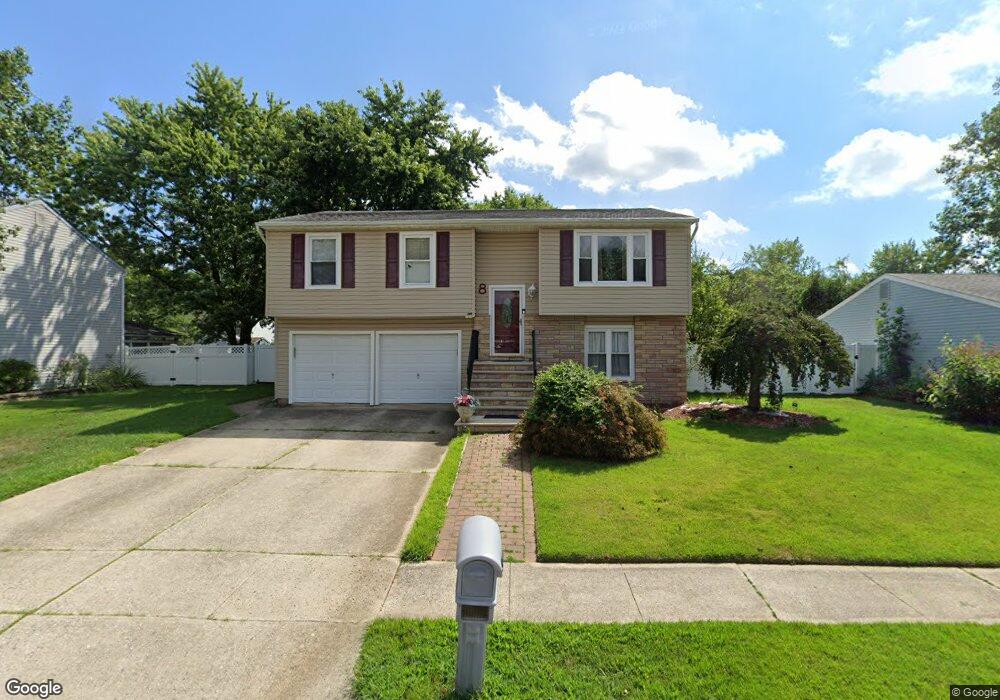
8 Wickham Ln Westampton, NJ 08060
Estimated Value: $488,000 - $606,097
Studio
--
Bath
2,755
Sq Ft
$202/Sq Ft
Est. Value
About This Home
This home is located at 8 Wickham Ln, Westampton, NJ 08060 and is currently estimated at $555,274, approximately $201 per square foot. 8 Wickham Ln is a home located in Burlington County with nearby schools including Holly Hills Elementary School, Westampton Intermediate School, and Rancocas Valley Regional High School.
Ownership History
Date
Name
Owned For
Owner Type
Purchase Details
Closed on
Oct 24, 2012
Sold by
Sapp Ronald F
Bought by
Sapp Shielynn E
Current Estimated Value
Purchase Details
Closed on
Mar 31, 2006
Sold by
Tims Richard and Tims Susan M
Bought by
Sapp Ronald and Sapp Shielynn
Home Financials for this Owner
Home Financials are based on the most recent Mortgage that was taken out on this home.
Original Mortgage
$379,900
Outstanding Balance
$251,113
Interest Rate
9.12%
Mortgage Type
Fannie Mae Freddie Mac
Estimated Equity
$304,161
Purchase Details
Closed on
Sep 28, 2000
Sold by
Wilson Michael J and Wilson Candace M
Bought by
Tims Richard and Tims Susan M
Home Financials for this Owner
Home Financials are based on the most recent Mortgage that was taken out on this home.
Original Mortgage
$167,200
Interest Rate
7.13%
Create a Home Valuation Report for This Property
The Home Valuation Report is an in-depth analysis detailing your home's value as well as a comparison with similar homes in the area
Home Values in the Area
Average Home Value in this Area
Purchase History
We collect this data history from publicly available records. To have your information removed, we recommend requesting removal directly through your county’s website.
| Date | Buyer | Sale Price | Title Company |
|---|---|---|---|
| Sapp Shielynn E | -- | None Available | |
| Sapp Ronald | $379,900 | Premier Abstract & Title Age | |
| Tims Richard | $176,000 | -- |
Source: Public Records
Mortgage History
We collect this data history from publicly available records. To have your information removed, we recommend requesting removal directly through your county’s website.
| Date | Status | Borrower | Loan Amount |
|---|---|---|---|
| Open | Sapp Ronald | $379,900 | |
| Previous Owner | Tims Richard | $167,200 |
Source: Public Records
Tax History
| Year | Tax Paid | Tax Assessment Tax Assessment Total Assessment is a certain percentage of the fair market value that is determined by local assessors to be the total taxable value of land and additions on the property. | Land | Improvement |
|---|---|---|---|---|
| 2025 | $8,326 | $296,400 | $90,000 | $206,400 |
| 2024 | $8,012 | $296,400 | $90,000 | $206,400 |
| 2023 | $8,012 | $296,400 | $90,000 | $206,400 |
| 2021 | $7,330 | $296,400 | $90,000 | $206,400 |
| 2020 | $7,300 | $296,400 | $90,000 | $206,400 |
| 2019 | $7,152 | $296,400 | $90,000 | $206,400 |
| 2018 | $7,060 | $296,400 | $90,000 | $206,400 |
| 2017 | $6,874 | $296,400 | $90,000 | $206,400 |
| 2016 | $6,746 | $296,400 | $90,000 | $206,400 |
| 2015 | $6,616 | $296,400 | $90,000 | $206,400 |
| 2014 | $6,447 | $296,400 | $90,000 | $206,400 |
Source: Public Records
Map
Nearby Homes
- 35 Lawrence Ln
- 6 Churchill St
- 22 Greenwich Dr
- 52 Kanabe Dr
- 858 Rancocas Rd
- 21 Whitlow Dr
- 16 Lancaster Ct
- 724 Woodlane Rd
- 916 Russo Dr
- 902 Lambert Dr
- 20 Orchard Ln
- 503 Pennington Dr
- 23 Longfellow Ln
- 31 Longfellow Ln
- 6 Regency Dr
- 28 Foundry Blvd
- 817 Woodlane Rd
- 18 Foundry Blvd
- 7 Foundry Blvd
- 104 Levis Dr
Your Personal Tour Guide
Ask me questions while you tour the home.