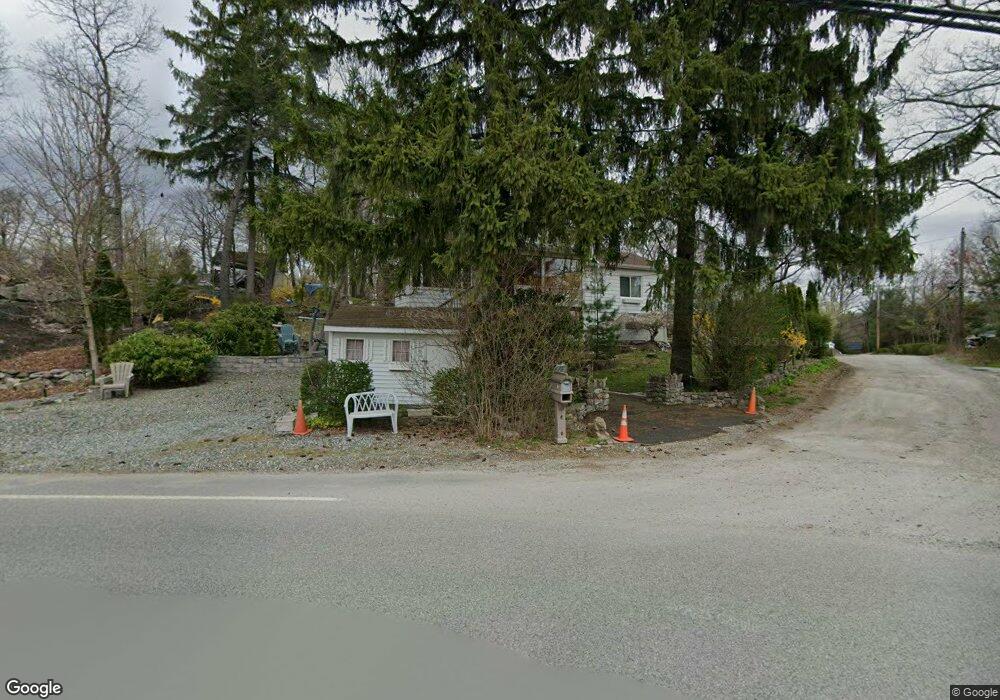
8 Yorktown Rd Hewitt, NJ 07421
Estimated Value: $286,000 - $309,000
--
Bed
--
Bath
844
Sq Ft
$354/Sq Ft
Est. Value
About This Home
This home is located at 8 Yorktown Rd, Hewitt, NJ 07421 and is currently estimated at $299,021, approximately $354 per square foot. 8 Yorktown Rd is a home located in Passaic County with nearby schools including Macopin Middle School and West Milford High School.
Ownership History
Date
Name
Owned For
Owner Type
Purchase Details
Closed on
Dec 19, 2006
Sold by
Wadel Christopher J
Bought by
Pierre Jean and Pierre Jessica
Current Estimated Value
Home Financials for this Owner
Home Financials are based on the most recent Mortgage that was taken out on this home.
Original Mortgage
$199,000
Outstanding Balance
$118,516
Interest Rate
6.24%
Mortgage Type
New Conventional
Estimated Equity
$180,505
Purchase Details
Closed on
Aug 24, 2000
Sold by
Nowak Felicia
Bought by
Wadel Christopher J
Home Financials for this Owner
Home Financials are based on the most recent Mortgage that was taken out on this home.
Original Mortgage
$97,198
Interest Rate
8%
Mortgage Type
FHA
Create a Home Valuation Report for This Property
The Home Valuation Report is an in-depth analysis detailing your home's value as well as a comparison with similar homes in the area
Home Values in the Area
Average Home Value in this Area
Purchase History
| Date | Buyer | Sale Price | Title Company |
|---|---|---|---|
| Pierre Jean | $199,000 | -- | |
| Wadel Christopher J | $98,000 | -- |
Source: Public Records
Mortgage History
| Date | Status | Borrower | Loan Amount |
|---|---|---|---|
| Open | Pierre Jean | $199,000 | |
| Previous Owner | Wadel Christopher J | $97,198 |
Source: Public Records
Tax History Compared to Growth
Tax History
| Year | Tax Paid | Tax Assessment Tax Assessment Total Assessment is a certain percentage of the fair market value that is determined by local assessors to be the total taxable value of land and additions on the property. | Land | Improvement |
|---|---|---|---|---|
| 2025 | $5,805 | $143,200 | $71,900 | $71,300 |
| 2024 | $5,835 | $143,200 | $71,900 | $71,300 |
| 2022 | $5,712 | $143,200 | $71,900 | $71,300 |
| 2021 | $5,420 | $143,200 | $71,900 | $71,300 |
| 2020 | $5,363 | $143,200 | $71,900 | $71,300 |
| 2019 | $5,291 | $143,200 | $71,900 | $71,300 |
| 2018 | $5,278 | $143,200 | $71,900 | $71,300 |
| 2017 | $5,303 | $143,200 | $71,900 | $71,300 |
| 2016 | $5,311 | $143,200 | $71,900 | $71,300 |
| 2015 | $5,250 | $143,200 | $71,900 | $71,300 |
| 2014 | $5,122 | $143,200 | $71,900 | $71,300 |
Source: Public Records
Map
Nearby Homes
- 424 Lake Shore Dr
- 3 Riverside Rd
- 40 Upper Greenwood Lake Rd
- 40 Upper Greenwood Rd
- 7 Chatham Rd
- 00 Fairlawn Dr
- 36 Morsemere Rd
- 0 Kresson Rd
- 360 Lake Shore Dr
- 74 Riverside Rd
- 109 Fairlawn Dr
- 5 Fanwood Ct
- 00 Jenkins Rd
- 40 Kingsland Rd
- 28 Risley Rd
- 96 Papscoe Rd
- 00 Linwood Rd
- 54 Race Track Dr
- 16 Hampton Rd
- 0 Gladstone Rd
- 10 Yorktown Rd
- 7 Chester Rd
- 29 Longhouse Dr
- 25 Longhouse Dr
- 43 Up Grnwd Rd
- 452 N Lake Shore Dr
- 16 Yorktown Rd
- 452 Lake Shore Dr
- 10 Chester Rd
- 22 Longhouse Dr
- 18 Yorktown Rd
- 458 Lake Shore Dr
- 456 Lake Shore Dr
- 450 Lake Shore Dr
- 460 Lake Shore Dr
- 10 Burrow Rd
- 10 Verona Rd
- 26 Longhouse Dr
- 7 Burrow Rd
- 12 Longhouse Dr