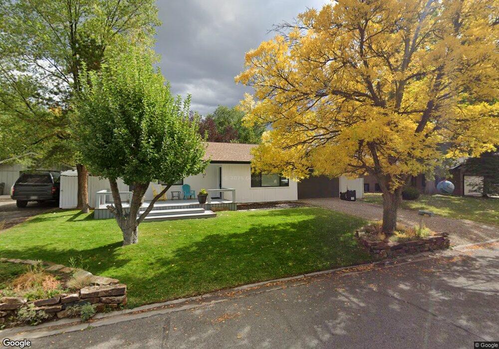
80 Arapahoe Carbondale, CO 81623
Estimated Value: $1,306,000 - $1,772,000
5
Beds
4
Baths
2,472
Sq Ft
$604/Sq Ft
Est. Value
About This Home
This home is located at 80 Arapahoe, Carbondale, CO 81623 and is currently estimated at $1,493,856, approximately $604 per square foot. 80 Arapahoe is a home located in Eagle County with nearby schools including Cornerstone Classical School and Waldorf School on the Roaring Fork.
Ownership History
Date
Name
Owned For
Owner Type
Purchase Details
Closed on
Sep 30, 2003
Sold by
Basalt Mtn Llc
Bought by
Smith Heather A
Current Estimated Value
Home Financials for this Owner
Home Financials are based on the most recent Mortgage that was taken out on this home.
Original Mortgage
$180,000
Outstanding Balance
$84,172
Interest Rate
6.24%
Mortgage Type
Purchase Money Mortgage
Estimated Equity
$1,409,685
Purchase Details
Closed on
Mar 25, 2003
Sold by
Crandall David J and Crandall Melanie A
Bought by
Basalt Mtn Llc
Purchase Details
Closed on
Mar 30, 1999
Sold by
Mccabe Jody B
Bought by
Crandall Melanie A and Crandall David J
Home Financials for this Owner
Home Financials are based on the most recent Mortgage that was taken out on this home.
Original Mortgage
$215,100
Interest Rate
6.82%
Create a Home Valuation Report for This Property
The Home Valuation Report is an in-depth analysis detailing your home's value as well as a comparison with similar homes in the area
Home Values in the Area
Average Home Value in this Area
Purchase History
| Date | Buyer | Sale Price | Title Company |
|---|---|---|---|
| Smith Heather A | $332,000 | Pitkin County Title Inc | |
| Basalt Mtn Llc | -- | -- | |
| Crandall Melanie A | $239,000 | -- |
Source: Public Records
Mortgage History
| Date | Status | Borrower | Loan Amount |
|---|---|---|---|
| Open | Smith Heather A | $180,000 | |
| Previous Owner | Crandall Melanie A | $215,100 |
Source: Public Records
Tax History Compared to Growth
Tax History
| Year | Tax Paid | Tax Assessment Tax Assessment Total Assessment is a certain percentage of the fair market value that is determined by local assessors to be the total taxable value of land and additions on the property. | Land | Improvement |
|---|---|---|---|---|
| 2024 | $4,983 | $66,750 | $12,700 | $54,050 |
| 2023 | $4,983 | $66,750 | $12,700 | $54,050 |
| 2022 | $2,985 | $43,960 | $11,120 | $32,840 |
| 2021 | $3,644 | $45,230 | $11,440 | $33,790 |
| 2020 | $3,335 | $43,440 | $9,650 | $33,790 |
| 2019 | $3,366 | $43,440 | $9,650 | $33,790 |
| 2018 | $3,190 | $40,780 | $7,630 | $33,150 |
| 2017 | $3,021 | $40,780 | $7,630 | $33,150 |
| 2016 | $2,606 | $34,560 | $7,960 | $26,600 |
| 2015 | -- | $34,560 | $7,960 | $26,600 |
| 2014 | $1,699 | $23,700 | $5,970 | $17,730 |
Source: Public Records
Map
Nearby Homes
- 140 Juniper Trail Unit 140
- 201 Tree Farm Dr Unit The Creekside
- 201 Tree Farm Dr Unit All Parcels
- 201 Tree Farm Dr Unit The Lakeview
- 145 Juniper Trail
- 128 Hopi
- TBD Tree Farm Dr Unit A4 - 201
- TBD Tree Farm Dr Unit A1-302
- TBD Tree Farm Dr Unit A2 - 301
- TBD Tree Farm Dr Unit A4 - 202
- TBD Tree Farm Dr Unit A1-202
- TBD Tree Farm Dr Unit The Edge at Tree Far
- TBD Tree Farm Dr Unit A1-203
- TBD Tree Farm Dr Unit A3 - 301
- TBD Tree Farm Dr Unit A1-301
- TBD Tree Farm Dr Unit A3 -201
- TBD Tree Farm Dr Unit A-2 302
- TBD Tree Farm Dr Unit A2-201
- TBD Tree Farm Dr Unit A1-201
- TBD Tree Farm Dr Unit A2-202