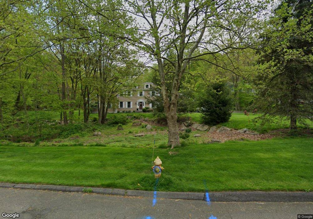
80 Cranbury Dr Trumbull, CT 06611
Daniel Farm District NeighborhoodEstimated Value: $896,000 - $980,000
3
Beds
3
Baths
3,034
Sq Ft
$304/Sq Ft
Est. Value
About This Home
This home is located at 80 Cranbury Dr, Trumbull, CT 06611 and is currently estimated at $922,970, approximately $304 per square foot. 80 Cranbury Dr is a home located in Fairfield County with nearby schools including Daniels Farm School, Hillcrest Middle School, and Trumbull High School.
Ownership History
Date
Name
Owned For
Owner Type
Purchase Details
Closed on
Apr 15, 2021
Sold by
Pietrunti Michael and Pietrunti Michelle
Bought by
Unger Daryl and Tintle Paige
Current Estimated Value
Home Financials for this Owner
Home Financials are based on the most recent Mortgage that was taken out on this home.
Original Mortgage
$620,100
Outstanding Balance
$554,998
Interest Rate
3%
Mortgage Type
Purchase Money Mortgage
Estimated Equity
$367,972
Purchase Details
Closed on
Jun 12, 2007
Sold by
Whalen Michael F
Bought by
Pietrunti Michael and Pietrunti Michelle
Purchase Details
Closed on
Jul 1, 1994
Sold by
Paul Bldrs Inc
Bought by
Whalen Michael and Whalen Josephine
Purchase Details
Closed on
Sep 3, 1993
Sold by
Squeglia Theresa
Bought by
Paul Bldrs
Create a Home Valuation Report for This Property
The Home Valuation Report is an in-depth analysis detailing your home's value as well as a comparison with similar homes in the area
Home Values in the Area
Average Home Value in this Area
Purchase History
| Date | Buyer | Sale Price | Title Company |
|---|---|---|---|
| Unger Daryl | $689,000 | None Available | |
| Unger Daryl | $689,000 | None Available | |
| Pietrunti Michael | $738,000 | -- | |
| Whalen Michael | $335,000 | -- | |
| Paul Bldrs | $107,500 | -- |
Source: Public Records
Mortgage History
| Date | Status | Borrower | Loan Amount |
|---|---|---|---|
| Open | Unger Daryl | $620,100 | |
| Closed | Unger Daryl | $620,100 | |
| Previous Owner | Paul Bldrs | $405,000 | |
| Previous Owner | Paul Bldrs | $25,000 |
Source: Public Records
Tax History Compared to Growth
Tax History
| Year | Tax Paid | Tax Assessment Tax Assessment Total Assessment is a certain percentage of the fair market value that is determined by local assessors to be the total taxable value of land and additions on the property. | Land | Improvement |
|---|---|---|---|---|
| 2025 | $15,439 | $418,180 | $156,100 | $262,080 |
| 2024 | $15,017 | $418,180 | $156,100 | $262,080 |
| 2023 | $14,774 | $418,180 | $156,100 | $262,080 |
| 2022 | $14,538 | $418,180 | $156,100 | $262,080 |
| 2021 | $14,057 | $384,650 | $141,960 | $242,690 |
| 2020 | $13,790 | $384,650 | $141,960 | $242,690 |
| 2018 | $13,449 | $384,650 | $141,960 | $242,690 |
| 2017 | $13,178 | $384,650 | $141,960 | $242,690 |
| 2016 | $12,913 | $384,650 | $141,960 | $242,690 |
| 2015 | $12,263 | $361,100 | $144,600 | $216,500 |
| 2014 | $12,000 | $361,100 | $144,600 | $216,500 |
Source: Public Records
Map
Nearby Homes
- 17 Moose Hill Rd
- 121 Lewis Rd
- 18 Skating Pond Rd
- 9 Lazy Brook Rd
- 93 Putting Green Rd N
- 15 Coral Dr
- 340 Moose Hill Rd
- 424 Waverly Rd
- 137 Greenwood Ln
- 6680 Main St
- 16 Winthrop Woods Rd
- 11211 Arganese Place Unit 11211
- 14 Gisella Rd
- 184 Putting Green Rd
- 193 Putting Green Rd
- 101 Royals Ct
- 6 Dartmouth Dr
- 230 Fitch Pass
- 440 Pitkin Hollow
- 6716 Main St
- 76 Cranbury Dr
- 25 Whitefield Dr
- 70 Cranbury Dr
- 19 Whitefield Dr
- 85 Cranbury Dr
- 55 Moose Hill Rd
- 71 Cranbury Dr
- 75 Cranbury Dr
- 91 Cranbury Dr
- 66 Cranbury Dr
- 15 Whitefield Dr
- 67 Cranbury Dr
- 49 Moose Hill Rd
- 20 Whitefield Dr
- 59 Moose Hill Rd
- 39 Moose Hill Rd
- 95 Cranbury Dr
- 5 Winhall Ln
- 101 Cranbury Dr
- 63 Moose Hill Rd