Estimated Value: $62,000 - $106,000
--
Bed
--
Bath
1,016
Sq Ft
$75/Sq Ft
Est. Value
About This Home
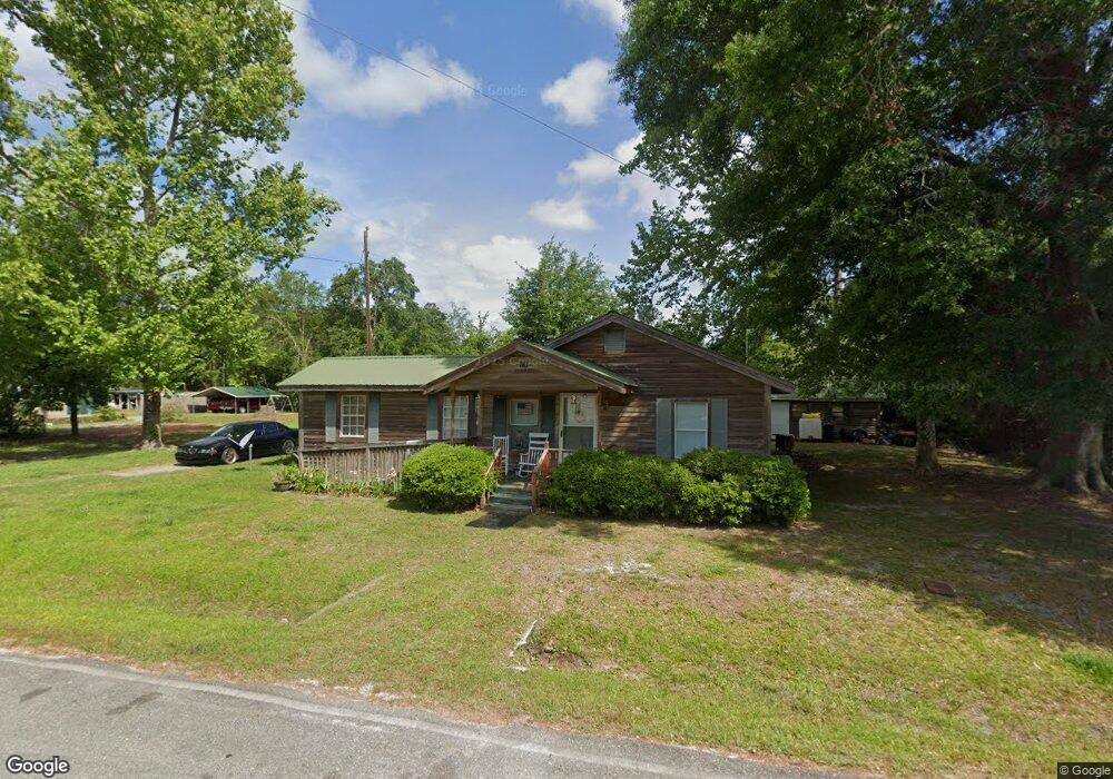
This home is located at 80 Day Ave, Fargo, GA 31631 and is currently estimated at $75,914, approximately $74 per square foot. 80 Day Ave is a home with nearby schools including Clinch County Elementary School, Clinch County Middle School, and Clinch County High School.
Ownership History
Date
Name
Owned For
Owner Type
Purchase Details
Closed on
Apr 23, 2021
Sold by
Fargo Church Of God
Bought by
Duncan William Todd
Current Estimated Value
Home Financials for this Owner
Home Financials are based on the most recent Mortgage that was taken out on this home.
Original Mortgage
$42,522
Outstanding Balance
$24,483
Interest Rate
3.1%
Mortgage Type
New Conventional
Estimated Equity
$51,431
Purchase Details
Closed on
Dec 30, 2019
Sold by
Graddy Fannie Faye
Bought by
Fargo Church Of God
Create a Home Valuation Report for This Property
The Home Valuation Report is an in-depth analysis detailing your home's value as well as a comparison with similar homes in the area
Home Values in the Area
Average Home Value in this Area
Purchase History
| Date | Buyer | Sale Price | Title Company |
|---|---|---|---|
| Duncan William Todd | $40,000 | -- | |
| Fargo Church Of God | $25,000 | -- |
Source: Public Records
Mortgage History
| Date | Status | Borrower | Loan Amount |
|---|---|---|---|
| Open | Duncan William Todd | $42,522 |
Source: Public Records
Tax History Compared to Growth
Tax History
| Year | Tax Paid | Tax Assessment Tax Assessment Total Assessment is a certain percentage of the fair market value that is determined by local assessors to be the total taxable value of land and additions on the property. | Land | Improvement |
|---|---|---|---|---|
| 2024 | $497 | $14,900 | $1,240 | $13,660 |
| 2023 | $505 | $15,148 | $1,240 | $13,908 |
| 2022 | $505 | $15,148 | $1,240 | $13,908 |
| 2021 | $506 | $15,188 | $1,280 | $13,908 |
| 2020 | $333 | $15,188 | $1,280 | $13,908 |
| 2019 | $440 | $15,188 | $1,280 | $13,908 |
| 2018 | $514 | $15,188 | $1,280 | $13,908 |
| 2017 | $514 | $15,188 | $1,280 | $13,908 |
| 2016 | $446 | $15,188 | $1,280 | $13,908 |
| 2015 | -- | $15,188 | $1,280 | $13,908 |
| 2014 | -- | $15,188 | $1,280 | $13,908 |
Source: Public Records
Map
Nearby Homes
- 106 Nancy Ave
- 729 U S 441
- 77 4th Ave
- TBD N Us Hwy 441
- NE 36th Dr
- 18246 SE 62nd Dr
- TBD NE 36th Dr
- 7332 SE 182nd Blvd
- 0 SE 67th Place
- TBD N Us Highway 441
- 0 N Us Highway 441
- 15000 County Road 6 E
- 2418 NE Omar Terrace
- TBD N Us Hwy 441 Lot C
- 264 Cuttings Loop Rd
- TBD SE 191 Ave
- 00 County Road 137
- 17073 Jack Dowling Cir
- TDB NE 25th Dr
- 1317 NE Drew Rd
- 110 Day Ave
- 231 Suwannee Dr
- 148 Nancy Ave
- 88 Nancy Ave
- 165 Day Ave
- 190 Day Ave
- 327 Suwannee Dr
- 370 Suwannee Dr
- 227 Day Ave
- 499 Suwannee Dr
- 88 Alfred Griffis Rd
- 13 Suwannee Dr
- 104-W W 2nd Ave
- 112 Pine St
- 617 Suwannee Dr
- 643 Suwannee Dr
- 71 Martin Luther King Dr
- 38 2nd Ave
- 38-W W 2nd Ave
- 105 Forest Ave