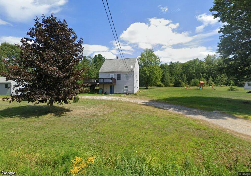
80 Fenderson Rd Parsonsfield, ME 04047
Estimated Value: $283,571 - $352,000
--
Bed
--
Bath
784
Sq Ft
$400/Sq Ft
Est. Value
About This Home
This home is located at 80 Fenderson Rd, Parsonsfield, ME 04047 and is currently estimated at $313,393, approximately $399 per square foot. 80 Fenderson Rd is a home with nearby schools including Ossipee Valley Christian School.
Ownership History
Date
Name
Owned For
Owner Type
Purchase Details
Closed on
Sep 15, 2020
Sold by
Hanson Kevin C
Bought by
Howes Tyler and Howes Amber
Current Estimated Value
Home Financials for this Owner
Home Financials are based on the most recent Mortgage that was taken out on this home.
Original Mortgage
$168,686
Outstanding Balance
$149,420
Interest Rate
2.8%
Mortgage Type
New Conventional
Estimated Equity
$163,973
Purchase Details
Closed on
Apr 20, 2010
Sold by
North Country Land Inc
Bought by
Hanson Kevin C
Create a Home Valuation Report for This Property
The Home Valuation Report is an in-depth analysis detailing your home's value as well as a comparison with similar homes in the area
Home Values in the Area
Average Home Value in this Area
Purchase History
| Date | Buyer | Sale Price | Title Company |
|---|---|---|---|
| Howes Tyler | -- | None Available | |
| Hanson Kevin C | -- | -- |
Source: Public Records
Mortgage History
| Date | Status | Borrower | Loan Amount |
|---|---|---|---|
| Open | Howes Tyler | $168,686 | |
| Previous Owner | Hanson Kevin C | $150,000 | |
| Previous Owner | Hanson Kevin C | $30,000 |
Source: Public Records
Tax History Compared to Growth
Tax History
| Year | Tax Paid | Tax Assessment Tax Assessment Total Assessment is a certain percentage of the fair market value that is determined by local assessors to be the total taxable value of land and additions on the property. | Land | Improvement |
|---|---|---|---|---|
| 2024 | $2,677 | $159,357 | $52,315 | $107,042 |
| 2023 | $2,582 | $159,357 | $52,315 | $107,042 |
| 2022 | $2,470 | $159,357 | $52,315 | $107,042 |
| 2021 | $2,462 | $159,357 | $52,315 | $107,042 |
| 2020 | $2,414 | $159,357 | $52,315 | $107,042 |
| 2019 | $2,374 | $159,357 | $52,315 | $107,042 |
| 2017 | $2,374 | $159,357 | $52,315 | $107,042 |
| 2016 | $2,374 | $159,357 | $52,315 | $107,042 |
| 2015 | $2,390 | $159,357 | $52,315 | $107,042 |
| 2013 | $2,327 | $159,357 | $52,315 | $107,042 |
Source: Public Records
Map
Nearby Homes
- 9 Penny Ln
- 1783 North Rd
- 178 Maplecrest Rd
- 27 Lynn Dr
- R13/038 Weeks Rd
- 1960 North Rd
- 27 Nocturne Rd
- 80 Spur Rd
- 424 Maplecrest Rd
- 17 Doris Ln
- 0 Milliken Rd Unit 1625728
- 264 Watson Hill Rd
- Lot #00 North Rd
- Lot #02 North Rd
- Lot# 01 North Rd
- Lot #5 Jordan Heights Rd
- 160 Quarry Rd
- 152 Quarry Rd
- 440 Quarry Rd
- 24 Emery Corner Rd
- 3 Fenderson Rd
- 5 Fenderson Rd
- 4 Fenderson Rd
- 85 Fenderson Rd
- 6 Michaelas Way
- 6 Michaela's Way
- Lot 5 Fenderson Rd
- Lot 4 Fenderson Rd
- Lots 4 & 5 Fenderson Rd
- 71 Fenderson Rd
- 66 Fenderson Rd
- 13 Teds Ln
- 62 Fenderson Rd
- 61 Fenderson Rd
- 52 Fenderson Rd
- 117 Fenderson Rd
- 41 Fenderson Rd
- 16 Teds Ln
- 25 Teds Ln
- 40 Fenderson Rd