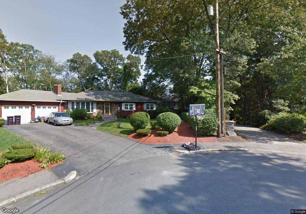
80 Heather Ln South Weymouth, MA 02190
South Weymouth NeighborhoodEstimated Value: $917,000 - $1,224,000
5
Beds
6
Baths
4,000
Sq Ft
$261/Sq Ft
Est. Value
About This Home
This home is located at 80 Heather Ln, South Weymouth, MA 02190 and is currently estimated at $1,043,750, approximately $260 per square foot. 80 Heather Ln is a home located in Norfolk County with nearby schools including Thomas V Nash, Abigail Adams Middle School, and Weymouth Middle School Chapman.
Ownership History
Date
Name
Owned For
Owner Type
Purchase Details
Closed on
Apr 2, 2019
Sold by
Walsh Kevin T and Walsh Joyce E
Bought by
Walsh Ft
Current Estimated Value
Purchase Details
Closed on
Aug 17, 2011
Sold by
Mento John L and Mento K M
Bought by
Walsh Kevin T and Walsh Joyce E
Home Financials for this Owner
Home Financials are based on the most recent Mortgage that was taken out on this home.
Original Mortgage
$400,000
Interest Rate
4.62%
Mortgage Type
Purchase Money Mortgage
Create a Home Valuation Report for This Property
The Home Valuation Report is an in-depth analysis detailing your home's value as well as a comparison with similar homes in the area
Home Values in the Area
Average Home Value in this Area
Purchase History
| Date | Buyer | Sale Price | Title Company |
|---|---|---|---|
| Walsh Ft | -- | -- | |
| Walsh Kevin T | $510,000 | -- |
Source: Public Records
Mortgage History
| Date | Status | Borrower | Loan Amount |
|---|---|---|---|
| Previous Owner | Walsh Kevin T | $400,000 |
Source: Public Records
Tax History Compared to Growth
Tax History
| Year | Tax Paid | Tax Assessment Tax Assessment Total Assessment is a certain percentage of the fair market value that is determined by local assessors to be the total taxable value of land and additions on the property. | Land | Improvement |
|---|---|---|---|---|
| 2025 | $8,496 | $841,200 | $252,900 | $588,300 |
| 2024 | $8,145 | $793,100 | $240,900 | $552,200 |
| 2023 | $8,105 | $775,600 | $243,200 | $532,400 |
| 2022 | $7,868 | $686,600 | $225,200 | $461,400 |
| 2021 | $8,017 | $682,900 | $225,200 | $457,700 |
| 2020 | $7,816 | $655,700 | $225,200 | $430,500 |
| 2019 | $7,628 | $629,400 | $216,600 | $412,800 |
| 2018 | $7,374 | $589,900 | $206,200 | $383,700 |
| 2017 | $7,276 | $568,000 | $196,500 | $371,500 |
| 2016 | $6,998 | $546,700 | $188,900 | $357,800 |
| 2015 | $6,713 | $520,400 | $188,900 | $331,500 |
| 2014 | $6,440 | $484,200 | $175,800 | $308,400 |
Source: Public Records
Map
Nearby Homes
- 120 Randolph St
- 193 Randolph St
- 50 Hollis St
- 211 Randolph St
- 24 Fisher Rd
- 18 Fountain Ln Unit 2
- 16 Jay Rd
- 68 Massapoag St Unit 7
- 27 Park Ave
- 308 Forest St
- 60 Greentree Ln Unit 38
- 45 Union St
- 55 Greentree Ln Unit 19
- 7 Woodcrest Ct Unit 4
- 11 Woodcrest Ct Unit 5
- 10 Woodcrest Ct Unit 4
- 8 Woodcrest Ct Unit 4
- 2 Mitchell Ln Unit B
- 92 Mercury St
- 354 Tilden Commons Ln