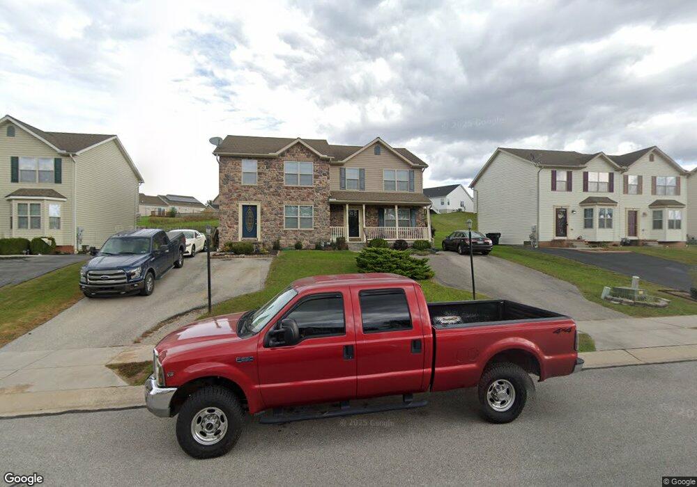
80 Hemlock Dr Unit 102A Hanover, PA 17331
Estimated Value: $237,147 - $246,000
3
Beds
3
Baths
1,276
Sq Ft
$191/Sq Ft
Est. Value
About This Home
This home is located at 80 Hemlock Dr Unit 102A, Hanover, PA 17331 and is currently estimated at $243,537, approximately $190 per square foot. 80 Hemlock Dr Unit 102A is a home located in Adams County with nearby schools including New Oxford Senior High School, St. Teresa of Calcutta Catholic School - Conewago Campus, and St. Teresa of Calcutta Catholic School - McSherrystown Campus.
Ownership History
Date
Name
Owned For
Owner Type
Purchase Details
Closed on
Jun 16, 2005
Sold by
Stone Ridge Development Corporation
Bought by
Turner Maria and Turner Andrew Michael
Current Estimated Value
Home Financials for this Owner
Home Financials are based on the most recent Mortgage that was taken out on this home.
Original Mortgage
$30,000
Outstanding Balance
$22,655
Interest Rate
5.82%
Mortgage Type
Credit Line Revolving
Estimated Equity
$220,882
Purchase Details
Closed on
Mar 23, 2005
Sold by
Stone Ridge Development Corp
Bought by
Merson Phillip J and Merson Denise A
Home Financials for this Owner
Home Financials are based on the most recent Mortgage that was taken out on this home.
Original Mortgage
$119,100
Interest Rate
5.95%
Mortgage Type
New Conventional
Create a Home Valuation Report for This Property
The Home Valuation Report is an in-depth analysis detailing your home's value as well as a comparison with similar homes in the area
Home Values in the Area
Average Home Value in this Area
Purchase History
| Date | Buyer | Sale Price | Title Company |
|---|---|---|---|
| Turner Maria | $171,900 | -- | |
| Merson Phillip J | $148,900 | -- |
Source: Public Records
Mortgage History
| Date | Status | Borrower | Loan Amount |
|---|---|---|---|
| Open | Turner Maria | $30,000 | |
| Open | Turner Maria | $75,000 | |
| Previous Owner | Merson Phillip J | $119,100 |
Source: Public Records
Tax History
| Year | Tax Paid | Tax Assessment Tax Assessment Total Assessment is a certain percentage of the fair market value that is determined by local assessors to be the total taxable value of land and additions on the property. | Land | Improvement |
|---|---|---|---|---|
| 2025 | $3,621 | $151,200 | $29,500 | $121,700 |
| 2024 | $3,344 | $151,200 | $29,500 | $121,700 |
| 2023 | $3,221 | $151,200 | $29,500 | $121,700 |
| 2022 | $3,122 | $151,200 | $29,500 | $121,700 |
| 2021 | $3,042 | $151,200 | $29,500 | $121,700 |
| 2020 | $3,047 | $151,200 | $29,500 | $121,700 |
| 2019 | $2,910 | $151,200 | $29,500 | $121,700 |
| 2018 | $2,849 | $151,200 | $29,500 | $121,700 |
| 2017 | $2,731 | $151,200 | $29,500 | $121,700 |
| 2016 | -- | $151,200 | $29,500 | $121,700 |
| 2015 | -- | $151,200 | $29,500 | $121,700 |
| 2014 | -- | $151,200 | $29,500 | $121,700 |
Source: Public Records
Map
Nearby Homes
- 177 Skyview Cir
- 136 Conewago Dr Unit 14
- 426 N 3rd St Unit 53
- 0 Red Hill Mt Misery Roads
- 340 Fairview Ave
- 209 N 3rd St
- 507 Ridge Ave Unit 48
- 235 Ridge Ave
- 504 North St
- 86 Barley Cir Unit 9
- 618 North St
- 23 Westview Dr Unit 6
- 527 Main St
- 128 North St
- 2779 Centennial Rd
- 5955 Hanover Rd
- 11 Flint Dr
- 65 Flint Dr
- 46 Flint Dr
- 192 Ledger Dr Unit 72
- 84 Hemlock Dr Unit 101B
- 78 Hemlock Dr Unit 102B
- 86 Hemlock Dr Unit 101A
- 74 Hemlock Dr Unit 103A
- 88 Hemlock Dr Unit 100B
- 72 Hemlock Dr Unit 103B
- 68 Hemlock Dr Unit 104A
- 90 Hemlock Dr Unit 100A
- 94 Hemlock Dr Unit 99B
- 66 Hemlock Dr Unit 104B
- 19 Solar Ct
- 79 Hemlock Dr Unit 42A
- 83 Hemlock Dr Unit 41B
- 77 Hemlock Dr Unit 42B
- 85 Hemlock Dr Unit 41A
- 62 Hemlock Dr Unit 105A
- 23 Solar Ct
- 73 Hemlock Dr Unit 43A
- 89 Hemlock Dr Unit 40B
- 37 Galaxy Dr
Your Personal Tour Guide
Ask me questions while you tour the home.