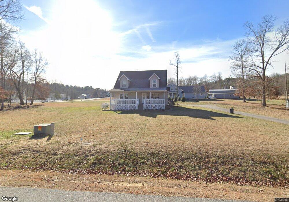
80 High Range Dr Blairsville, GA 30512
Ivylog NeighborhoodEstimated Value: $449,553 - $545,000
3
Beds
3
Baths
1,916
Sq Ft
$258/Sq Ft
Est. Value
About This Home
This home is located at 80 High Range Dr, Blairsville, GA 30512 and is currently estimated at $494,138, approximately $257 per square foot. 80 High Range Dr is a home with nearby schools including Union County Primary School, Union County Elementary School, and Union County Middle School.
Ownership History
Date
Name
Owned For
Owner Type
Purchase Details
Closed on
Mar 22, 2013
Sold by
England Alicia F
Bought by
England Alicia F and England Matthew S
Current Estimated Value
Home Financials for this Owner
Home Financials are based on the most recent Mortgage that was taken out on this home.
Original Mortgage
$10,875
Interest Rate
3.56%
Mortgage Type
New Conventional
Purchase Details
Closed on
Feb 27, 2013
Sold by
Meadows Of Ivy Log Partner
Bought by
England Alicia F
Home Financials for this Owner
Home Financials are based on the most recent Mortgage that was taken out on this home.
Original Mortgage
$10,875
Interest Rate
3.56%
Mortgage Type
New Conventional
Purchase Details
Closed on
Oct 4, 2012
Sold by
Meadows Of Ivy Log Partner
Bought by
Cantrell Shirley S and Cox Malcolm A
Create a Home Valuation Report for This Property
The Home Valuation Report is an in-depth analysis detailing your home's value as well as a comparison with similar homes in the area
Home Values in the Area
Average Home Value in this Area
Purchase History
| Date | Buyer | Sale Price | Title Company |
|---|---|---|---|
| England Alicia F | -- | -- | |
| England Alicia F | $14,500 | -- | |
| Cantrell Shirley S | $16,900 | -- |
Source: Public Records
Mortgage History
| Date | Status | Borrower | Loan Amount |
|---|---|---|---|
| Closed | England Alicia F | $10,875 | |
| Closed | England Alicia F | $10,875 |
Source: Public Records
Tax History Compared to Growth
Tax History
| Year | Tax Paid | Tax Assessment Tax Assessment Total Assessment is a certain percentage of the fair market value that is determined by local assessors to be the total taxable value of land and additions on the property. | Land | Improvement |
|---|---|---|---|---|
| 2024 | $2,059 | $176,400 | $11,720 | $164,680 |
| 2023 | $2,248 | $170,840 | $11,720 | $159,120 |
| 2022 | $1,836 | $139,912 | $11,320 | $128,592 |
| 2021 | $1,735 | $112,084 | $12,000 | $100,084 |
| 2020 | $1,350 | $73,369 | $10,200 | $63,169 |
| 2019 | $1,276 | $73,369 | $10,200 | $63,169 |
| 2018 | $1,289 | $73,369 | $10,200 | $63,169 |
| 2017 | $1,254 | $73,369 | $10,200 | $63,169 |
| 2016 | $179 | $10,200 | $10,200 | $0 |
| 2015 | $181 | $10,200 | $10,200 | $0 |
| 2013 | -- | $7,115 | $7,115 | $0 |
Source: Public Records
Map
Nearby Homes
- 0 Mile High Dr Unit 10557479
- 223 High Range Dr
- 406 Ivy Bend
- LT 14 Vista Ridge
- LT 13 Vista Ridge
- LT 14 Fox Crossing
- LT 15 Fox Crossing
- 1133 Garrett Cir
- 64 Guy Ln
- 869 Garrett Cir
- 869 Garrett Cir Unit 215
- 41C Garrett Cir
- 116/117 Highland Park
- Lot 25 Highland Falls
- 466 Ivylog Creek Rd
- 180 Chimney Ridge
- 196 Chimney Ridge
- 868 Old Owen Dr
- 3273 Ivylog Rd
- 423 Chimney Ridge
- 50 Grassy Ct
- 107 High Range Dr
- 2161 Fieldcrest Way Unit LOT 58)
- 2162 Fieldcrest Way
- 53 Grassy Ct
- 58 Fieldcrest Way
- 0 High Range Dr Unit 20067
- 0 High Range Dr Unit 208574
- 0 High Range Dr Unit 115858
- 0 High Range Dr Unit 95316
- 0 High Range Dr Unit 8765766
- 0 High Range Dr Unit 8572975
- 0 High Range Dr Unit 3030602
- 0 Mile High Dr Unit Lot 16 8162726
- 0 Mile High Dr Unit 10442629
- 0 Mile High Dr Unit 10326372
- 137 High Range Dr
- 53 Grassy Ct
- 3901 High Range Dr
- 193 High Range Dr