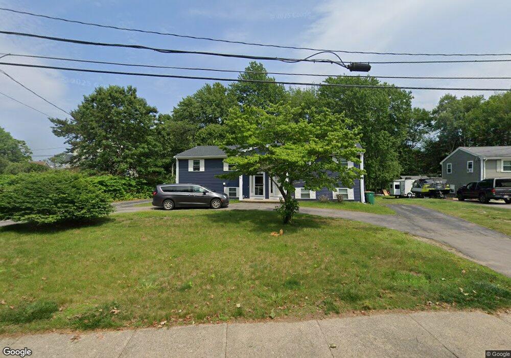
80 High St Mansfield, MA 02048
Estimated Value: $671,000 - $768,000
6
Beds
4
Baths
2,658
Sq Ft
$263/Sq Ft
Est. Value
About This Home
This home is located at 80 High St, Mansfield, MA 02048 and is currently estimated at $698,071, approximately $262 per square foot. 80 High St is a home located in Bristol County with nearby schools including Everett W. Robinson Elementary School, Jordan/Jackson Elementary School, and Harold L. Qualters Middle School.
Ownership History
Date
Name
Owned For
Owner Type
Purchase Details
Closed on
Aug 8, 2006
Sold by
Keefe John J and Keefe Emilia
Bought by
Keefe John J
Current Estimated Value
Home Financials for this Owner
Home Financials are based on the most recent Mortgage that was taken out on this home.
Original Mortgage
$260,000
Interest Rate
6.7%
Mortgage Type
Purchase Money Mortgage
Purchase Details
Closed on
Jan 19, 2001
Sold by
Howey Jon A and Howey Maureen M
Bought by
Keefe John J and Keefe Emila
Home Financials for this Owner
Home Financials are based on the most recent Mortgage that was taken out on this home.
Original Mortgage
$198,400
Interest Rate
7.52%
Mortgage Type
Purchase Money Mortgage
Create a Home Valuation Report for This Property
The Home Valuation Report is an in-depth analysis detailing your home's value as well as a comparison with similar homes in the area
Home Values in the Area
Average Home Value in this Area
Purchase History
| Date | Buyer | Sale Price | Title Company |
|---|---|---|---|
| Keefe John J | -- | -- | |
| Keefe John J | $248,000 | -- |
Source: Public Records
Mortgage History
| Date | Status | Borrower | Loan Amount |
|---|---|---|---|
| Open | Keefe John J | $290,000 | |
| Closed | Keefe John J | $260,000 | |
| Previous Owner | Keefe John J | $198,400 |
Source: Public Records
Tax History
| Year | Tax Paid | Tax Assessment Tax Assessment Total Assessment is a certain percentage of the fair market value that is determined by local assessors to be the total taxable value of land and additions on the property. | Land | Improvement |
|---|---|---|---|---|
| 2025 | $7,989 | $606,600 | $274,900 | $331,700 |
| 2024 | $7,474 | $553,600 | $274,900 | $278,700 |
| 2023 | $7,296 | $517,800 | $274,900 | $242,900 |
| 2022 | $7,347 | $484,300 | $254,600 | $229,700 |
| 2021 | $3,977 | $404,000 | $204,100 | $199,900 |
| 2020 | $6,056 | $394,300 | $194,400 | $199,900 |
| 2019 | $5,272 | $346,400 | $162,100 | $184,300 |
| 2018 | $5,152 | $330,900 | $154,500 | $176,400 |
| 2017 | $4,200 | $279,600 | $150,000 | $129,600 |
| 2016 | $4,102 | $266,200 | $142,900 | $123,300 |
| 2015 | $4,050 | $261,300 | $142,900 | $118,400 |
Source: Public Records
Map
Nearby Homes
- 150 Rumford Ave Unit 110
- 266 N Main St Unit 3
- 28 Court St
- 152 Central St
- 22 Pleasant St Unit C
- 166 Chauncy St
- 44 Fairfield Park Unit 44
- 81 Chilson Ave
- 73-75 Draper Ave
- 46 Hope St
- 619 N Main St
- 4 Concetta Cir
- 356 Central St
- 1 Deer Path Ln
- 460 Ware St
- 571 Ware St
- 14 Windchime Dr
- 233 Central St
- 261 East St
- 4 Erick Rd Unit 90
- 88 High St Unit 90
- 74 High St Unit 76
- 98 High St Unit 100
- 90 High St Unit 2
- 70 High St
- 110 High St Unit 114
- 50 High St
- 50 High St Unit 2
- 125 High St Unit 10A
- 125 High St Unit 203
- 125 High St Unit 103
- 125 High St Unit 6 & 7
- 114 Rumford Ave
- 114 Rumford Ave Unit A
- 96 Rumford Ave
- 96 Rumford Ave Unit 2
- 120 High St
- 106 Rumford Ave
- 92 Rumford Ave
- 42 W Church St
Your Personal Tour Guide
Ask me questions while you tour the home.