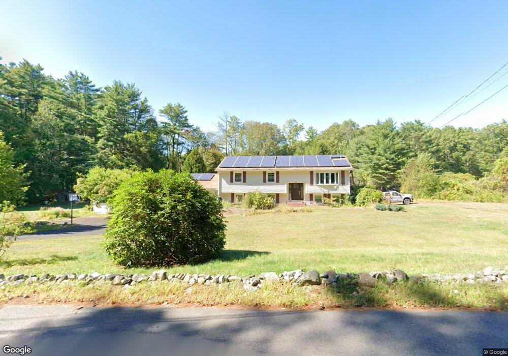
80 Holden Rd Shirley, MA 01464
Estimated Value: $586,605 - $672,000
3
Beds
2
Baths
2,436
Sq Ft
$254/Sq Ft
Est. Value
About This Home
This home is located at 80 Holden Rd, Shirley, MA 01464 and is currently estimated at $618,401, approximately $253 per square foot. 80 Holden Rd is a home located in Middlesex County with nearby schools including Page Hilltop School, Lura A. White Elementary School, and Ayer Shirley Regional Middle School.
Ownership History
Date
Name
Owned For
Owner Type
Purchase Details
Closed on
May 14, 2025
Sold by
Mason Laura M
Bought by
Laura M Mason Ret and Mason
Current Estimated Value
Purchase Details
Closed on
May 27, 2010
Sold by
Dubitsky John L and Dubitsky Susan M
Bought by
Mason Allan E and Mason Laura M
Home Financials for this Owner
Home Financials are based on the most recent Mortgage that was taken out on this home.
Original Mortgage
$245,600
Interest Rate
5.13%
Mortgage Type
Purchase Money Mortgage
Purchase Details
Closed on
Nov 10, 2006
Sold by
Bean Diana J and Bean Jerry K
Bought by
Dubitsky John L and Dubitsky Susan M
Home Financials for this Owner
Home Financials are based on the most recent Mortgage that was taken out on this home.
Original Mortgage
$268,000
Interest Rate
6.31%
Mortgage Type
Purchase Money Mortgage
Create a Home Valuation Report for This Property
The Home Valuation Report is an in-depth analysis detailing your home's value as well as a comparison with similar homes in the area
Home Values in the Area
Average Home Value in this Area
Purchase History
| Date | Buyer | Sale Price | Title Company |
|---|---|---|---|
| Laura M Mason Ret | -- | None Available | |
| Laura M Mason Ret | -- | None Available | |
| Mason Allan E | $315,000 | -- | |
| Mason Allan E | $315,000 | -- | |
| Dubitsky John L | $335,000 | -- | |
| Dubitsky John L | $335,000 | -- |
Source: Public Records
Mortgage History
| Date | Status | Borrower | Loan Amount |
|---|---|---|---|
| Previous Owner | Mason Allan E | $245,600 | |
| Previous Owner | Dubitsky John L | $268,000 | |
| Previous Owner | Dubitsky John L | $10,000 |
Source: Public Records
Tax History Compared to Growth
Tax History
| Year | Tax Paid | Tax Assessment Tax Assessment Total Assessment is a certain percentage of the fair market value that is determined by local assessors to be the total taxable value of land and additions on the property. | Land | Improvement |
|---|---|---|---|---|
| 2025 | $5,951 | $458,800 | $136,500 | $322,300 |
| 2024 | $5,622 | $414,300 | $124,800 | $289,500 |
| 2023 | $5,164 | $364,200 | $124,800 | $239,400 |
| 2022 | $5,440 | $351,400 | $120,900 | $230,500 |
| 2021 | $5,595 | $338,500 | $109,200 | $229,300 |
| 2020 | $5,368 | $333,200 | $109,200 | $224,000 |
| 2019 | $5,472 | $340,300 | $109,200 | $231,100 |
| 2018 | $5,212 | $317,400 | $104,500 | $212,900 |
| 2017 | $5,085 | $307,800 | $101,400 | $206,400 |
| 2016 | $5,003 | $303,000 | $101,400 | $201,600 |
| 2015 | $4,655 | $268,900 | $99,800 | $169,100 |
Source: Public Records
Map
Nearby Homes
- 11 Longwood Dr
- 12 Hazen Rd
- 49 Parker Rd
- 61 Parker Rd
- 878 Flat Hill Rd
- 22 Townsend Rd
- 45 Spring St
- 2 Oakes Landing
- 166 Elmwood Rd
- 110 Burrage St
- 4 Hill Ln
- 1790 Massachusetts Ave Unit 25
- 1790 Massachusetts Ave Unit 22
- 659 Reservoir Rd
- 4 Ambrose Way Unit 4
- 7 Ambrose Way Unit 5
- 6 Ambrose Way Unit 3
- 17 Ambrose Way Unit 17
- 9 Ambrose Way Unit 9
- 5 Ambrose Way Unit 5