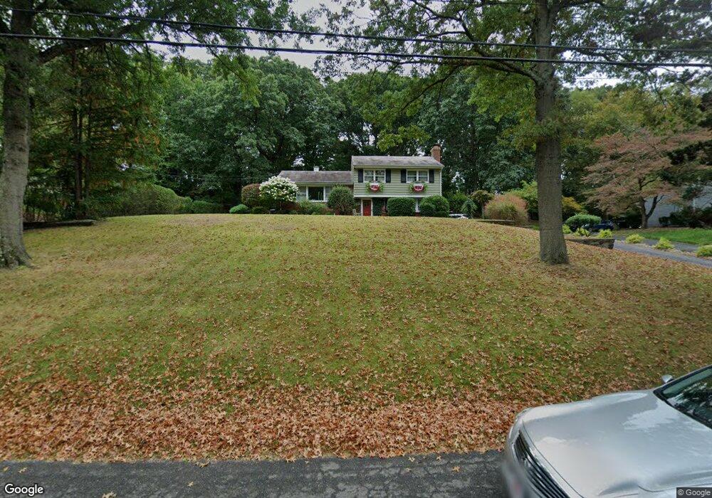
80 Iler Dr Middletown, NJ 07748
New Monmouth NeighborhoodEstimated Value: $730,000 - $863,000
3
Beds
3
Baths
1,723
Sq Ft
$471/Sq Ft
Est. Value
About This Home
This home is located at 80 Iler Dr, Middletown, NJ 07748 and is currently estimated at $810,940, approximately $470 per square foot. 80 Iler Dr is a home located in Monmouth County with nearby schools including Nut Swamp Elementary School, Thompson Middle School, and Middletown - South High School.
Ownership History
Date
Name
Owned For
Owner Type
Purchase Details
Closed on
Sep 27, 2007
Sold by
Burroughs Nancy and Nutley Jean
Bought by
Odonnell William E and Odonnell Fiona L
Current Estimated Value
Home Financials for this Owner
Home Financials are based on the most recent Mortgage that was taken out on this home.
Original Mortgage
$416,813
Outstanding Balance
$260,522
Interest Rate
6.59%
Mortgage Type
Purchase Money Mortgage
Estimated Equity
$550,418
Purchase Details
Closed on
Jun 15, 2005
Sold by
Knapp Mildred J
Bought by
Burroughs Nancy and Nutley Jean
Create a Home Valuation Report for This Property
The Home Valuation Report is an in-depth analysis detailing your home's value as well as a comparison with similar homes in the area
Home Values in the Area
Average Home Value in this Area
Purchase History
| Date | Buyer | Sale Price | Title Company |
|---|---|---|---|
| Odonnell William E | $439,050 | Multiple | |
| Burroughs Nancy | -- | -- |
Source: Public Records
Mortgage History
| Date | Status | Borrower | Loan Amount |
|---|---|---|---|
| Open | Odonnell William E | $416,813 |
Source: Public Records
Tax History
| Year | Tax Paid | Tax Assessment Tax Assessment Total Assessment is a certain percentage of the fair market value that is determined by local assessors to be the total taxable value of land and additions on the property. | Land | Improvement |
|---|---|---|---|---|
| 2025 | $10,961 | $728,200 | $524,400 | $203,800 |
| 2024 | $9,978 | $666,300 | $427,700 | $238,600 |
| 2023 | $9,978 | $574,100 | $412,000 | $162,100 |
| 2022 | $8,495 | $469,400 | $312,500 | $156,900 |
| 2021 | $8,495 | $408,400 | $268,800 | $139,600 |
| 2020 | $8,129 | $380,200 | $243,800 | $136,400 |
| 2019 | $8,015 | $379,500 | $243,800 | $135,700 |
| 2018 | $8,085 | $373,100 | $243,800 | $129,300 |
| 2017 | $7,842 | $369,200 | $243,800 | $125,400 |
| 2016 | $8,332 | $391,000 | $268,800 | $122,200 |
| 2015 | $7,925 | $371,000 | $248,800 | $122,200 |
| 2014 | $7,913 | $361,500 | $238,800 | $122,700 |
Source: Public Records
Map
Nearby Homes
- 164 Heights Terrace
- 0 Hamiltonian Dr Unit 22600718
- 49 Stork Ct
- 2103 Buckingham Cir
- 1604 Buckingham Cir
- 1502 Buckingham Cir
- 3503 Buckingham Cir
- 3701 James Ct
- 3903 Buckingham Cir
- 7 Meehan Ct
- 17 Crestview Dr
- 46 Augustus Dr
- 6 Waller Dr
- 10 Waller Dr
- 712 Abby Rd Unit 712
- 58 Augustus Dr
- 80 Edmund Way
- 39 Melrose Terrace
- 911 Middletown Lincroft Rd
- 3 Deridder Ct
Your Personal Tour Guide
Ask me questions while you tour the home.