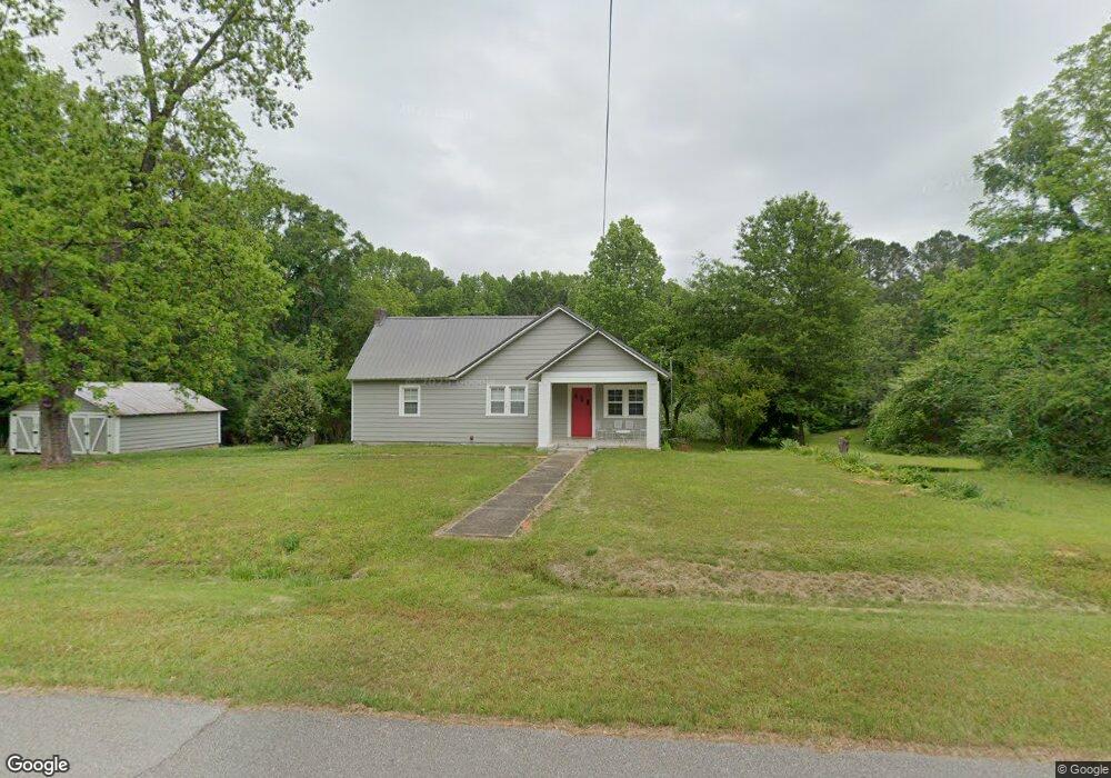
80 John Harris Rd Lagrange, GA 30240
Estimated Value: $169,000 - $272,000
3
Beds
2
Baths
1,706
Sq Ft
$135/Sq Ft
Est. Value
About This Home
This home is located at 80 John Harris Rd, Lagrange, GA 30240 and is currently estimated at $229,552, approximately $134 per square foot. 80 John Harris Rd is a home located in Troup County with nearby schools including Franklin Forest Elementary School, Hollis Hand Elementary School, and Ethel W. Kight Elementary School.
Ownership History
Date
Name
Owned For
Owner Type
Purchase Details
Closed on
May 1, 2017
Sold by
Cato Dwight
Bought by
Evans Martha
Current Estimated Value
Purchase Details
Closed on
Feb 13, 2006
Sold by
Wingo Sara Beatrice
Bought by
Cato Dwight and Cato Rita
Purchase Details
Closed on
Nov 1, 1987
Sold by
Sara Norene Wingo
Bought by
Sara Beatrice Wingo
Purchase Details
Closed on
Jul 1, 1985
Sold by
John T Wingo
Bought by
Sara Norene Wingo
Purchase Details
Closed on
Nov 2, 1984
Sold by
Sara Beatrice Wingo
Bought by
John T Wingo
Purchase Details
Closed on
Jul 24, 1984
Sold by
John T Wingo
Bought by
Sara Beatrice Wingo
Purchase Details
Closed on
Apr 1, 1950
Sold by
Angroves Louie S and Angroves Wm S
Bought by
John T Wingo
Create a Home Valuation Report for This Property
The Home Valuation Report is an in-depth analysis detailing your home's value as well as a comparison with similar homes in the area
Purchase History
| Date | Buyer | Sale Price | Title Company |
|---|---|---|---|
| Evans Martha | $45,000 | -- | |
| Cato Dwight | $79,000 | -- | |
| Sara Beatrice Wingo | -- | -- | |
| Sara Norene Wingo | -- | -- | |
| John T Wingo | -- | -- | |
| Sara Beatrice Wingo | -- | -- | |
| John T Wingo | -- | -- |
Source: Public Records
Tax History
| Year | Tax Paid | Tax Assessment Tax Assessment Total Assessment is a certain percentage of the fair market value that is determined by local assessors to be the total taxable value of land and additions on the property. | Land | Improvement |
|---|---|---|---|---|
| 2025 | $1,384 | $52,580 | $13,760 | $38,820 |
| 2024 | $1,384 | $50,740 | $13,760 | $36,980 |
| 2023 | $1,019 | $37,380 | $13,760 | $23,620 |
| 2022 | $963 | $35,740 | $13,760 | $21,980 |
| 2021 | $771 | $25,576 | $10,640 | $14,936 |
| 2020 | $687 | $22,776 | $10,640 | $12,136 |
| 2019 | $693 | $22,976 | $10,640 | $12,336 |
| 2018 | $659 | $21,856 | $10,640 | $11,216 |
| 2017 | $543 | $18,000 | $10,640 | $7,360 |
Source: Public Records
Map
Nearby Homes
- 110 Pond View Point
- 103 Woodchase
- 502 Ashford Cir
- 102 Woodchase
- 107 Windridge
- 109 Windridge
- 64 Waterview Ct
- 209 River Oaks Dr
- 219 E Yorktown Dr
- 114 Red Oak Trail
- 1784 Mooty Bridge Rd
- 106 Highland Park
- 104 Englewood Dr
- 0 Waterview Dr Unit 10558462
- 206 Sturbridge Dr
- 42 Wooding Place
- 104 Sweetgum Dr
- 223 Village Dr
- 207 Lakeshore Dr
- 1006 Wares Cross Rd
- 81 John Harris Rd
- 44 John Harris Rd
- 34 John Harris Rd
- 37 John Harris Rd
- 0 Lot 4 Ridge N Unit Lot 4 319541
- 2304 Mooty Bridge Rd
- 2295 Mooty Bridge Rd
- 6475 2283 Mooty Bridge
- 2283 Mooty Bridge Rd
- 100 Holly Point Dr
- 2265 Mooty Bridge Rd
- 104 Holly Point Dr
- 110 Holly Point Dr
- 102 Holly Point Dr
- 106 Holly Point Dr
- 108 Holly Point Dr
- 2252 Mooty Bridge Rd
- 2225 Mooty Bridge Rd
- 2241 Mooty Bridge Rd Unit TRACT 2
- 2241 Mooty Bridge Rd Unit TRACT 1
Your Personal Tour Guide
Ask me questions while you tour the home.