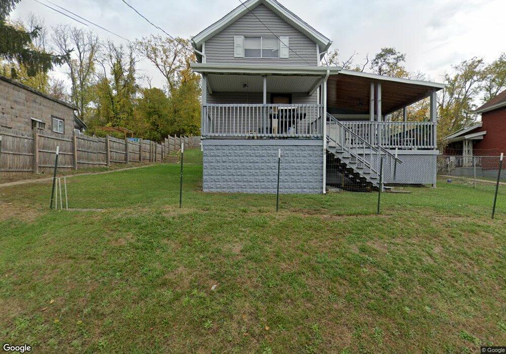
80 Main St Daisytown, PA 15427
Estimated Value: $79,000 - $123,771
3
Beds
1
Bath
1,280
Sq Ft
$76/Sq Ft
Est. Value
About This Home
This home is located at 80 Main St, Daisytown, PA 15427 and is currently estimated at $96,943, approximately $75 per square foot. 80 Main St is a home with nearby schools including California Area Elementary School, California Area Middle School, and California Area Senior High School.
Ownership History
Date
Name
Owned For
Owner Type
Purchase Details
Closed on
Mar 10, 2000
Sold by
Antal Ernet D
Bought by
Miller David R
Current Estimated Value
Home Financials for this Owner
Home Financials are based on the most recent Mortgage that was taken out on this home.
Original Mortgage
$29,000
Outstanding Balance
$9,751
Interest Rate
8.18%
Estimated Equity
$87,192
Create a Home Valuation Report for This Property
The Home Valuation Report is an in-depth analysis detailing your home's value as well as a comparison with similar homes in the area
Home Values in the Area
Average Home Value in this Area
Purchase History
| Date | Buyer | Sale Price | Title Company |
|---|---|---|---|
| Miller David R | $14,400 | -- |
Source: Public Records
Mortgage History
| Date | Status | Borrower | Loan Amount |
|---|---|---|---|
| Open | Miller David R | $29,000 |
Source: Public Records
Tax History Compared to Growth
Tax History
| Year | Tax Paid | Tax Assessment Tax Assessment Total Assessment is a certain percentage of the fair market value that is determined by local assessors to be the total taxable value of land and additions on the property. | Land | Improvement |
|---|---|---|---|---|
| 2025 | $1,596 | $82,200 | $14,400 | $67,800 |
| 2024 | $1,474 | $82,200 | $14,400 | $67,800 |
| 2023 | $1,474 | $82,200 | $14,400 | $67,800 |
| 2022 | $1,424 | $82,200 | $14,400 | $67,800 |
| 2021 | $1,383 | $82,200 | $14,400 | $67,800 |
| 2020 | $1,310 | $82,200 | $14,400 | $67,800 |
| 2019 | $1,249 | $82,200 | $14,400 | $67,800 |
| 2018 | $1,221 | $82,200 | $14,400 | $67,800 |
| 2017 | $165 | $82,200 | $14,400 | $67,800 |
| 2016 | $165 | $6,634 | $683 | $5,951 |
| 2015 | -- | $6,634 | $683 | $5,951 |
| 2014 | $146 | $6,634 | $683 | $5,951 |
| 2013 | $146 | $6,634 | $683 | $5,951 |
Source: Public Records
Map
Nearby Homes
- 618 Pike Run Dr
- 497 Pike Run Dr
- 684 Pike Run Dr
- 21 Daisytown Rd
- 36 Daisytown Rd
- 537 Old National Pike
- 17 Mulberry Ct
- 936 Pike Run Dr
- 335 Malden Rd
- 28 Intermediate Unit Dr
- 32 Intermediate Unit Dr
- 145 Short Ridge Rd
- 960 Pike Run Dr
- 15 School St
- 477 A & B Pike Run Dr
- 44 Kaukonen Dr
- 801 National Pike W
- 882 Highpoint Dr
- 93 South St
- 1135 Mccrory Ln