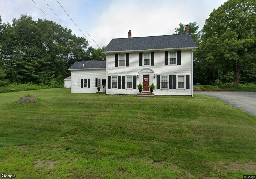
80 Main St Douglas, MA 01516
Estimated Value: $542,711 - $727,000
4
Beds
3
Baths
2,194
Sq Ft
$275/Sq Ft
Est. Value
About This Home
This home is located at 80 Main St, Douglas, MA 01516 and is currently estimated at $604,428, approximately $275 per square foot. 80 Main St is a home located in Worcester County with nearby schools including Douglas Primary School, Douglas Middle School, and Douglas High School.
Ownership History
Date
Name
Owned For
Owner Type
Purchase Details
Closed on
Apr 19, 1996
Sold by
Perkins Patricia
Bought by
Perkins Christopher and Perkins Kimberly
Current Estimated Value
Home Financials for this Owner
Home Financials are based on the most recent Mortgage that was taken out on this home.
Original Mortgage
$79,002
Outstanding Balance
$3,715
Interest Rate
7.34%
Mortgage Type
Purchase Money Mortgage
Estimated Equity
$600,713
Create a Home Valuation Report for This Property
The Home Valuation Report is an in-depth analysis detailing your home's value as well as a comparison with similar homes in the area
Home Values in the Area
Average Home Value in this Area
Purchase History
| Date | Buyer | Sale Price | Title Company |
|---|---|---|---|
| Perkins Christopher | $109,000 | -- |
Source: Public Records
Mortgage History
| Date | Status | Borrower | Loan Amount |
|---|---|---|---|
| Open | Perkins Christopher | $79,002 |
Source: Public Records
Tax History
| Year | Tax Paid | Tax Assessment Tax Assessment Total Assessment is a certain percentage of the fair market value that is determined by local assessors to be the total taxable value of land and additions on the property. | Land | Improvement |
|---|---|---|---|---|
| 2025 | $60 | $453,800 | $83,600 | $370,200 |
| 2024 | $5,881 | $435,000 | $76,000 | $359,000 |
| 2023 | $5,695 | $396,600 | $76,000 | $320,600 |
| 2022 | $5,727 | $350,500 | $70,200 | $280,300 |
| 2021 | $5,618 | $336,000 | $66,900 | $269,100 |
| 2020 | $5,457 | $321,400 | $66,900 | $254,500 |
| 2019 | $5,296 | $302,600 | $66,900 | $235,700 |
| 2018 | $4,731 | $294,400 | $66,900 | $227,500 |
| 2017 | $4,555 | $272,400 | $71,400 | $201,000 |
| 2016 | $4,420 | $262,800 | $71,400 | $191,400 |
| 2015 | $4,326 | $262,800 | $71,400 | $191,400 |
Source: Public Records
Map
Nearby Homes
Your Personal Tour Guide
Ask me questions while you tour the home.