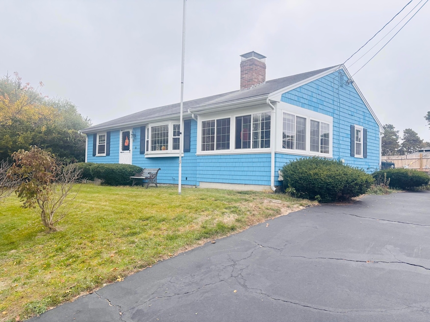
80 Michaels Ave Dennis Port, MA 02639
Dennis Port NeighborhoodEstimated payment $3,257/month
Highlights
- Deck
- No HOA
- Linen Closet
- Wood Flooring
- Porch
- Property is near shops
About This Home
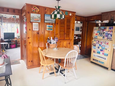
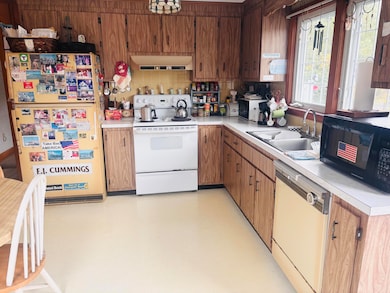
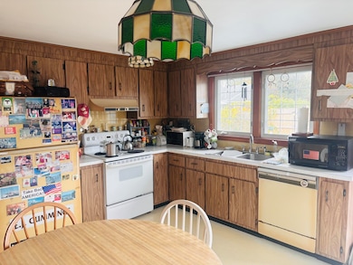
Original Baker Ranch with 3 Bedrooms and 1.5 baths. The porch has windows and heat. Living room with gas fireplace. New grade level Title 5 system installed April 2025.

Home Details
Home Type
- Single Family
Est. Annual Taxes
- $2,416
Year Built
- Built in 1975
Lot Details
- 7,841 Sq Ft Lot
- Fenced
Home Design
- Poured Concrete
- Pitched Roof
- Shingle Roof
- Asphalt Roof
- Shingle Siding
Interior Spaces
- 982 Sq Ft Home
- 1-Story Property
- Gas Fireplace
- Electric Range
Flooring
- Wood
- Vinyl
Bedrooms and Bathrooms
- 3 Bedrooms
- Linen Closet
Basement
- Basement Fills Entire Space Under The House
- Interior Basement Entry
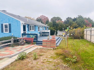
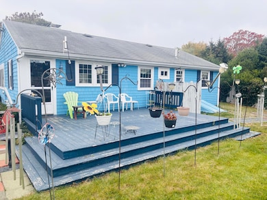
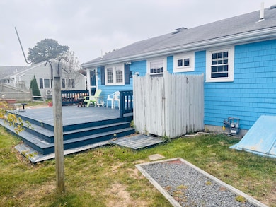
Outdoor Features
- Deck
- Porch
Location
- Property is near shops
Utilities
- No Cooling
- Heating Available
- Gas Water Heater
- Septic Tank
- Private Sewer
Listing and Financial Details
- Assessor Parcel Number DENN M:000053 P:007000
Community Details
Overview
- No Home Owners Association
Recreation
- Bike Trail
Map
Home Values in the Area
Average Home Value in this Area
Tax History
| Year | Tax Paid | Tax Assessment Tax Assessment Total Assessment is a certain percentage of the fair market value that is determined by local assessors to be the total taxable value of land and additions on the property. | Land | Improvement |
|---|---|---|---|---|
| 2025 | $2,416 | $558,000 | $204,000 | $354,000 |
| 2024 | $2,274 | $518,100 | $196,100 | $322,000 |
| 2023 | $2,200 | $471,100 | $178,300 | $292,800 |
| 2022 | $2,155 | $384,900 | $160,600 | $224,300 |
| 2021 | $2,198 | $364,500 | $180,000 | $184,500 |
| 2020 | $1,982 | $324,900 | $157,500 | $167,400 |
| 2019 | $1,871 | $303,300 | $154,400 | $148,900 |
| 2018 | $1,779 | $280,600 | $147,000 | $133,600 |
| 2017 | $1,635 | $265,800 | $136,500 | $129,300 |
| 2016 | $1,674 | $256,300 | $147,000 | $109,300 |
| 2015 | $1,640 | $256,300 | $147,000 | $109,300 |
| 2014 | $1,494 | $235,300 | $126,000 | $109,300 |
Property History
| Date | Event | Price | List to Sale | Price per Sq Ft |
|---|---|---|---|---|
| 11/02/2025 11/02/25 | Pending | -- | -- | -- |
| 10/30/2025 10/30/25 | For Sale | $579,900 | -- | $591 / Sq Ft |
Purchase History
| Date | Type | Sale Price | Title Company |
|---|---|---|---|
| Quit Claim Deed | -- | -- | |
| Deed | -- | -- | |
| Deed | $362,500 | -- |
Source: Cape Cod & Islands Association of REALTORS®
MLS Number: 22505441
APN: DENN-000053-000000-000007
Disclaimer: Certain information contained herein is derived from information provided by parties other than Homes.com. All information provided is deemed reliable, but is not guaranteed to be accurate and should be independently verified.
![]() All data relating to real estate for sale on this page comes from the Broker Reciprocity (BR) of the Cape Cod & Islands Multiple Listing Service, Inc. Detailed information about real estate listings held by brokerage firms other than CC&I Assoc. of REALTORS®, Inc. includes the name of the listing company. Neither the listing company nor CC&I Assoc. of REALTORS®, Inc. shall be responsible for any typographical errors, misinformation, misprints and shall be held totally harmless. The Broker providing this data believes it to be correct, but advises interested parties to confirm any item before relying on it in a purchase decision. All properties are subject to prior sale, changes, or withdrawal. Copyright 2025 © Cape Cod & Islands Multiple Listing Service, Inc. All rights reserved.
All data relating to real estate for sale on this page comes from the Broker Reciprocity (BR) of the Cape Cod & Islands Multiple Listing Service, Inc. Detailed information about real estate listings held by brokerage firms other than CC&I Assoc. of REALTORS®, Inc. includes the name of the listing company. Neither the listing company nor CC&I Assoc. of REALTORS®, Inc. shall be responsible for any typographical errors, misinformation, misprints and shall be held totally harmless. The Broker providing this data believes it to be correct, but advises interested parties to confirm any item before relying on it in a purchase decision. All properties are subject to prior sale, changes, or withdrawal. Copyright 2025 © Cape Cod & Islands Multiple Listing Service, Inc. All rights reserved.
- 19 Standish Way
- 31 Easy St
- 37 Ocean Dr Unit 2
- 12 Spoonbill Rd
- 22 Wixon Rd
- 71 Main St
- 4 Coffey Ln
- 64 Beaten Rd
- 125 Main St Unit 3
- 15 Woodside Park Rd
- 61 Trotters Ln
- 72 Bassett Ln
- 112 Old Wharf Rd Unit E4
- 112 Old Wharf Rd Unit E1
- 154 Old Wharf Rd Unit 26
- 154 Old Wharf Rd Unit 14
- 120 Old Wharf Rd Unit 11
- 113 Old Wharf Rd Unit 7
- 268 Main St