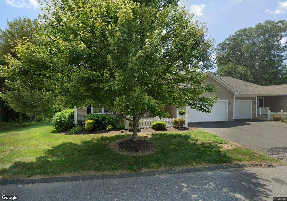
80 Mourning Dove Trail Unit 80 East Windsor, CT 06088
Estimated Value: $414,525 - $434,000
2
Beds
2
Baths
1,608
Sq Ft
$266/Sq Ft
Est. Value
About This Home
This home is located at 80 Mourning Dove Trail Unit 80, East Windsor, CT 06088 and is currently estimated at $428,131, approximately $266 per square foot. 80 Mourning Dove Trail Unit 80 is a home located in Hartford County with nearby schools including Broad Brook Elementary School, East Windsor Middle School, and East Windsor High School.
Ownership History
Date
Name
Owned For
Owner Type
Purchase Details
Closed on
May 11, 2011
Sold by
Newberry Village Llc
Bought by
Heaton Thomas K and Heaton Marie L
Current Estimated Value
Home Financials for this Owner
Home Financials are based on the most recent Mortgage that was taken out on this home.
Original Mortgage
$211,200
Outstanding Balance
$146,774
Interest Rate
4.88%
Estimated Equity
$281,357
Create a Home Valuation Report for This Property
The Home Valuation Report is an in-depth analysis detailing your home's value as well as a comparison with similar homes in the area
Home Values in the Area
Average Home Value in this Area
Purchase History
| Date | Buyer | Sale Price | Title Company |
|---|---|---|---|
| Heaton Thomas K | $264,000 | -- |
Source: Public Records
Mortgage History
| Date | Status | Borrower | Loan Amount |
|---|---|---|---|
| Open | Heaton Thomas K | $211,200 |
Source: Public Records
Tax History Compared to Growth
Tax History
| Year | Tax Paid | Tax Assessment Tax Assessment Total Assessment is a certain percentage of the fair market value that is determined by local assessors to be the total taxable value of land and additions on the property. | Land | Improvement |
|---|---|---|---|---|
| 2025 | $6,131 | $226,840 | $0 | $226,840 |
| 2024 | $5,934 | $226,840 | $0 | $226,840 |
| 2023 | $6,913 | $188,980 | $0 | $188,980 |
| 2022 | $2,504 | $188,980 | $0 | $188,980 |
| 2021 | $6,879 | $188,980 | $0 | $188,980 |
| 2020 | $6,883 | $188,980 | $0 | $188,980 |
| 2019 | $5,834 | $188,980 | $0 | $188,980 |
| 2018 | $6,702 | $188,980 | $0 | $188,980 |
| 2017 | $5,176 | $169,790 | $0 | $169,790 |
| 2016 | $5,455 | $169,790 | $0 | $169,790 |
| 2015 | $5,146 | $169,790 | $0 | $169,790 |
| 2014 | $5,056 | $169,790 | $0 | $169,790 |
Source: Public Records
Map
Nearby Homes
- 80 Mourning Dove Trail
- 78 Mourning Dove Trail
- 78 Mourning Dove Trail Unit 78
- 81 Mourning Dove Trail
- 81 Mourning Dove Trail Unit 81
- 2 Mourning Dove Trail Unit 2
- 2 Mourning Dove Trail
- 4 Mourning Dove Trail
- 83 Mourning Dove Trail
- 83 Mourning Dove Trail Unit 70
- 83 Mourning Dove Trail Unit 83
- 74 Mourning Dove Trail
- 74 Mourning Dove Trail Unit 74
- 85 Mourning Dove Trail
- 85 Mourning Dove Trail Unit 85
- 2 Mallard Ct
- 72 Mourning Dove Trail
- 72 Mourning Dove Trail Unit 72
- 1 Mourning Dove Trail Unit 1
- 1 Mourning Dove Trail