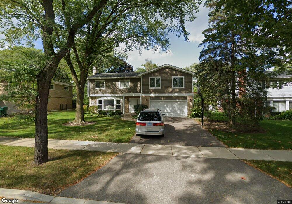
80 Mulberry Rd Deerfield, IL 60015
Briarwood NeighborhoodEstimated Value: $763,000 - $875,359
4
Beds
3
Baths
3,002
Sq Ft
$275/Sq Ft
Est. Value
About This Home
This home is located at 80 Mulberry Rd, Deerfield, IL 60015 and is currently estimated at $825,590, approximately $275 per square foot. 80 Mulberry Rd is a home located in Lake County with nearby schools including Kipling Elementary School, Alan B Shepard Middle School, and Deerfield High School.
Ownership History
Date
Name
Owned For
Owner Type
Purchase Details
Closed on
Jul 1, 2005
Sold by
Dworsky Ashley and Dworsky Melina
Bought by
Kushnir David and Kushnir Lena
Current Estimated Value
Home Financials for this Owner
Home Financials are based on the most recent Mortgage that was taken out on this home.
Original Mortgage
$500,000
Outstanding Balance
$262,354
Interest Rate
5.74%
Mortgage Type
Fannie Mae Freddie Mac
Estimated Equity
$563,236
Purchase Details
Closed on
Jun 26, 2000
Sold by
Cook Brian J and Cook Mary Faith
Bought by
Dworsky Ashley and Zrecny Melina
Home Financials for this Owner
Home Financials are based on the most recent Mortgage that was taken out on this home.
Original Mortgage
$350,400
Interest Rate
7.87%
Create a Home Valuation Report for This Property
The Home Valuation Report is an in-depth analysis detailing your home's value as well as a comparison with similar homes in the area
Home Values in the Area
Average Home Value in this Area
Purchase History
| Date | Buyer | Sale Price | Title Company |
|---|---|---|---|
| Kushnir David | $625,000 | Rtc | |
| Dworsky Ashley | $438,000 | Mercury Title |
Source: Public Records
Mortgage History
| Date | Status | Borrower | Loan Amount |
|---|---|---|---|
| Open | Kushnir David | $500,000 | |
| Previous Owner | Dworsky Ashley | $350,400 |
Source: Public Records
Tax History Compared to Growth
Tax History
| Year | Tax Paid | Tax Assessment Tax Assessment Total Assessment is a certain percentage of the fair market value that is determined by local assessors to be the total taxable value of land and additions on the property. | Land | Improvement |
|---|---|---|---|---|
| 2024 | $17,458 | $213,650 | $61,007 | $152,643 |
| 2023 | $19,076 | $193,432 | $55,234 | $138,198 |
| 2022 | $19,076 | $207,284 | $59,328 | $147,956 |
| 2021 | $17,999 | $199,849 | $57,200 | $142,649 |
| 2020 | $17,311 | $200,269 | $57,320 | $142,949 |
| 2019 | $16,914 | $199,929 | $57,223 | $142,706 |
| 2018 | $15,100 | $194,515 | $60,650 | $133,865 |
| 2017 | $15,657 | $193,895 | $60,457 | $133,438 |
| 2016 | $13,434 | $186,563 | $58,171 | $128,392 |
| 2015 | $13,151 | $175,292 | $54,657 | $120,635 |
| 2014 | $14,786 | $191,823 | $55,049 | $136,774 |
| 2012 | $14,424 | $190,130 | $54,563 | $135,567 |
Source: Public Records
Map
Nearby Homes
- 1921 Beechnut Rd
- 2140 Beechnut Rd
- 2065 Walnut Cir
- 215 Waukegan Rd
- 1744 Walnut Cir
- 1851 Oakwood Rd
- 316 Linden Rd
- 370 Briar Ln
- 707 Brierhill Rd
- 1816 Rosemary Rd
- 757 Kipling Place
- 630 Hermitage Dr
- 850 Evergreen Way
- 1380 Rosemary Ln
- 1220 Rudolph Rd Unit 3H
- 945 Villas Ct
- 834 Poplar Ln
- 626 Barberry Rd
- 666 Barberry Rd
- 1795 Lake Cook Rd Unit 110
- 70 Mulberry Rd
- 94 Mulberry Rd
- 81 Larkdale Rd
- 56 Mulberry Rd
- 116 Mulberry Rd
- 69 Larkdale Rd
- 95 Larkdale Rd
- 65 Mulberry Rd
- 75 Mulberry Rd
- 85 Mulberry Rd
- 75 Mulberry Rd
- 115 Larkdale Rd
- 57 Larkdale Rd
- 97 Mulberry Rd
- 122 Mulberry Rd
- 40 Mulberry Rd
- 60 Eastwood Dr
- 109 Mulberry Rd
- 119 Larkdale Rd
- 49 Mulberry Rd