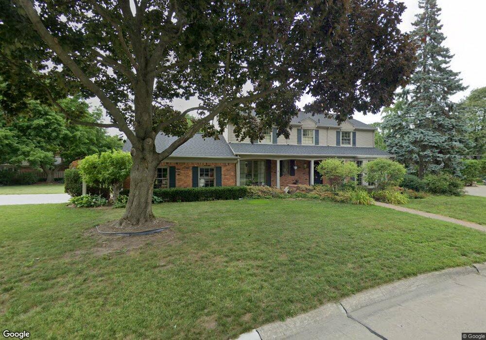
80 N Duval Rd Grosse Pointe Shores, MI 48236
Estimated Value: $620,538 - $659,000
4
Beds
3
Baths
2,681
Sq Ft
$240/Sq Ft
Est. Value
About This Home
This home is located at 80 N Duval Rd, Grosse Pointe Shores, MI 48236 and is currently estimated at $642,385, approximately $239 per square foot. 80 N Duval Rd is a home located in Wayne County with nearby schools including Ferry Elementary School, Parcells Middle School, and Grosse Pointe North High School.
Ownership History
Date
Name
Owned For
Owner Type
Purchase Details
Closed on
Apr 7, 2010
Sold by
Bac Home Loans Servicing Lp
Bought by
Federal National Mortgage Association
Current Estimated Value
Purchase Details
Closed on
Jan 27, 2010
Sold by
Sabbah Nader
Bought by
Bac Home Loans Servicing Lp
Purchase Details
Closed on
May 17, 2006
Sold by
Daly Francis A and Daly Karen
Bought by
Chase Home Finance Llc
Purchase Details
Closed on
Mar 3, 2003
Sold by
Huetteman John and Huetteman Candace K
Bought by
Daly Francis A
Create a Home Valuation Report for This Property
The Home Valuation Report is an in-depth analysis detailing your home's value as well as a comparison with similar homes in the area
Home Values in the Area
Average Home Value in this Area
Purchase History
| Date | Buyer | Sale Price | Title Company |
|---|---|---|---|
| Federal National Mortgage Association | -- | Attorneys Title Agency Llc | |
| Bac Home Loans Servicing Lp | $401,820 | None Available | |
| Chase Home Finance Llc | $586,338 | None Available | |
| Daly Francis A | $750,000 | -- |
Source: Public Records
Tax History Compared to Growth
Tax History
| Year | Tax Paid | Tax Assessment Tax Assessment Total Assessment is a certain percentage of the fair market value that is determined by local assessors to be the total taxable value of land and additions on the property. | Land | Improvement |
|---|---|---|---|---|
| 2025 | $10,541 | $291,100 | $0 | $0 |
| 2024 | $10,541 | $283,300 | $0 | $0 |
| 2023 | $10,541 | $256,000 | $0 | $0 |
| 2022 | $10,541 | $249,600 | $0 | $0 |
| 2021 | $10,541 | $256,200 | $0 | $0 |
| 2019 | $10,731 | $235,300 | $0 | $0 |
| 2018 | $6,818 | $238,500 | $0 | $0 |
| 2017 | $6,942 | $232,300 | $0 | $0 |
| 2016 | $10,317 | $222,700 | $0 | $0 |
| 2015 | $18,766 | $195,100 | $0 | $0 |
| 2013 | $18,180 | $181,830 | $0 | $0 |
| 2011 | -- | $206,630 | $0 | $0 |
Source: Public Records
Map
Nearby Homes
- 21560 van K Dr
- 34 Putnam Place
- 700 Woods Ln
- 580 N Brys Dr
- 22925 Gary Ln Unit 77
- 22852 Allen Ct Unit 150
- 23118 Westbury St
- 935 S Brys Dr
- 23280 Clairwood St
- 23112 Marter Rd
- 23162 Doremus St
- 22997 Carolina St
- 65 Vernier Rd
- 1039 Hawthorne Rd
- 22948 Lingemann St
- 1158 Hawthorne Rd
- 1291 Roslyn Rd
- 20670 Vernier Cir
- 926 Lochmoor Place
- 1381 Brys Dr
- 70 N Duval Rd
- 21890 van K Dr
- 21860 van K Dr
- 85 Crestwood Dr
- 61 N Duval Rd Unit Bldg-Unit
- 61 N Duval Rd
- 95 Crestwood Dr
- 75 Crestwood Dr
- 509 Robert John Rd
- 85 S Duval Rd
- 21838 van K Dr Unit Bldg-Unit
- 72 S Duval Rd
- 60 N Duval Rd
- 542 N Rosedale Ct
- 65 Crestwood Dr
- 517 Robert John Rd
- 543 N Rosedale Ct
- 51 N Duval Rd
- 544 S Rosedale Ct
- 90 Crestwood Dr