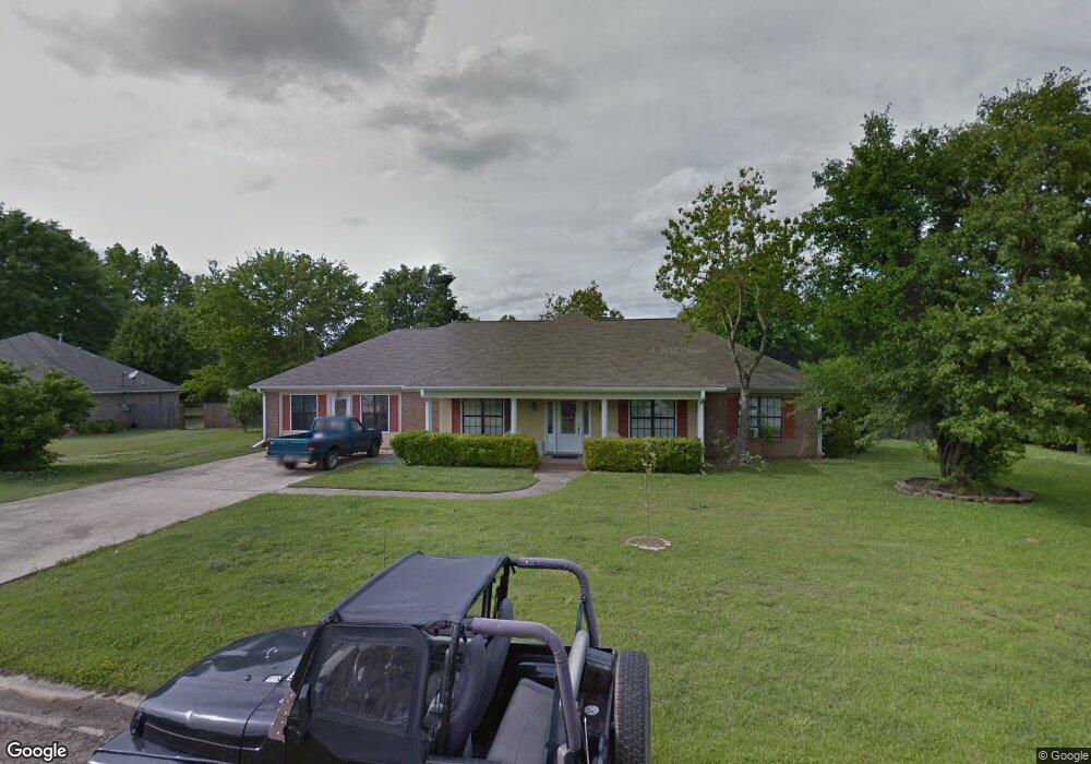
80 Powers Place Columbus, MS 39702
Estimated Value: $268,212 - $307,000
Studio
--
Bath
2,640
Sq Ft
$110/Sq Ft
Est. Value
About This Home
This home is located at 80 Powers Place, Columbus, MS 39702 and is currently estimated at $289,303, approximately $109 per square foot. 80 Powers Place is a home.
Ownership History
Date
Name
Owned For
Owner Type
Purchase Details
Closed on
May 22, 2017
Sold by
Atkins Ann C and Atkins Mary Ann C
Bought by
Atkins Ann C and Atkins Mary Ann C
Current Estimated Value
Home Financials for this Owner
Home Financials are based on the most recent Mortgage that was taken out on this home.
Original Mortgage
$181,623
Outstanding Balance
$153,786
Interest Rate
4.87%
Mortgage Type
FHA
Estimated Equity
$135,517
Purchase Details
Closed on
Jul 21, 2010
Sold by
Atkins Mary Ann C and Atkins Ann C
Bought by
Culpepper Glynn H
Home Financials for this Owner
Home Financials are based on the most recent Mortgage that was taken out on this home.
Original Mortgage
$0
Interest Rate
5.03%
Create a Home Valuation Report for This Property
The Home Valuation Report is an in-depth analysis detailing your home's value as well as a comparison with similar homes in the area
Home Values in the Area
Average Home Value in this Area
Purchase History
| Date | Buyer | Sale Price | Title Company |
|---|---|---|---|
| Atkins Ann C | -- | None Available | |
| Culpepper Glynn H | -- | -- |
Source: Public Records
Mortgage History
| Date | Status | Borrower | Loan Amount |
|---|---|---|---|
| Open | Atkins Ann C | $181,623 | |
| Previous Owner | Culpepper Glynn H | $0 |
Source: Public Records
Tax History
| Year | Tax Paid | Tax Assessment Tax Assessment Total Assessment is a certain percentage of the fair market value that is determined by local assessors to be the total taxable value of land and additions on the property. | Land | Improvement |
|---|---|---|---|---|
| 2025 | $713 | $16,675 | $0 | $0 |
| 2024 | $708 | $16,675 | $0 | $0 |
| 2023 | $705 | $14,792 | $0 | $0 |
| 2022 | $705 | $14,792 | $0 | $0 |
| 2021 | $2,066 | $22,188 | $0 | $0 |
| 2020 | $642 | $14,792 | $0 | $0 |
| 2019 | $668 | $14,786 | $0 | $0 |
| 2018 | $668 | $14,864 | $0 | $0 |
| 2017 | $639 | $14,864 | $0 | $0 |
| 2016 | $639 | $14,864 | $0 | $0 |
| 2015 | $677 | $15,304 | $0 | $0 |
| 2014 | $682 | $15,367 | $0 | $0 |
Source: Public Records
Map
Nearby Homes
- 17 Paige Cove
- 178 Rogers Way
- 333 Drake Cir
- 164 Sleepy Fawn Park
- 2654 Yorkville Rd E
- 836 Oswalt Rd
- 346 Williams Place
- 220 Woodridge Place
- 16 Jenny Ln
- 262 Center Rd
- 60 1st Colony Dr
- 9 Monticello Cir
- 274 Hughes Rd
- 59 Savannah St
- 91 Wilson Dr
- 0 Fiesta Dr
- 0 Yorkville Rd E
- 76 Richardson Rd
- 139 Lakeover Dr W
- Lot 3 Lost Lake Hills Rd
- 50 Powers Place
- 78 Powers Place
- 55 Powers Place
- 77 Powers Place
- 79 Powers Place
- 47 Powers Place
- 45 Hardy Place
- 75 Hardy Place
- 156 W Swoope Dr
- 122 W Swoope Dr
- 91 Hardy Place
- 192 W Swoope Dr
- 106 W Swoope Dr
- 99 Hardy Place
- 324 Jones Dr
- 304 Jones Dr
- 64 Hardy Place
- 214 W Swoope Dr
- 280 Jones Dr
- 336 Jones Dr
Your Personal Tour Guide
Ask me questions while you tour the home.