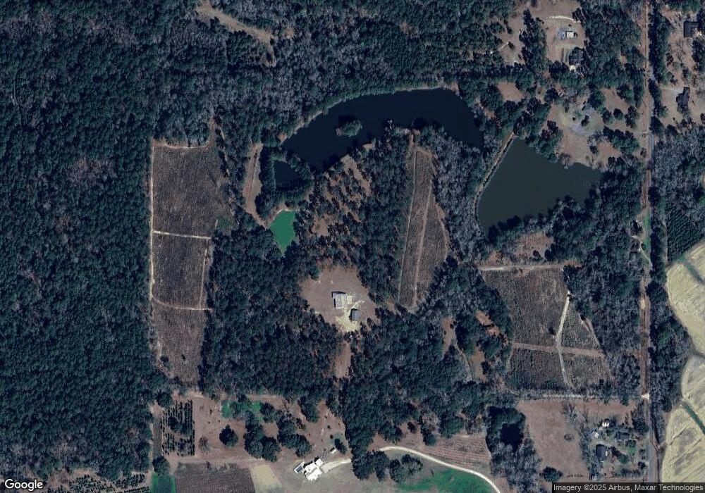
80 River Forks Ln Ochlocknee, GA 31773
Estimated Value: $417,000 - $634,692
--
Bed
--
Bath
2,466
Sq Ft
$213/Sq Ft
Est. Value
About This Home
This home is located at 80 River Forks Ln, Ochlocknee, GA 31773 and is currently estimated at $525,846, approximately $213 per square foot. 80 River Forks Ln is a home with nearby schools including Hand in Hand Primary School, Cross Creek Elementary School, and Garrison-Pilcher Elementary School.
Ownership History
Date
Name
Owned For
Owner Type
Purchase Details
Closed on
Oct 21, 2016
Sold by
Chester R
Bought by
Darty Dave E and Darty Linda C
Current Estimated Value
Home Financials for this Owner
Home Financials are based on the most recent Mortgage that was taken out on this home.
Original Mortgage
$100,000
Outstanding Balance
$63,812
Interest Rate
3.48%
Mortgage Type
New Conventional
Estimated Equity
$462,034
Purchase Details
Closed on
Dec 22, 2014
Sold by
Stewart Kimberly Jane
Bought by
Bennett Chester R and Bennett Julie G
Purchase Details
Closed on
Feb 5, 2003
Sold by
Stewart Joe Allen
Bought by
Stewart Kimberly Jane
Purchase Details
Closed on
Jan 17, 1992
Bought by
Stewart Joe Allen
Create a Home Valuation Report for This Property
The Home Valuation Report is an in-depth analysis detailing your home's value as well as a comparison with similar homes in the area
Home Values in the Area
Average Home Value in this Area
Purchase History
| Date | Buyer | Sale Price | Title Company |
|---|---|---|---|
| Darty Dave E | $262,500 | -- | |
| Bennett Chester R | $220,000 | -- | |
| Stewart Kimberly Jane | -- | -- | |
| Stewart Joe Allen | $43,000 | -- |
Source: Public Records
Mortgage History
| Date | Status | Borrower | Loan Amount |
|---|---|---|---|
| Open | Darty Dave E | $100,000 |
Source: Public Records
Tax History Compared to Growth
Tax History
| Year | Tax Paid | Tax Assessment Tax Assessment Total Assessment is a certain percentage of the fair market value that is determined by local assessors to be the total taxable value of land and additions on the property. | Land | Improvement |
|---|---|---|---|---|
| 2024 | $3,040 | $198,369 | $67,136 | $131,233 |
| 2023 | $2,750 | $187,942 | $67,136 | $120,806 |
| 2022 | $2,521 | $165,197 | $67,136 | $98,061 |
| 2021 | $2,465 | $142,800 | $58,368 | $84,432 |
| 2020 | $2,370 | $136,936 | $58,368 | $78,568 |
| 2019 | $988 | $81,845 | $58,368 | $23,477 |
| 2018 | $497 | $71,595 | $66,524 | $5,071 |
| 2017 | $496 | $71,612 | $66,524 | $5,088 |
| 2016 | $461 | $73,332 | $68,822 | $4,509 |
| 2015 | $458 | $73,332 | $68,822 | $4,509 |
| 2014 | $450 | $73,332 | $68,822 | $4,509 |
| 2013 | -- | $86,752 | $82,243 | $4,509 |
Source: Public Records
Map
Nearby Homes
- 27286 U S Highway 19
- 107 Mossy Creek Way
- 105 Mossy Creek Way
- 00 Rupp Rd
- 27286 U S 19
- 106 Spiral Rd
- 00 Parcel # 053a313 West Shore Dr Lot 21
- 475 W Shore Dr
- 365 W Shore Dr
- 250 Knoll Rd
- 693 W Shore Dr
- 171 Longwood Dr
- 800 N Westshore Dr
- 800 Westshore Dr
- 475 Longwood Dr
- 0 Georgia 202
- 23481 U S 19
- 8805 Georgia 202
- 210 Egg and Butter Rd N
- 210 Egg & Butter Rd
- 821 Pummy Rd
- 132 River Forks Ln
- 977 Pummy Rd
- 1010 Pummy Rd
- 683 Pummy Rd
- 639 Pummy Rd
- 176 River Forks Ln
- 1041 Pummy Rd
- 1084 Pummy Rd
- 539 Pummy Rd
- 459 Pummy Rd
- 480 Pummy Rd
- 1287 Pummy Rd
- 271 Pummy Rd
- 000 Pummy Rd (76+ - Acres)
- 457 Pummy Rd
- 0000 (61 Acres) Pummy Rd
- 1389 Pummy Rd
- 600 Bond Rd
- 221 Pummy Rd
