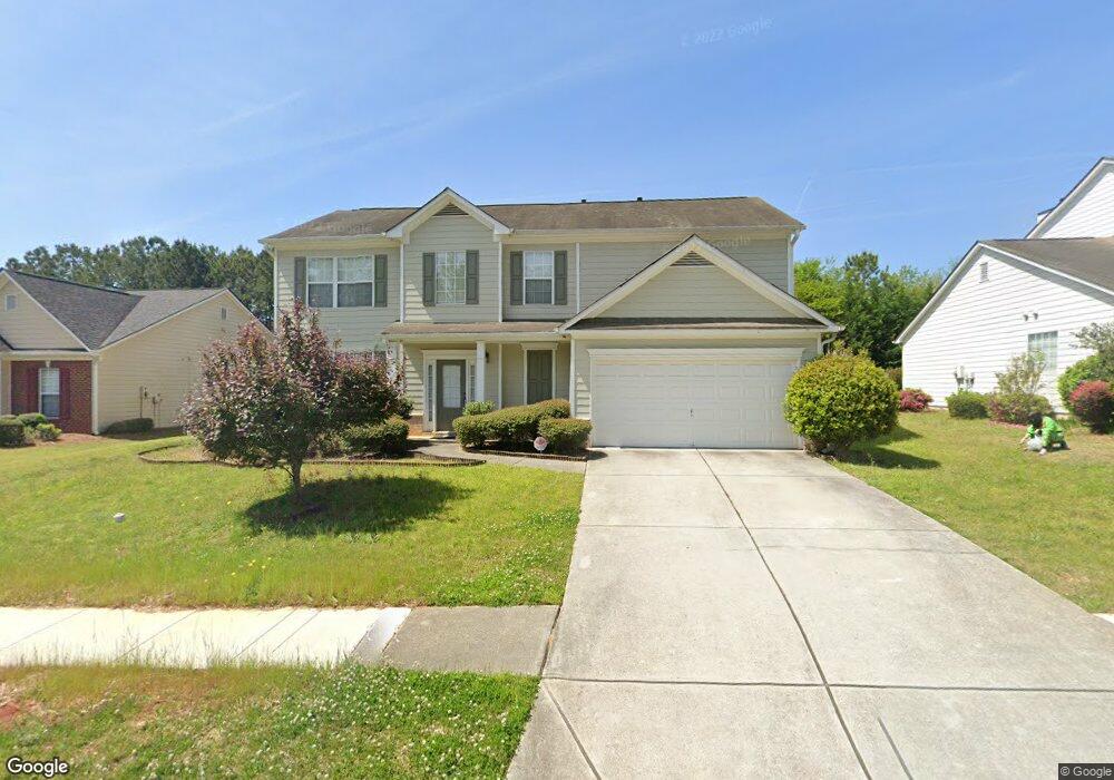
80 Rosemoore Dr Unit 1 Covington, GA 30014
Estimated Value: $322,890 - $377,000
4
Beds
3
Baths
2,469
Sq Ft
$140/Sq Ft
Est. Value
About This Home
This home is located at 80 Rosemoore Dr Unit 1, Covington, GA 30014 and is currently estimated at $345,723, approximately $140 per square foot. 80 Rosemoore Dr Unit 1 is a home located in Newton County with nearby schools including East Newton Elementary School, Cousins Middle School, and Eastside High School.
Ownership History
Date
Name
Owned For
Owner Type
Purchase Details
Closed on
Apr 25, 2025
Sold by
Yallah A Ali
Bought by
Moon Avery Swords and Moon Dustin Jeffrey
Current Estimated Value
Purchase Details
Closed on
Apr 9, 2004
Sold by
Mccar Dev Corp
Bought by
Yaliah A Ali
Home Financials for this Owner
Home Financials are based on the most recent Mortgage that was taken out on this home.
Original Mortgage
$167,350
Interest Rate
5.35%
Mortgage Type
VA
Create a Home Valuation Report for This Property
The Home Valuation Report is an in-depth analysis detailing your home's value as well as a comparison with similar homes in the area
Home Values in the Area
Average Home Value in this Area
Purchase History
| Date | Buyer | Sale Price | Title Company |
|---|---|---|---|
| Moon Avery Swords | $330,000 | -- | |
| Yaliah A Ali | $170,100 | -- |
Source: Public Records
Mortgage History
| Date | Status | Borrower | Loan Amount |
|---|---|---|---|
| Previous Owner | Yaliah A Ali | $167,350 |
Source: Public Records
Tax History
| Year | Tax Paid | Tax Assessment Tax Assessment Total Assessment is a certain percentage of the fair market value that is determined by local assessors to be the total taxable value of land and additions on the property. | Land | Improvement |
|---|---|---|---|---|
| 2025 | $2,933 | $115,360 | $21,600 | $93,760 |
| 2024 | $2,809 | $108,440 | $21,600 | $86,840 |
| 2023 | $2,785 | $100,360 | $10,000 | $90,360 |
| 2022 | $2,259 | $80,960 | $10,000 | $70,960 |
| 2021 | $2,241 | $71,840 | $10,000 | $61,840 |
| 2020 | $2,194 | $63,760 | $10,000 | $53,760 |
| 2019 | $2,193 | $62,760 | $10,000 | $52,760 |
| 2018 | $2,072 | $58,840 | $10,000 | $48,840 |
| 2017 | $2,098 | $59,600 | $11,200 | $48,400 |
| 2016 | $1,608 | $45,320 | $9,000 | $36,320 |
| 2015 | $1,308 | $36,720 | $3,200 | $33,520 |
| 2014 | $1,303 | $36,720 | $0 | $0 |
Source: Public Records
Map
Nearby Homes
- 20 Kestrel Cir
- 18 River Walk Farm Pkwy
- 370 Granary Walk
- 0 Piper Rd Unit 7693971
- 0 Piper Rd Unit 10659921
- 324 Piper Rd
- 35 Crossbill Trail
- 0 Briarpatch Dr Unit 10562648
- 295 River Walk Farm Pkwy
- 344 Riverwalk Pkwy
- 25 Scarlett Ct
- 391 River Walk Farm Pkwy Unit 11
- 323 River Walk Farm
- 13268 Tolstoy Ln
- 420 River Walk Farm Pkwy Unit LOT 43
- 312 River Walk Farm
- 669 River Walk Farm Pwy #75
- 338 River Walk Farm
- 344 River Walk Farm
- 344 River Walk Farm Unit LOT 73
- 70 Rosemoore Dr
- 90 Rosemoore Dr
- 50 Kestrel Cir
- 60 Rosemoore Dr
- 100 Rosemoore Dr
- 60 Kestrel Cir
- 40 Kestrel Cir
- 75 Rosemoore Dr
- 65 Rosemoore Dr
- 70 Kestrel Cir
- 30 Kestrel Cir
- 85 Rosemoore Dr
- 110 Rosemoore Dr Unit 2
- 55 Rosemoore Dr
- 95 Rosemoore Dr Unit 2
- 80 Kestrel Cir
- 45 Rosemoore Dr
- 120 Rosemoore Dr
- 40 Rosemoore Dr
- 45 Kestrel Cir
Your Personal Tour Guide
Ask me questions while you tour the home.