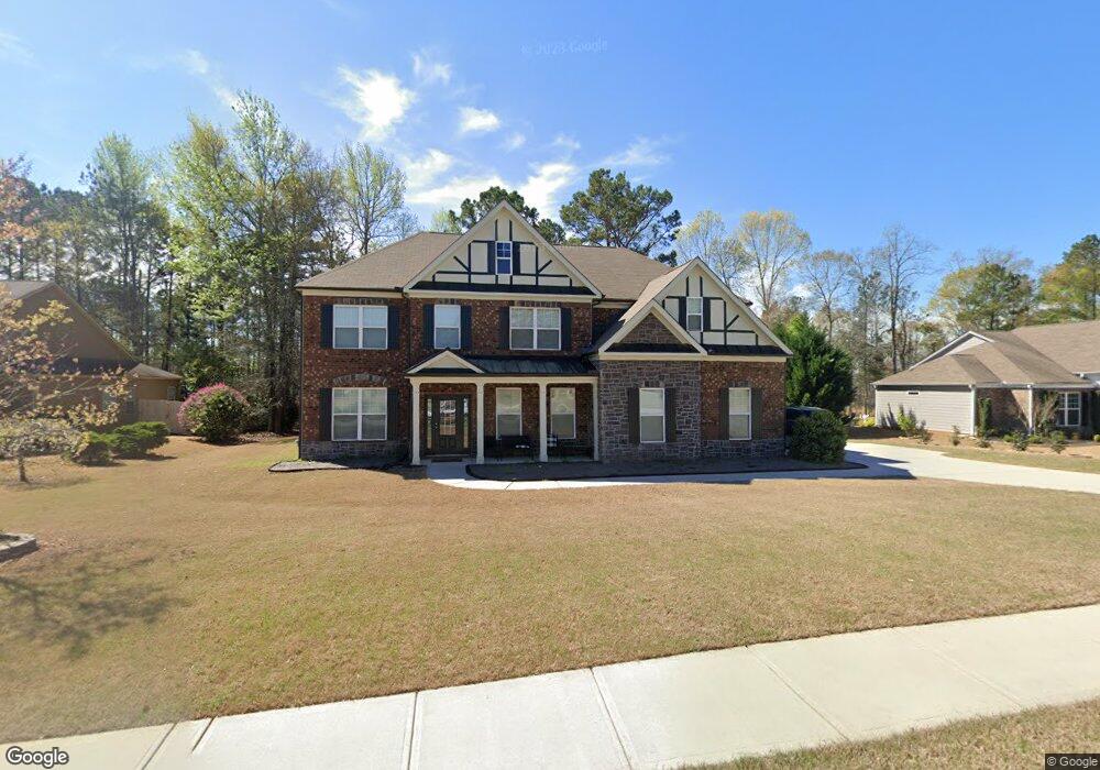
80 Savannah Dr Senoia, GA 30276
Estimated Value: $488,023 - $542,000
4
Beds
4
Baths
3,274
Sq Ft
$159/Sq Ft
Est. Value
About This Home
This home is located at 80 Savannah Dr, Senoia, GA 30276 and is currently estimated at $519,506, approximately $158 per square foot. 80 Savannah Dr is a home with nearby schools including Willis Road Elementary School, East Coweta Middle School, and East Coweta High School.
Ownership History
Date
Name
Owned For
Owner Type
Purchase Details
Closed on
Sep 14, 2011
Sold by
Dr Horton Inc
Bought by
Stitz Christopher Michael
Current Estimated Value
Home Financials for this Owner
Home Financials are based on the most recent Mortgage that was taken out on this home.
Original Mortgage
$231,880
Outstanding Balance
$158,638
Interest Rate
4.24%
Mortgage Type
VA
Estimated Equity
$360,868
Purchase Details
Closed on
Mar 8, 2005
Sold by
Scarbrough and Rolader Developme
Bought by
D R Horton Inc
Purchase Details
Closed on
Aug 19, 2004
Sold by
Tlsr Lp
Bought by
428 Llc
Purchase Details
Closed on
Mar 10, 2004
Sold by
Twin Lakes Partnersh
Bought by
Twin Lakes Investors Llc
Purchase Details
Closed on
Sep 8, 1989
Bought by
Twin Lakes Partnersh
Purchase Details
Closed on
Jun 30, 1988
Bought by
Atlanta Associates I
Create a Home Valuation Report for This Property
The Home Valuation Report is an in-depth analysis detailing your home's value as well as a comparison with similar homes in the area
Home Values in the Area
Average Home Value in this Area
Purchase History
| Date | Buyer | Sale Price | Title Company |
|---|---|---|---|
| Stitz Christopher Michael | $227,000 | -- | |
| D R Horton Inc | $7,640,000 | -- | |
| 428 Llc | -- | -- | |
| Twin Lakes Investors Llc | $5,250,000 | -- | |
| Twin Lakes Partnersh | -- | -- | |
| Atlanta Associates I | -- | -- |
Source: Public Records
Mortgage History
| Date | Status | Borrower | Loan Amount |
|---|---|---|---|
| Open | Stitz Christopher Michael | $231,880 |
Source: Public Records
Tax History Compared to Growth
Tax History
| Year | Tax Paid | Tax Assessment Tax Assessment Total Assessment is a certain percentage of the fair market value that is determined by local assessors to be the total taxable value of land and additions on the property. | Land | Improvement |
|---|---|---|---|---|
| 2024 | $4,750 | $174,688 | $30,000 | $144,688 |
| 2023 | $4,750 | $155,156 | $30,000 | $125,156 |
| 2022 | $3,708 | $130,846 | $24,000 | $106,846 |
| 2021 | $3,729 | $121,710 | $24,000 | $97,710 |
| 2020 | $3,796 | $121,710 | $24,000 | $97,710 |
| 2019 | $3,753 | $109,231 | $26,000 | $83,231 |
| 2018 | $3,773 | $109,231 | $26,000 | $83,231 |
| 2017 | $3,659 | $105,548 | $26,000 | $79,548 |
| 2016 | $3,894 | $112,177 | $26,000 | $86,177 |
| 2015 | $3,342 | $98,177 | $12,000 | $86,177 |
| 2014 | $3,686 | $96,704 | $12,000 | $84,704 |
Source: Public Records
Map
Nearby Homes
- 165 Tudor Way
- 250 Calebee Ave
- 225 Renwick Dr
- 35 Paddle Boat Cove
- 135 Mulberry Dr
- 400 Mulberry Dr
- 305 Staffin Dr
- 270 Staffin Dr
- 260 Staffin Dr
- SAVANNAH Plan at Heritage Pointe
- Jean Lee Plan at Heritage Pointe
- Hampshire Plan at Heritage Pointe
- Edison Plan at Heritage Pointe
- Marlene Plan at Heritage Pointe
- 330 Renwick Dr
- 110 Cohabie Ct
- 155 Filson Dr
- 160 Blue Heron Blvd
- 70 Teal Ct
- 80 Streamside Dr
- 70 Savannah Dr
- 90 Savannah Dr
- 60 Savannah Dr Unit LOT 116
- 60 Savannah Dr
- 20 Charleston Dr
- 65 Savannah Dr Unit LOT 151
- 65 Savannah Dr
- 95 Savannah Dr
- 100 Savannah Dr Unit LOT 112
- 100 Savannah Dr
- 50 Savannah Dr
- 105 Savannah Dr
- 110 Savannah Dr
- 40 Charleston Dr
- 40 Charleston Dr Unit 150
- 125 Renwick Dr
- 145 Renwick Dr
- 0 Charleston Dr Unit 9025454
- 0 Charleston Dr Unit 3272658
- 0 Charleston Dr Unit 8553201