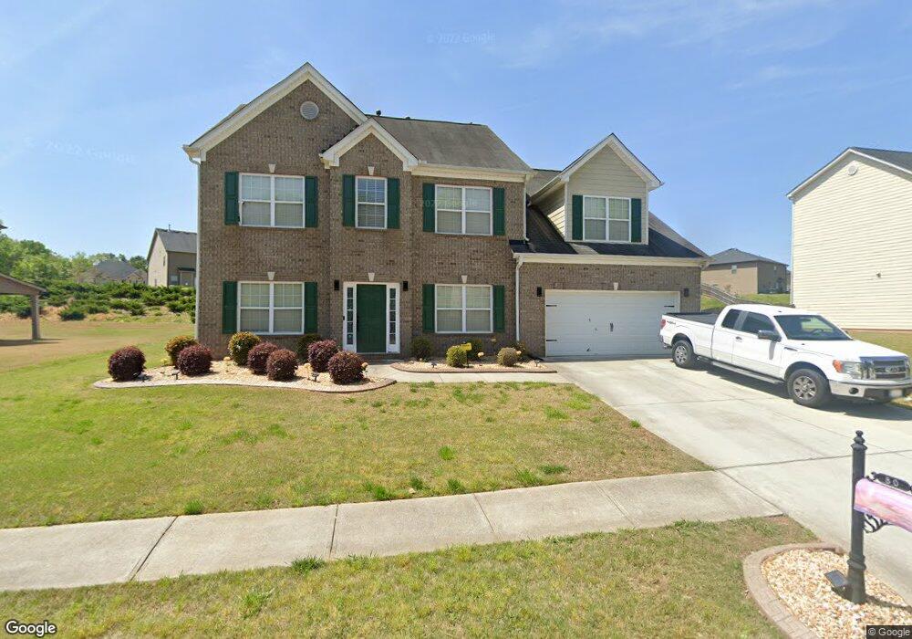
80 Snapdragon Ln Covington, GA 30014
Estimated Value: $380,000 - $439,000
5
Beds
3
Baths
3,355
Sq Ft
$119/Sq Ft
Est. Value
About This Home
This home is located at 80 Snapdragon Ln, Covington, GA 30014 and is currently estimated at $397,889, approximately $118 per square foot. 80 Snapdragon Ln is a home located in Newton County with nearby schools including East Newton Elementary School, Cousins Middle School, and Eastside High School.
Ownership History
Date
Name
Owned For
Owner Type
Purchase Details
Closed on
Dec 22, 2010
Sold by
First Citizens Bk & Trust Co
Bought by
Pardo Robert B
Current Estimated Value
Home Financials for this Owner
Home Financials are based on the most recent Mortgage that was taken out on this home.
Original Mortgage
$123,780
Outstanding Balance
$81,765
Interest Rate
4.37%
Mortgage Type
FHA
Estimated Equity
$316,124
Purchase Details
Closed on
Sep 7, 2010
Sold by
River Walk Builders Llc
Bought by
First Citizens Bk & Trust Co
Create a Home Valuation Report for This Property
The Home Valuation Report is an in-depth analysis detailing your home's value as well as a comparison with similar homes in the area
Home Values in the Area
Average Home Value in this Area
Purchase History
| Date | Buyer | Sale Price | Title Company |
|---|---|---|---|
| Pardo Robert B | $127,000 | -- | |
| First Citizens Bk & Trust Co | $132,000 | -- |
Source: Public Records
Mortgage History
| Date | Status | Borrower | Loan Amount |
|---|---|---|---|
| Open | Pardo Robert B | $123,780 |
Source: Public Records
Tax History
| Year | Tax Paid | Tax Assessment Tax Assessment Total Assessment is a certain percentage of the fair market value that is determined by local assessors to be the total taxable value of land and additions on the property. | Land | Improvement |
|---|---|---|---|---|
| 2025 | $3,797 | $157,320 | $21,600 | $135,720 |
| 2024 | $3,690 | $147,080 | $21,600 | $125,480 |
| 2023 | $3,881 | $144,600 | $10,000 | $134,600 |
| 2022 | $3,143 | $117,400 | $10,000 | $107,400 |
| 2021 | $3,081 | $103,440 | $10,000 | $93,440 |
| 2020 | $2,972 | $90,800 | $10,000 | $80,800 |
| 2019 | $2,964 | $89,280 | $10,000 | $79,280 |
| 2018 | $2,777 | $83,280 | $10,000 | $73,280 |
| 2017 | $2,992 | $89,520 | $11,200 | $78,320 |
| 2016 | $2,110 | $63,840 | $9,000 | $54,840 |
| 2015 | $1,624 | $49,840 | $3,200 | $46,640 |
| 2014 | $1,621 | $49,840 | $0 | $0 |
Source: Public Records
Map
Nearby Homes
- 18 River Walk Farm Pkwy
- 20 Kestrel Cir
- 35 Crossbill Trail
- 370 Granary Walk
- 0 Briarpatch Dr Unit 10562648
- 0 Piper Rd Unit 7693971
- 0 Piper Rd Unit 10659921
- 295 River Walk Farm Pkwy
- 344 Riverwalk Pkwy
- 324 Piper Rd
- 391 River Walk Farm Pkwy Unit 11
- 420 River Walk Farm Pkwy Unit LOT 43
- 323 River Walk Farm
- 312 River Walk Farm
- 669 River Walk Farm Pwy #75
- 338 River Walk Farm
- 344 River Walk Farm
- 344 River Walk Farm Unit LOT 73
- 685 Egrets Landing #58
- 359 River Walk Farm Pwy #4
- 90 Snapdragon Ln
- 70 Snapdragon Ln
- 70 Snapdragon Ln Unit 428
- 80 Foxgrove Cove
- 60 Snapdragon Ln
- 100 Snapdragon Ln
- 75 Snapdragon Ln
- 180 Snapdragon Ln
- 65 Snapdragon Ln
- 170 Snapdragon Ln
- 85 Fox Grove Cove
- 50 Snapdragon Ln
- 70 Foxgrove Cove
- 130 Snapdragon Ln
- 105 Snapdragon Ln
- 55 Snapdragon Ln
- 30 Snapdragon Ln
- 115 Snapdragon Ln
- 60 Foxgrove Cove
- 190 Snapdragon Ln
Your Personal Tour Guide
Ask me questions while you tour the home.