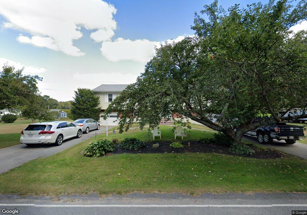
80 Sodom Rd Unit 82 Westport, MA 02790
Brownell/Giffords Corner NeighborhoodEstimated Value: $493,000 - $615,000
4
Beds
--
Bath
1,884
Sq Ft
$298/Sq Ft
Est. Value
About This Home
This home is located at 80 Sodom Rd Unit 82, Westport, MA 02790 and is currently estimated at $560,720, approximately $297 per square foot. 80 Sodom Rd Unit 82 is a home located in Bristol County with nearby schools including Alice A. Macomber Primary School, Westport Elementary School, and Westport Middle-High School.
Ownership History
Date
Name
Owned For
Owner Type
Purchase Details
Closed on
Mar 12, 2019
Sold by
Delisle Janice K
Bought by
Delisle Janice K and Welch Suzanne
Current Estimated Value
Home Financials for this Owner
Home Financials are based on the most recent Mortgage that was taken out on this home.
Original Mortgage
$115,000
Interest Rate
4%
Mortgage Type
New Conventional
Purchase Details
Closed on
Mar 27, 1998
Sold by
Desrochers Roger and Desrochers Claudette
Bought by
Delisle Janice K
Home Financials for this Owner
Home Financials are based on the most recent Mortgage that was taken out on this home.
Original Mortgage
$157,500
Interest Rate
6.96%
Mortgage Type
Purchase Money Mortgage
Create a Home Valuation Report for This Property
The Home Valuation Report is an in-depth analysis detailing your home's value as well as a comparison with similar homes in the area
Home Values in the Area
Average Home Value in this Area
Purchase History
| Date | Buyer | Sale Price | Title Company |
|---|---|---|---|
| Delisle Janice K | -- | -- | |
| Delisle Janice K | $175,000 | -- |
Source: Public Records
Mortgage History
| Date | Status | Borrower | Loan Amount |
|---|---|---|---|
| Previous Owner | Delisle Janice K | $115,000 | |
| Previous Owner | Delisle Janice K | $10,000 | |
| Previous Owner | Delisle Janice K | $157,500 | |
| Previous Owner | Delisle Janice K | $40,000 |
Source: Public Records
Tax History Compared to Growth
Tax History
| Year | Tax Paid | Tax Assessment Tax Assessment Total Assessment is a certain percentage of the fair market value that is determined by local assessors to be the total taxable value of land and additions on the property. | Land | Improvement |
|---|---|---|---|---|
| 2025 | $3,777 | $507,000 | $171,100 | $335,900 |
| 2024 | $3,748 | $484,900 | $151,600 | $333,300 |
| 2023 | $3,676 | $450,500 | $131,300 | $319,200 |
| 2022 | $3,484 | $410,900 | $131,300 | $279,600 |
| 2021 | $3,375 | $391,500 | $113,400 | $278,100 |
| 2020 | $2,643 | $313,500 | $103,100 | $210,400 |
| 2019 | $2,590 | $313,200 | $103,100 | $210,100 |
| 2018 | $2,748 | $336,400 | $121,600 | $214,800 |
| 2017 | $2,569 | $322,300 | $121,600 | $200,700 |
| 2016 | $2,429 | $307,100 | $121,600 | $185,500 |
| 2015 | $2,488 | $313,800 | $121,600 | $192,200 |
Source: Public Records
Map
Nearby Homes
- 6 Angel Ct
- 218 American Legion Hwy
- 40 Robert St
- 33 Moniz Dr
- 47 Devol Ave
- 771 Sanford Rd
- 47 Robert St
- 308 Robert St
- 51 Newton St
- 118 Charlotte White Rd
- 0 Tickle Rd Unit 73453134
- 219 Tickle Rd
- 4 Main Rd
- 978 Sodom Rd
- 8 Campion Ave
- 374 Crandall Rd
- 0 Crandall Rd
- 100 Cory's Ln
- 14 Glendale Ave
- 1125 Stafford Rd Unit 5