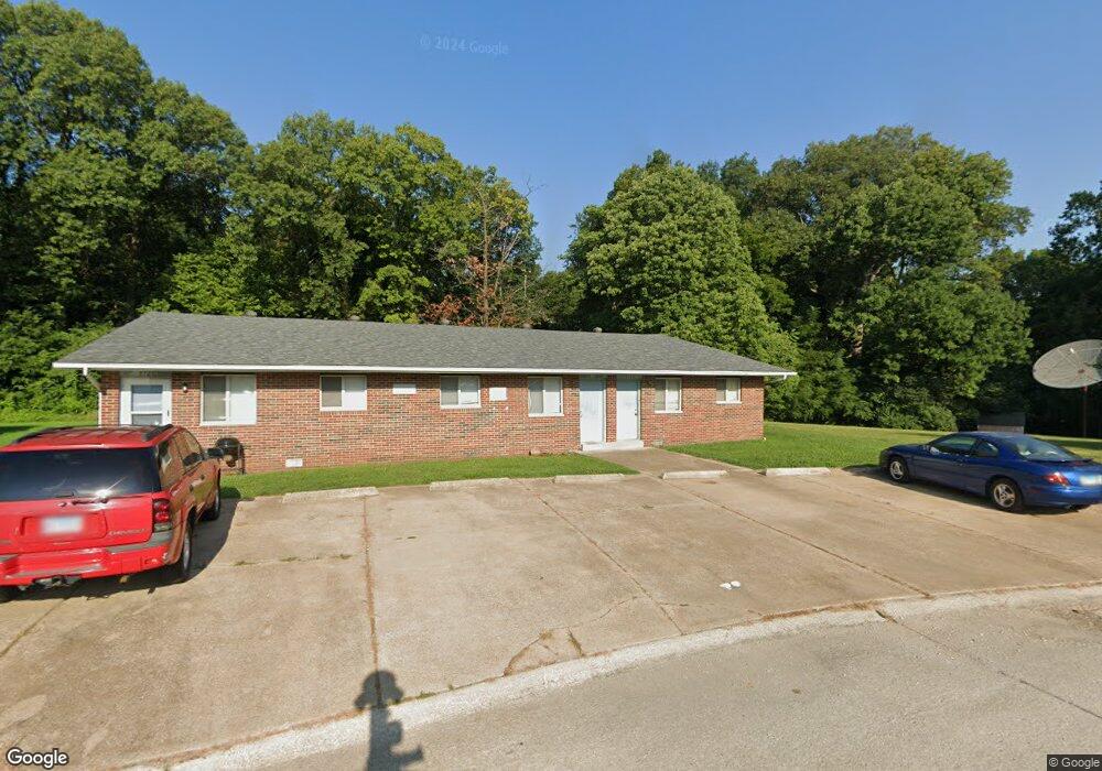
800 Carol Ln Maryville, IL 62062
Estimated Value: $245,000 - $277,000
2
Beds
1
Bath
1,344
Sq Ft
$195/Sq Ft
Est. Value
About This Home
This home is located at 800 Carol Ln, Maryville, IL 62062 and is currently estimated at $262,746, approximately $195 per square foot. 800 Carol Ln is a home located in Madison County with nearby schools including Maryville Elementary School, Dorris Intermediate School, and Collinsville Middle School.
Ownership History
Date
Name
Owned For
Owner Type
Purchase Details
Closed on
Feb 26, 2015
Sold by
Lindow Todd
Bought by
Lindow Properties Llc
Current Estimated Value
Purchase Details
Closed on
Aug 10, 2007
Sold by
Lindow Todd
Bought by
Lindow Todd
Purchase Details
Closed on
Jul 24, 2006
Sold by
Tiemann Alvin E and Tiemann Marcella J
Bought by
Lindow Const Co
Purchase Details
Closed on
Nov 3, 2003
Sold by
Lindow Todd
Bought by
Marcella Alvin E and Tiemann Marcella J
Create a Home Valuation Report for This Property
The Home Valuation Report is an in-depth analysis detailing your home's value as well as a comparison with similar homes in the area
Home Values in the Area
Average Home Value in this Area
Purchase History
| Date | Buyer | Sale Price | Title Company |
|---|---|---|---|
| Lindow Properties Llc | -- | None Available | |
| Lindow Todd | -- | Title & Escrow Plus Inc | |
| Lindow Const Co | -- | None Available | |
| Marcella Alvin E | -- | -- |
Source: Public Records
Tax History Compared to Growth
Tax History
| Year | Tax Paid | Tax Assessment Tax Assessment Total Assessment is a certain percentage of the fair market value that is determined by local assessors to be the total taxable value of land and additions on the property. | Land | Improvement |
|---|---|---|---|---|
| 2024 | $4,250 | $64,920 | $8,600 | $56,320 |
| 2023 | $4,250 | $59,690 | $7,830 | $51,860 |
| 2022 | $3,984 | $55,200 | $7,240 | $47,960 |
| 2021 | $3,610 | $51,860 | $6,800 | $45,060 |
| 2020 | $3,487 | $49,480 | $6,490 | $42,990 |
| 2019 | $2,572 | $36,220 | $6,270 | $29,950 |
| 2018 | $2,514 | $34,310 | $5,940 | $28,370 |
| 2017 | $2,464 | $33,630 | $5,820 | $27,810 |
| 2016 | $2,511 | $33,630 | $5,820 | $27,810 |
| 2015 | $1,956 | $32,760 | $5,670 | $27,090 |
| 2014 | $1,956 | $32,760 | $5,670 | $27,090 |
| 2013 | $1,956 | $32,760 | $5,670 | $27,090 |
Source: Public Records
Map
Nearby Homes
- 501 Drost St
- 419 N Donk Ave
- 1313 Jacquelyn Ct
- 137 W Zupan St
- 201 S Lange Ave
- 1005 Daniel Dr
- 1014 Daniel Dr
- 1029 Andra Dr
- 912 Oakridge Dr
- 29 Dogwood Terrace
- 53 Cheshire Dr
- 14 Lou Juan Dr
- 1 Heather Green
- 24 Alta St
- 2301 Preswyck Ct
- 126 Kingsbrooke Blvd
- 0 Route 159
- 505 Huntington
- 10 Dunbridge Ct
- 77 Kingsley Way