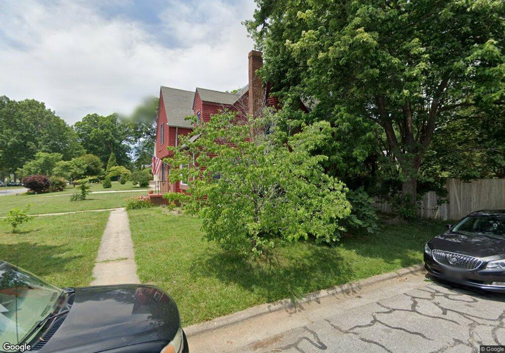
800 Ferndale Blvd High Point, NC 27262
Greater High Point NeighborhoodEstimated Value: $299,000 - $332,000
4
Beds
3
Baths
1,909
Sq Ft
$166/Sq Ft
Est. Value
About This Home
This home is located at 800 Ferndale Blvd, High Point, NC 27262 and is currently estimated at $317,061, approximately $166 per square foot. 800 Ferndale Blvd is a home located in Guilford County with nearby schools including Northwood Elementary School, Ferndale Middle School, and High Point Central High School.
Ownership History
Date
Name
Owned For
Owner Type
Purchase Details
Closed on
Aug 12, 1999
Sold by
Teague Roy A and Teague Brenda D
Bought by
Sutphin Norman J and Sutphin Kimberly L
Current Estimated Value
Home Financials for this Owner
Home Financials are based on the most recent Mortgage that was taken out on this home.
Original Mortgage
$119,700
Outstanding Balance
$34,532
Interest Rate
7.7%
Mortgage Type
VA
Estimated Equity
$282,529
Create a Home Valuation Report for This Property
The Home Valuation Report is an in-depth analysis detailing your home's value as well as a comparison with similar homes in the area
Home Values in the Area
Average Home Value in this Area
Purchase History
| Date | Buyer | Sale Price | Title Company |
|---|---|---|---|
| Sutphin Norman J | $117,500 | -- |
Source: Public Records
Mortgage History
| Date | Status | Borrower | Loan Amount |
|---|---|---|---|
| Open | Sutphin Norman J | $119,700 |
Source: Public Records
Tax History Compared to Growth
Tax History
| Year | Tax Paid | Tax Assessment Tax Assessment Total Assessment is a certain percentage of the fair market value that is determined by local assessors to be the total taxable value of land and additions on the property. | Land | Improvement |
|---|---|---|---|---|
| 2025 | $2,733 | $198,300 | $55,000 | $143,300 |
| 2024 | $2,733 | $198,300 | $55,000 | $143,300 |
| 2023 | $2,733 | $198,300 | $55,000 | $143,300 |
| 2022 | $2,673 | $198,300 | $55,000 | $143,300 |
| 2021 | $1,947 | $141,300 | $25,000 | $116,300 |
| 2020 | $1,947 | $141,300 | $25,000 | $116,300 |
| 2019 | $1,947 | $141,300 | $0 | $0 |
| 2018 | $1,937 | $141,300 | $0 | $0 |
| 2017 | $1,937 | $141,300 | $0 | $0 |
| 2016 | $1,926 | $137,300 | $0 | $0 |
| 2015 | $1,936 | $137,300 | $0 | $0 |
| 2014 | $1,969 | $137,300 | $0 | $0 |
Source: Public Records
Map
Nearby Homes
- 810 Ferndale Blvd
- 702 Gatewood Ave
- 509 Chestnut Dr
- 601 W Westwood Ave
- 1110 Adams St
- 911 N Rotary Dr
- 1011 Ferndale Blvd
- 1007 N Rotary Dr
- 707 Kennedy Ave
- 1307 Tipton St
- 209 Kennedy Ave
- 803 Sunset Dr
- 1116 Ferndale Blvd
- 317 W High Ave Unit 15A
- 3637 Hobart Place
- 207 N Rotary Dr Unit A
- 1042 Rockford Rd
- 510 Otteray Ave
- 1304 Wickliff Ave
- 1207 N Main St
- 802 Ferndale Blvd
- 742 Ferndale Blvd
- 804 Ferndale Blvd
- 601 Gatewood Ave
- 603 Gatewood Ave
- 732 Ferndale Blvd
- 535 Gatewood Ave
- 605 Gatewood Ave
- 806 Ferndale Blvd
- 533 Gatewood Ave
- 730 Ferndale Blvd
- 607 Gatewood Ave
- 531 Gatewood Ave
- 728 Ferndale Blvd
- 808 Ferndale Blvd
- 529 Gatewood Ave
- 609 Gatewood Ave
- 600 Gatewood Ave
- 604 Gatewood Ave
- 726 Ferndale Blvd