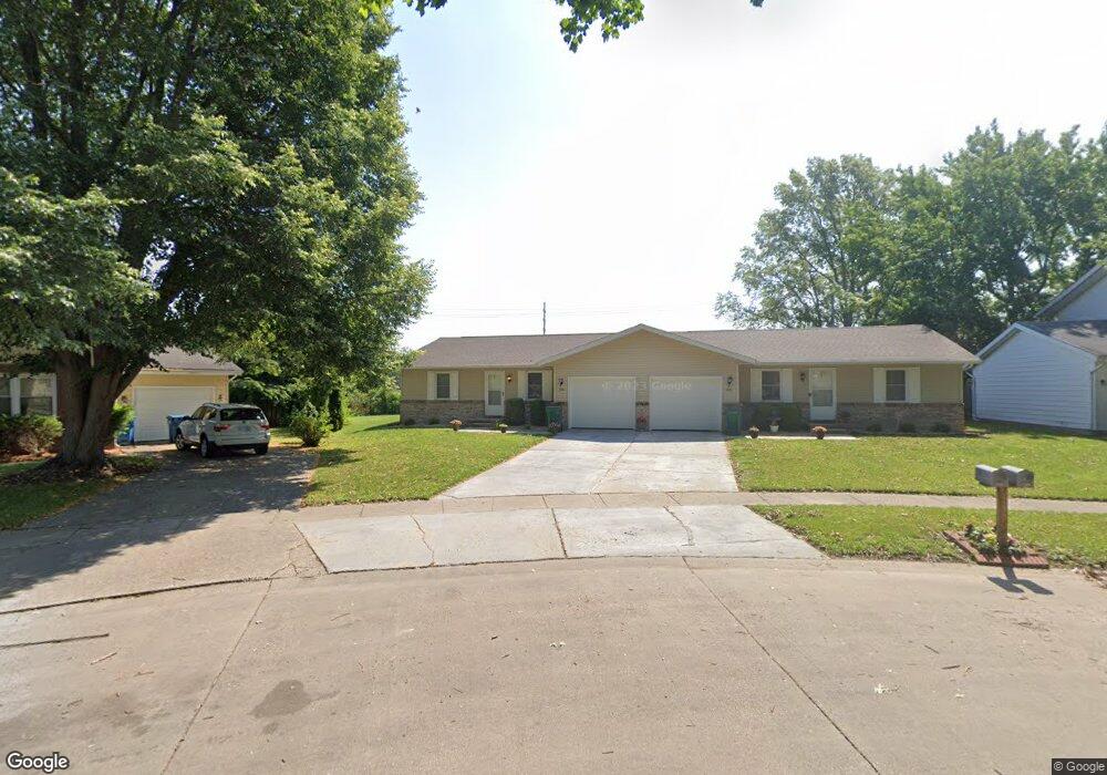
800 Freemans Farm Rd Springfield, IL 62704
Pasfield Park West NeighborhoodEstimated Value: $190,000 - $210,000
--
Bed
--
Bath
--
Sq Ft
0.35
Acres
About This Home
This home is located at 800 Freemans Farm Rd, Springfield, IL 62704 and is currently estimated at $201,067. 800 Freemans Farm Rd is a home located in Sangamon County with nearby schools including Dubois Elementary School, U.S. Grant Middle School, and Springfield High School.
Ownership History
Date
Name
Owned For
Owner Type
Purchase Details
Closed on
Jun 13, 2023
Sold by
Giacomini Thomas
Bought by
Davis Kathy
Current Estimated Value
Home Financials for this Owner
Home Financials are based on the most recent Mortgage that was taken out on this home.
Original Mortgage
$151,455
Outstanding Balance
$147,664
Interest Rate
6.75%
Mortgage Type
FHA
Estimated Equity
$53,403
Create a Home Valuation Report for This Property
The Home Valuation Report is an in-depth analysis detailing your home's value as well as a comparison with similar homes in the area
Home Values in the Area
Average Home Value in this Area
Purchase History
| Date | Buyer | Sale Price | Title Company |
|---|---|---|---|
| Davis Kathy | $155,000 | None Listed On Document |
Source: Public Records
Mortgage History
| Date | Status | Borrower | Loan Amount |
|---|---|---|---|
| Open | Davis Kathy | $151,455 |
Source: Public Records
Tax History Compared to Growth
Tax History
| Year | Tax Paid | Tax Assessment Tax Assessment Total Assessment is a certain percentage of the fair market value that is determined by local assessors to be the total taxable value of land and additions on the property. | Land | Improvement |
|---|---|---|---|---|
| 2024 | $4,352 | $57,814 | $12,748 | $45,066 |
| 2023 | $4,267 | $51,668 | $11,646 | $40,022 |
| 2022 | $4,673 | $52,151 | $11,047 | $41,104 |
| 2021 | $4,518 | $50,198 | $10,633 | $39,565 |
| 2020 | $4,428 | $50,273 | $10,649 | $39,624 |
| 2019 | $4,346 | $50,098 | $10,612 | $39,486 |
| 2018 | $4,212 | $49,853 | $10,560 | $39,293 |
| 2017 | $4,125 | $49,208 | $10,423 | $38,785 |
| 2016 | $4,044 | $48,490 | $10,271 | $38,219 |
| 2015 | $4,005 | $47,910 | $10,148 | $37,762 |
| 2014 | $3,945 | $47,600 | $10,082 | $37,518 |
| 2013 | $3,857 | $47,600 | $10,082 | $37,518 |
Source: Public Records
Map
Nearby Homes
- 19 Bellerive Rd
- 1109 Larchmont Dr
- 313 S Durkin Dr Unit 313
- 2523 Gaylord Ave
- 3116 Victoria Dr
- 612 Rock River Rd
- 55 Trailridge Ln
- 308 S Oxford Rd
- 608 Rock River Rd
- 604 Rock River Rd
- 160 S Durkin Dr Unit 4
- 609 Rock River Rd
- 613 Rock River Rd
- 3421 Conifer Dr
- 3113 Autumn Wood Dr
- 169 Bellerive Rd
- 3229 W Point Dr
- 2309 W Lawrence Ave
- 2924 Dartmoor Ct
- 3200 Greenbriar Dr
- 2801 Ticonderoga St
- 804 Freemans Farm Rd
- 806 Freemans Farm Rd
- 2805 Ticonderoga St
- 808 Freemans Farm Rd
- 2800 Ticonderoga St
- 805 Freemans Farm Rd
- 2809 Ticonderoga St
- 812 Freemans Farm Rd
- 2804 Ticonderoga St
- 809 Freemans Farm Rd
- 813 Freemans Farm Rd
- 2808 Ticonderoga St
- 2813 Ticonderoga St
- 949 Clocktower Dr
- 949 Clocktower Dr
- 816 Freemans Farm Rd
- 816 Freemans Farm Rd Unit A
- 817 Freemans Farm Rd
- 804 Rickard Rd