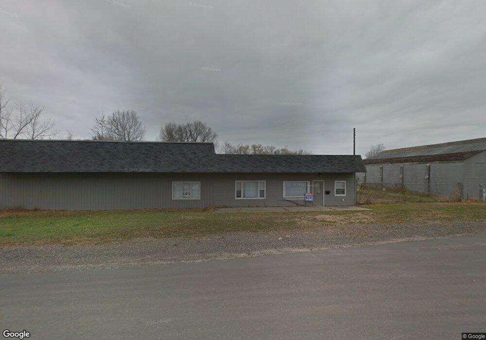
800 Hanson St Mauston, WI 53948
Estimated Value: $1,286,610
--
Bed
--
Bath
2,760
Sq Ft
$466/Sq Ft
Est. Value
About This Home
This home is located at 800 Hanson St, Mauston, WI 53948 and is currently estimated at $1,286,610, approximately $466 per square foot. 800 Hanson St is a home located in Juneau County with nearby schools including West Side Elementary School, Lyndon Station Elementary School, and Grayside Elementary School.
Ownership History
Date
Name
Owned For
Owner Type
Purchase Details
Closed on
Dec 10, 2012
Sold by
Dearborn Street Holdings Llc Series 5 Ro
Bought by
Milliren Trevor
Current Estimated Value
Purchase Details
Closed on
Mar 5, 2012
Sold by
Federal Deposit Insurance Corporation
Bought by
Dearborn Street Holdings Llc Series 5 Ro
Create a Home Valuation Report for This Property
The Home Valuation Report is an in-depth analysis detailing your home's value as well as a comparison with similar homes in the area
Home Values in the Area
Average Home Value in this Area
Purchase History
| Date | Buyer | Sale Price | Title Company |
|---|---|---|---|
| Milliren Trevor | $21,000 | -- | |
| Dearborn Street Holdings Llc Series 5 Ro | -- | -- |
Source: Public Records
Tax History Compared to Growth
Tax History
| Year | Tax Paid | Tax Assessment Tax Assessment Total Assessment is a certain percentage of the fair market value that is determined by local assessors to be the total taxable value of land and additions on the property. | Land | Improvement |
|---|---|---|---|---|
| 2024 | $1,821 | $76,300 | $30,200 | $46,100 |
| 2023 | $1,652 | $76,300 | $30,200 | $46,100 |
| 2022 | $1,629 | $76,300 | $30,200 | $46,100 |
| 2021 | $1,805 | $60,900 | $25,800 | $35,100 |
| 2020 | $1,766 | $60,900 | $25,800 | $35,100 |
| 2019 | $1,745 | $60,900 | $25,800 | $35,100 |
| 2018 | $1,688 | $60,900 | $25,800 | $35,100 |
| 2017 | $1,674 | $60,900 | $25,800 | $35,100 |
| 2016 | $1,699 | $60,900 | $25,800 | $35,100 |
| 2015 | $1,854 | $60,900 | $25,800 | $35,100 |
| 2014 | $1,729 | $60,900 | $25,800 | $35,100 |
| 2013 | -- | $60,900 | $25,800 | $35,100 |
Source: Public Records
Map
Nearby Homes
- 722 E State St
- 810 S Hickory St
- 813 S Hickory St
- 12.35 AC Highway 58 Trunk
- 120 W Milwaukee St
- 202 Wisconsin St
- 420 E Monroe St
- 234 Tremont St
- 914 Marshall Dr
- 318 Tremont St
- 108 Hanover St
- 415 West Ave
- L5 Buttner Ct
- 0 Fleet St Unit 1978417
- 0.3 acres Lincoln St
- 1.6 acres Prospect and Lincoln St
- Lot 47 Turner Dr
- 0.53 acres Prospect Ave
- 506 W State St
- 5.12 Ac College Ave
- 306 Bluff St
- 800 Prairie St
- 802 Prairie St
- 804 Prairie St
- 806 Prairie St
- 808 Prairie St
- 810 Prairie St
- 711 Prairie St
- 709 Prairie St
- 807 Prairie St
- 707 Prairie St
- 705 Prairie St
- 809 Prairie St
- 900 Prairie St
- 421 Maughs St
- 902 Prairie St
- 701 Prairie St
- 208 S Spring St
- 802 La Crosse St
- 718 La Crosse St