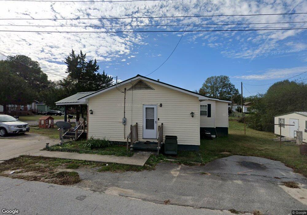
800 Mcnair Ave Elberton, GA 30635
Estimated Value: $75,000 - $109,000
--
Bed
1
Bath
1,046
Sq Ft
$85/Sq Ft
Est. Value
About This Home
This home is located at 800 Mcnair Ave, Elberton, GA 30635 and is currently estimated at $89,391, approximately $85 per square foot. 800 Mcnair Ave is a home located in Elbert County with nearby schools including Elbert County Primary School, Elbert County Elementary School, and Elbert County Middle School.
Ownership History
Date
Name
Owned For
Owner Type
Purchase Details
Closed on
May 23, 2023
Sold by
Turman Loyalty
Bought by
Turman Loyalty Bernard and Turman Amy Denise
Current Estimated Value
Purchase Details
Closed on
May 17, 2023
Sold by
Turman Loyalty
Bought by
Turman Loyalty Bernard and Turman Amy Denise
Purchase Details
Closed on
Dec 21, 2021
Sold by
Smith Cheryl
Bought by
Turman Amy
Purchase Details
Closed on
Aug 1, 1978
Purchase Details
Closed on
Nov 1, 1976
Purchase Details
Closed on
Feb 1, 1972
Purchase Details
Closed on
Mar 1, 1971
Create a Home Valuation Report for This Property
The Home Valuation Report is an in-depth analysis detailing your home's value as well as a comparison with similar homes in the area
Home Values in the Area
Average Home Value in this Area
Purchase History
| Date | Buyer | Sale Price | Title Company |
|---|---|---|---|
| Turman Loyalty Bernard | -- | -- | |
| Turman Loyalty Bernard | -- | -- | |
| Turman Amy | -- | -- | |
| -- | -- | -- | |
| -- | -- | -- | |
| -- | $14,100 | -- | |
| -- | -- | -- |
Source: Public Records
Tax History Compared to Growth
Tax History
| Year | Tax Paid | Tax Assessment Tax Assessment Total Assessment is a certain percentage of the fair market value that is determined by local assessors to be the total taxable value of land and additions on the property. | Land | Improvement |
|---|---|---|---|---|
| 2024 | $364 | $24,810 | $2,128 | $22,682 |
| 2023 | $364 | $24,810 | $2,128 | $22,682 |
| 2022 | $453 | $20,416 | $2,128 | $18,288 |
| 2021 | $457 | $20,416 | $2,128 | $18,288 |
| 2020 | $369 | $15,397 | $2,128 | $13,269 |
| 2019 | $381 | $15,397 | $2,128 | $13,269 |
| 2018 | $390 | $15,397 | $2,128 | $13,269 |
| 2017 | $313 | $11,952 | $2,128 | $9,824 |
| 2016 | $292 | $11,952 | $2,128 | $9,824 |
| 2015 | -- | $11,952 | $2,128 | $9,824 |
| 2014 | -- | $11,952 | $2,128 | $9,824 |
| 2013 | -- | $10,816 | $2,128 | $8,688 |
Source: Public Records
Map
Nearby Homes
- 214 Campbell St
- 1061 Porter Dr
- 349 Cook St
- 44 Clairmont Ave
- 122 Parkwood Dr
- 211 Snyder Ave
- 346 N Oliver St
- 6 Wood Duck Dr
- 345 N Oliver St
- 0 Old Middleton Rd Unit 22775401
- 0 Old Middleton Rd Unit 10651016
- 135 Brookside Dr
- 120 S Tusten St
- 968 Ext Elbert St
- 105 S Thomas St
- 245 Edwards St
- 173 Brookside Dr
- 252 Edwards St
- 0 Ruckersville Rd Unit 18922672
- 0 Ruckersville Rd Unit 10490441
- 0 Lincoln Ave Unit 8828247
- 202 Lincoln Ave
- 804 Mcnair Ave
- 801 Mcnair Ave
- 803 Mcnair Ave
- 806 Mcnair Ave
- 805 Mcnair Ave
- 807 Mcnair Ave
- 808 Mcnair Ave
- 834 Lincoln Ave
- 839 Lincoln Ave
- 828 Lincoln Ave
- 809 Mcnair Ave
- 841 Lincoln Ave
- 838 Lincoln Ave
- 843 Lincoln Ave
- 509 Mill Street Extension
- 1010 Campbell Street Extension
- 527 Mill Street Extension
- 845 Lincoln Ave