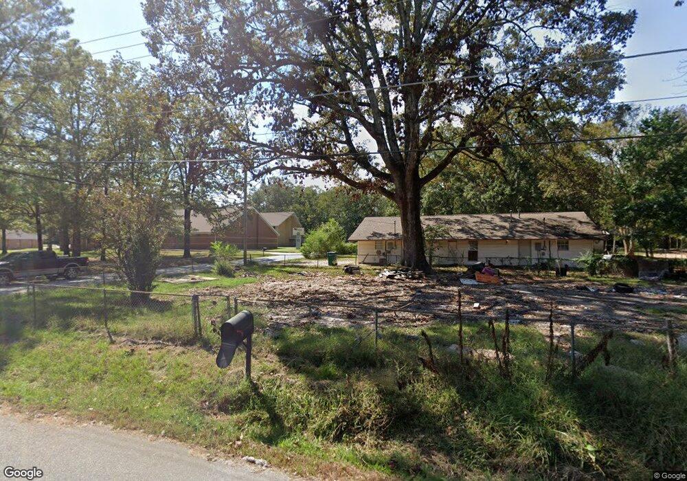
800 Moreland St White Hall, AR 71602
Estimated Value: $47,000 - $65,000
--
Bed
1
Bath
794
Sq Ft
$73/Sq Ft
Est. Value
About This Home
This home is located at 800 Moreland St, White Hall, AR 71602 and is currently estimated at $58,333, approximately $73 per square foot. 800 Moreland St is a home located in Jefferson County with nearby schools including Matthews Elementary School, Robert F. Morehead Middle School, and Dollarway High School.
Ownership History
Date
Name
Owned For
Owner Type
Purchase Details
Closed on
Feb 28, 2013
Sold by
J & N Enterprises Of White Hall Inc
Bought by
Works Jerry
Current Estimated Value
Home Financials for this Owner
Home Financials are based on the most recent Mortgage that was taken out on this home.
Original Mortgage
$72,749
Outstanding Balance
$51,230
Interest Rate
3.57%
Mortgage Type
New Conventional
Estimated Equity
$7,103
Purchase Details
Closed on
Feb 6, 2003
Bought by
J & N Enterprises Inc
Purchase Details
Closed on
Aug 29, 1988
Bought by
Brown Bonnie and Brown Husb
Purchase Details
Closed on
May 11, 1979
Bought by
Cooper Loretta
Create a Home Valuation Report for This Property
The Home Valuation Report is an in-depth analysis detailing your home's value as well as a comparison with similar homes in the area
Home Values in the Area
Average Home Value in this Area
Purchase History
| Date | Buyer | Sale Price | Title Company |
|---|---|---|---|
| Works Jerry | -- | -- | |
| J & N Enterprises Inc | $6,000 | -- | |
| Brown Bonnie | $11,000 | -- | |
| Cooper Loretta | -- | -- |
Source: Public Records
Mortgage History
| Date | Status | Borrower | Loan Amount |
|---|---|---|---|
| Open | Works Jerry | $72,749 |
Source: Public Records
Tax History Compared to Growth
Tax History
| Year | Tax Paid | Tax Assessment Tax Assessment Total Assessment is a certain percentage of the fair market value that is determined by local assessors to be the total taxable value of land and additions on the property. | Land | Improvement |
|---|---|---|---|---|
| 2025 | $200 | $2,970 | $600 | $2,370 |
| 2024 | $301 | $5,600 | $600 | $5,000 |
| 2023 | $276 | $5,600 | $600 | $5,000 |
| 2022 | $225 | $3,730 | $720 | $3,010 |
| 2021 | $225 | $3,730 | $720 | $3,010 |
| 2020 | $225 | $3,730 | $720 | $3,010 |
| 2019 | $225 | $3,730 | $720 | $3,010 |
| 2018 | $225 | $3,730 | $720 | $3,010 |
| 2017 | $240 | $3,970 | $960 | $3,010 |
| 2016 | $240 | $3,970 | $960 | $3,010 |
| 2015 | $228 | $3,970 | $960 | $3,010 |
| 2014 | -- | $3,970 | $960 | $3,010 |
Source: Public Records
Map
Nearby Homes
- 5301 W Malcomb St Unit 5303
- 5501 W Mosley St
- 5801 W Jones St
- 5811 W Jones St
- 1300 N Haley St
- 5812 Windham Ave
- 5809 Carbon St
- 6106 W Jones St
- Lot 16 and 17 Eureka Heights #5 Subdivision
- 5515 Kennedy Ave
- 12 Shirley St
- 5004 W Barraque St
- 52 Western Dr
- 6401 Sunset Rd
- 00 Sturgis Rd
- 6102 Dollarway Rd
- 6204 Dollarway Rd
- 6809 Stump Rd
- 2305 Betty St
- 00 Sidney Flipper
- 5507 W Malcomb St
- 803 Moreland St
- 903 Moreland St
- 5415 W Malcomb St
- 5511 W Malcomb St
- 5413 W Malcomb St
- 5504 Hoover St
- 5416 W Malcomb St
- 5502 Hoover St
- 719 Moreland St
- 5513 W Malcomb St
- 909 Moreland St
- 5508 Hoover St
- 810 N Hutchinson St
- 5514 W Malcomb St
- 5512 Hoover St
- 1000 Moreland St
- 918 N Hutchinson St
- 5402 W Malcomb St
- W Malcomb