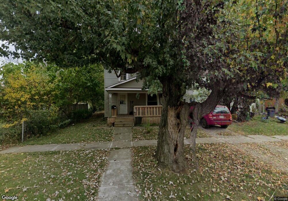
800 N State St Marion, OH 43302
Estimated Value: $128,000 - $169,000
4
Beds
1
Bath
1,620
Sq Ft
$93/Sq Ft
Est. Value
About This Home
This home is located at 800 N State St, Marion, OH 43302 and is currently estimated at $151,333, approximately $93 per square foot. 800 N State St is a home located in Marion County with nearby schools including William H. Taft Elementary School, Ulysses S. Grant Middle School, and Harding High School.
Ownership History
Date
Name
Owned For
Owner Type
Purchase Details
Closed on
Jul 3, 2008
Sold by
Us Bank Na
Bought by
Maynard Michael
Current Estimated Value
Purchase Details
Closed on
Feb 25, 2008
Sold by
Amos John
Bought by
Us Bank Na and Asset Backed Securities Corp Home Equity
Purchase Details
Closed on
Feb 4, 2004
Bought by
Maynard Michael
Purchase Details
Closed on
Jun 10, 2002
Bought by
Maynard Michael
Purchase Details
Closed on
May 14, 2002
Bought by
Maynard Michael
Purchase Details
Closed on
Jan 22, 1999
Bought by
Maynard Michael
Purchase Details
Closed on
Oct 21, 1998
Bought by
Maynard Michael
Purchase Details
Closed on
Mar 17, 1997
Bought by
Maynard Michael
Purchase Details
Closed on
Dec 24, 1996
Bought by
Maynard Michael
Create a Home Valuation Report for This Property
The Home Valuation Report is an in-depth analysis detailing your home's value as well as a comparison with similar homes in the area
Home Values in the Area
Average Home Value in this Area
Purchase History
| Date | Buyer | Sale Price | Title Company |
|---|---|---|---|
| Maynard Michael | $5,500 | Resource Title Agy | |
| Us Bank Na | $37,500 | Versatitle Shapiro & Felty | |
| Maynard Michael | $52,200 | -- | |
| Maynard Michael | $27,000 | -- | |
| Maynard Michael | $16,700 | -- | |
| Maynard Michael | $49,500 | -- | |
| Maynard Michael | -- | -- | |
| Maynard Michael | $66,700 | -- | |
| Maynard Michael | $17,000 | -- | |
| Maynard Michael | $16,600 | -- |
Source: Public Records
Tax History Compared to Growth
Tax History
| Year | Tax Paid | Tax Assessment Tax Assessment Total Assessment is a certain percentage of the fair market value that is determined by local assessors to be the total taxable value of land and additions on the property. | Land | Improvement |
|---|---|---|---|---|
| 2024 | $727 | $18,920 | $1,800 | $17,120 |
| 2023 | $727 | $18,920 | $1,800 | $17,120 |
| 2022 | $675 | $18,920 | $1,800 | $17,120 |
| 2021 | $616 | $15,540 | $1,570 | $13,970 |
| 2020 | $617 | $15,540 | $1,570 | $13,970 |
| 2019 | $685 | $15,540 | $1,570 | $13,970 |
| 2018 | $553 | $13,930 | $1,560 | $12,370 |
| 2017 | $560 | $13,930 | $1,560 | $12,370 |
| 2016 | $556 | $13,930 | $1,560 | $12,370 |
| 2015 | $555 | $13,600 | $1,480 | $12,120 |
| 2014 | $557 | $13,600 | $1,480 | $12,120 |
| 2012 | $602 | $14,640 | $1,690 | $12,950 |
Source: Public Records
Map
Nearby Homes
- 736 N Main St
- 197 Harrison St
- 149 Fairview St
- 197 Wallace St
- 593 N State St
- 552 N Prospect St
- 1015 N Main St
- 524 N State St
- 291 Patten St
- 749 Richmond Ave
- 455 Park St
- 592 N Greenwood St
- 434 N State St
- 935 Richmond Ave
- 551 Universal Ave Unit 555
- 395 N Main St
- 375 N Main St
- 966 Bikini Dr
- 560 Nassau Dr
- 721 Robinson St