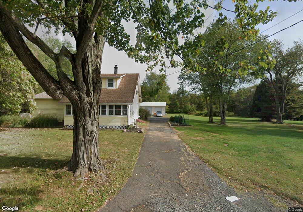
800 Newmans Ln Martinsville, NJ 08836
Estimated Value: $619,608 - $929,000
--
Bed
--
Bath
1,382
Sq Ft
$538/Sq Ft
Est. Value
About This Home
This home is located at 800 Newmans Ln, Martinsville, NJ 08836 and is currently estimated at $742,902, approximately $537 per square foot. 800 Newmans Ln is a home located in Somerset County with nearby schools including Crim Primary School, Bridgewater-Raritan Middle School, and Hillside Intermediate School.
Ownership History
Date
Name
Owned For
Owner Type
Purchase Details
Closed on
Jun 9, 2000
Sold by
Smith Dave
Bought by
Paul Lenox and Wilkins Sherri
Current Estimated Value
Home Financials for this Owner
Home Financials are based on the most recent Mortgage that was taken out on this home.
Original Mortgage
$188,388
Outstanding Balance
$67,738
Interest Rate
8.5%
Estimated Equity
$675,164
Purchase Details
Closed on
Jul 30, 1999
Sold by
Fitzpatrick Jeanne
Bought by
Smith Dave
Create a Home Valuation Report for This Property
The Home Valuation Report is an in-depth analysis detailing your home's value as well as a comparison with similar homes in the area
Home Values in the Area
Average Home Value in this Area
Purchase History
| Date | Buyer | Sale Price | Title Company |
|---|---|---|---|
| Paul Lenox | $225,000 | -- | |
| Smith Dave | $200,000 | -- |
Source: Public Records
Mortgage History
| Date | Status | Borrower | Loan Amount |
|---|---|---|---|
| Open | Paul Lenox | $188,388 |
Source: Public Records
Tax History Compared to Growth
Tax History
| Year | Tax Paid | Tax Assessment Tax Assessment Total Assessment is a certain percentage of the fair market value that is determined by local assessors to be the total taxable value of land and additions on the property. | Land | Improvement |
|---|---|---|---|---|
| 2025 | $9,645 | $504,800 | $343,300 | $161,500 |
| 2024 | $9,645 | $495,100 | $343,300 | $151,800 |
| 2023 | $9,484 | $478,000 | $343,300 | $134,700 |
| 2022 | $8,972 | $435,100 | $343,300 | $91,800 |
| 2021 | $9,052 | $428,400 | $343,300 | $85,100 |
| 2020 | $8,992 | $427,600 | $343,300 | $84,300 |
| 2019 | $9,052 | $426,400 | $343,300 | $83,100 |
| 2018 | $9,008 | $425,300 | $343,300 | $82,000 |
| 2017 | $8,938 | $421,600 | $343,300 | $78,300 |
| 2016 | $8,799 | $421,400 | $343,300 | $78,100 |
| 2015 | $8,776 | $420,500 | $343,300 | $77,200 |
| 2014 | $8,845 | $417,400 | $343,300 | $74,100 |
Source: Public Records
Map
Nearby Homes
- 1869 Washington Valley Rd
- 1899 Washington Valley Rd
- 1831 Washington Valley Rd
- 10 Assante Ln
- 112 Loft Dr Unit II112
- 57 Christy Dr
- 61 Christy Dr
- 2044 Washington Valley Rd
- 1825 Kennesaw Way
- 2105 Washington Valley Rd
- 2111 Washington Valley Rd
- 7 Meyers Way
- 1930 Mountain Top Rd
- 2138 Washington Valley Rd
- 6 Mount Horeb Rd
- 499 Foothill Rd
- 5 Bittle Ct
- 6 Hardwood Ct
- 114 Branch Rd
- 1600 Mountain Top Rd