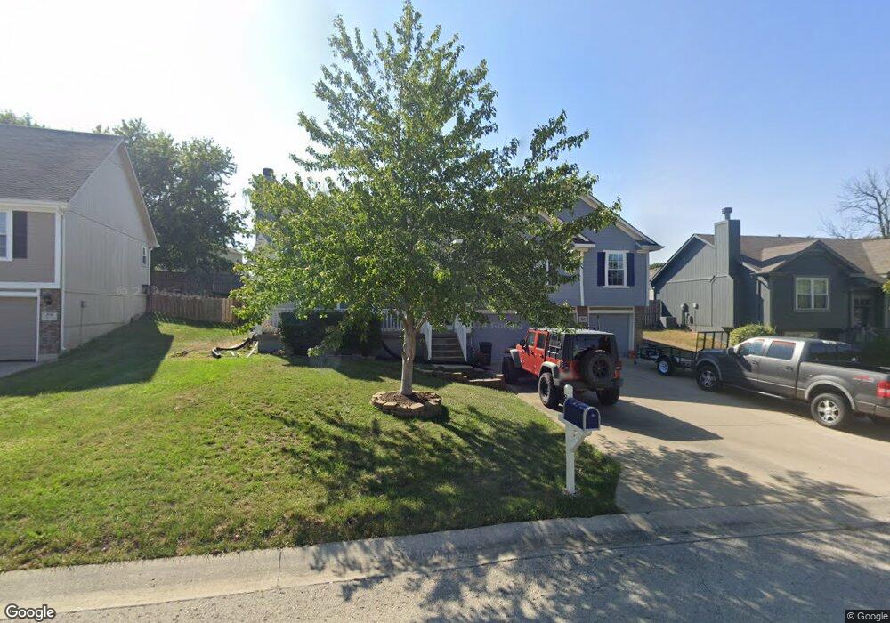
800 NW Albatross Dr Grain Valley, MO 64029
Estimated Value: $302,000 - $345,000
3
Beds
2
Baths
1,553
Sq Ft
$209/Sq Ft
Est. Value
About This Home
This home is located at 800 NW Albatross Dr, Grain Valley, MO 64029 and is currently estimated at $324,585, approximately $209 per square foot. 800 NW Albatross Dr is a home located in Jackson County with nearby schools including Grain Valley High School.
Ownership History
Date
Name
Owned For
Owner Type
Purchase Details
Closed on
Oct 22, 2007
Sold by
Sallee Homes Inc
Bought by
Zaiser Michael Eric
Current Estimated Value
Home Financials for this Owner
Home Financials are based on the most recent Mortgage that was taken out on this home.
Original Mortgage
$191,298
Outstanding Balance
$120,735
Interest Rate
6.42%
Mortgage Type
FHA
Estimated Equity
$203,850
Purchase Details
Closed on
Jun 7, 2005
Sold by
Valley Hills Development Co
Bought by
Sallee Homes Inc
Home Financials for this Owner
Home Financials are based on the most recent Mortgage that was taken out on this home.
Original Mortgage
$142,000
Interest Rate
5.79%
Mortgage Type
Purchase Money Mortgage
Create a Home Valuation Report for This Property
The Home Valuation Report is an in-depth analysis detailing your home's value as well as a comparison with similar homes in the area
Home Values in the Area
Average Home Value in this Area
Purchase History
| Date | Buyer | Sale Price | Title Company |
|---|---|---|---|
| Zaiser Michael Eric | -- | Stewart Title Of Kansas City | |
| Sallee Homes Inc | -- | Stewart |
Source: Public Records
Mortgage History
| Date | Status | Borrower | Loan Amount |
|---|---|---|---|
| Open | Zaiser Michael Eric | $191,298 | |
| Previous Owner | Sallee Homes Inc | $142,000 |
Source: Public Records
Tax History Compared to Growth
Tax History
| Year | Tax Paid | Tax Assessment Tax Assessment Total Assessment is a certain percentage of the fair market value that is determined by local assessors to be the total taxable value of land and additions on the property. | Land | Improvement |
|---|---|---|---|---|
| 2025 | $3,982 | $46,486 | $5,932 | $40,554 |
| 2024 | $3,833 | $48,344 | $5,784 | $42,560 |
| 2023 | $3,833 | $48,344 | $5,936 | $42,408 |
| 2022 | $3,186 | $35,150 | $7,429 | $27,721 |
| 2021 | $3,112 | $35,150 | $7,429 | $27,721 |
| 2020 | $3,150 | $35,101 | $7,429 | $27,672 |
| 2019 | $3,086 | $35,101 | $7,429 | $27,672 |
| 2018 | $1,608,569 | $33,423 | $5,214 | $28,209 |
| 2017 | $3,145 | $33,423 | $5,214 | $28,209 |
| 2016 | $3,065 | $32,585 | $6,251 | $26,334 |
| 2014 | $3,148 | $33,219 | $5,715 | $27,504 |
Source: Public Records
Map
Nearby Homes
- 605 NW Silverstone Cir
- 1211 NW Scenic Dr
- 1206 NW Baytree Dr
- 1007 NW Long Dr
- 1208 NW Golfview Dr
- 1229 NW Ashley Dr
- 1235 NW Ashley Ln
- 708 Pavillion Dr
- 2609 NE Amanda Ln
- 2601 NE Wheatley Dr
- 2613 NE Amanda Ln
- 2701 NE Crestview St
- 2700 NE Crestview St
- 2605 NE Crestview St
- 2601 NE Crestview St
- 1400 NW Burr Oak Ct
- 2513 NE Wheatley Dr
- 2512 NE Wheatley Dr
- 1403 NW Burr Oak Ct
- 2704 NE Amanda Ln
- 714 NW Albatross Dr
- 801 NW Albatross Dr
- 712 NW Albatross Dr
- 802 NW Albatross Dr
- 715 NW Albatross Dr
- 1102 NW Meadow Ct
- 1103 NW Meadow Ct
- 803 NW Albatross Dr
- 710 NW Albatross Dr
- 804 NW Albatross Dr
- 713 NW Albatross Dr
- 711 NW Albatross Dr
- 1105 NW Scenic Dr
- 1104 NW Meadow Ct
- 1105 NW Meadow Ct
- 956 NW Baytree Dr
- 804 NW Par Dr
- 802 NW Par Dr
- 1107 NW Scenic Dr
- 958 NW Baytree Dr