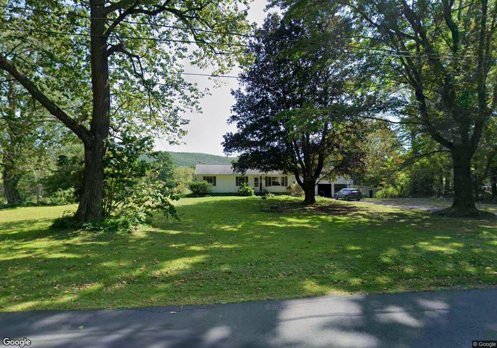
800 Partridge Rd Lanesborough, MA 01237
Estimated Value: $358,000 - $411,000
3
Beds
2
Baths
1,056
Sq Ft
$371/Sq Ft
Est. Value
About This Home
This home is located at 800 Partridge Rd, Lanesborough, MA 01237 and is currently estimated at $392,177, approximately $371 per square foot. 800 Partridge Rd is a home located in Berkshire County with nearby schools including Lanesborough Elementary School and Mt. Greylock Regional High School.
Ownership History
Date
Name
Owned For
Owner Type
Purchase Details
Closed on
May 8, 2013
Sold by
Lagerwall Glenn E and Lagerwall Kimberly J
Bought by
Lagerwall Kimberly J
Current Estimated Value
Purchase Details
Closed on
May 6, 2009
Sold by
Lagerwall Glenn E and Smith Kimberly J
Bought by
Lagerwall Glenn E and Lagerwall Kimberly J
Home Financials for this Owner
Home Financials are based on the most recent Mortgage that was taken out on this home.
Original Mortgage
$208,800
Interest Rate
4.9%
Mortgage Type
Purchase Money Mortgage
Purchase Details
Closed on
Aug 30, 2002
Sold by
Gillett Viola M
Bought by
Lagerwall Glenn E and Smith Kimberly J
Home Financials for this Owner
Home Financials are based on the most recent Mortgage that was taken out on this home.
Original Mortgage
$161,020
Interest Rate
6.55%
Mortgage Type
Purchase Money Mortgage
Create a Home Valuation Report for This Property
The Home Valuation Report is an in-depth analysis detailing your home's value as well as a comparison with similar homes in the area
Home Values in the Area
Average Home Value in this Area
Purchase History
| Date | Buyer | Sale Price | Title Company |
|---|---|---|---|
| Lagerwall Kimberly J | -- | -- | |
| Lagerwall Glenn E | -- | -- | |
| Lagerwall Glenn E | $166,000 | -- |
Source: Public Records
Mortgage History
| Date | Status | Borrower | Loan Amount |
|---|---|---|---|
| Previous Owner | Lagerwall Glenn E | $208,800 | |
| Previous Owner | Lagerwall Glenn E | $26,100 | |
| Previous Owner | Lagerwall Glenn E | $161,020 | |
| Previous Owner | Lagerwall Glenn E | $10,000 |
Source: Public Records
Tax History Compared to Growth
Tax History
| Year | Tax Paid | Tax Assessment Tax Assessment Total Assessment is a certain percentage of the fair market value that is determined by local assessors to be the total taxable value of land and additions on the property. | Land | Improvement |
|---|---|---|---|---|
| 2025 | $5,419 | $323,900 | $85,600 | $238,300 |
| 2024 | $5,166 | $303,700 | $85,600 | $218,100 |
| 2023 | $5,131 | $290,400 | $81,600 | $208,800 |
| 2022 | $4,685 | $245,300 | $81,600 | $163,700 |
| 2021 | $5,019 | $247,500 | $95,500 | $152,000 |
| 2020 | $4,903 | $237,100 | $91,200 | $145,900 |
| 2019 | $5,271 | $232,900 | $91,200 | $141,700 |
| 2018 | $4,894 | $228,700 | $91,200 | $137,500 |
| 2017 | $4,849 | $232,100 | $95,000 | $137,100 |
| 2016 | $4,482 | $231,500 | $95,000 | $136,500 |
| 2015 | $4,379 | $230,700 | $95,000 | $135,700 |
Source: Public Records
Map
Nearby Homes
- 60 Old Cheshire Rd
- 20 Westview Rd
- 69 Baker St
- 66 Baker St
- 63 Baker St
- 580 S Main St Unit Building 4 unit 2
- 580 S Main St Unit 2-1
- 67 Gulf Rd
- 39 N Mountain Rd
- 18 Billings St
- 25 Yarmouth St
- 0 Cheshire Rd
- 71 Miner Lots 2 and 3 Rd
- 215 Partridge Rd
- 0 Ocean St
- 0 Goodell Rd
- 0 Miner Rd
- 134 Oak Hill Rd
- 127 Oak Hill Rd
- 8 Balance Rock Rd