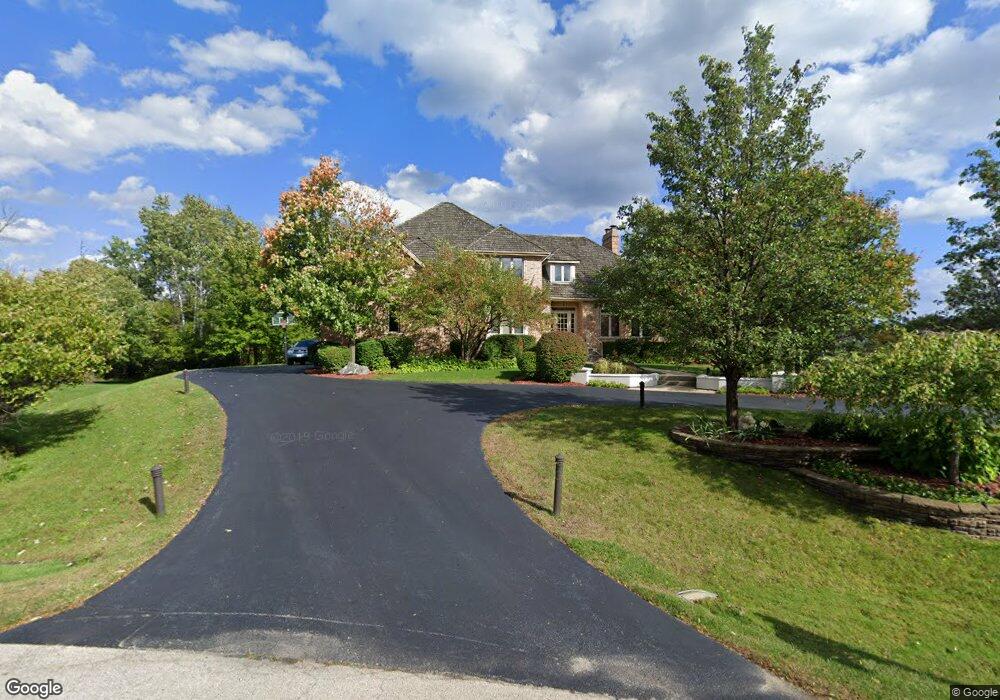
800 Port Clinton Ct E Unit 9 Buffalo Grove, IL 60089
The Woodlands of Fiore NeighborhoodEstimated Value: $910,000 - $1,137,000
4
Beds
4
Baths
3,707
Sq Ft
$270/Sq Ft
Est. Value
About This Home
This home is located at 800 Port Clinton Ct E Unit 9, Buffalo Grove, IL 60089 and is currently estimated at $1,000,393, approximately $269 per square foot. 800 Port Clinton Ct E Unit 9 is a home located in Lake County with nearby schools including Country Meadows Elementary School, Woodlawn Middle School, and Adlai E Stevenson High School.
Ownership History
Date
Name
Owned For
Owner Type
Purchase Details
Closed on
May 24, 2011
Sold by
Baskin Neil M and Baskin Kathy S
Bought by
Korsunsky Dimitry and Korsunsky Olga
Current Estimated Value
Home Financials for this Owner
Home Financials are based on the most recent Mortgage that was taken out on this home.
Original Mortgage
$532,500
Outstanding Balance
$347,849
Interest Rate
3.62%
Mortgage Type
New Conventional
Estimated Equity
$652,544
Purchase Details
Closed on
Apr 5, 2005
Sold by
Baskin Neil M
Bought by
Baskin Neil M and Baskin Kathy S
Purchase Details
Closed on
Jan 31, 2005
Sold by
Goldman Alan S and Goldman Lori S
Bought by
Baskin Neil M
Home Financials for this Owner
Home Financials are based on the most recent Mortgage that was taken out on this home.
Original Mortgage
$625,000
Interest Rate
5.83%
Mortgage Type
Purchase Money Mortgage
Purchase Details
Closed on
Sep 8, 1993
Sold by
Bank Of Waukegan
Bought by
Goldman Alan S and Goldman Lori S
Home Financials for this Owner
Home Financials are based on the most recent Mortgage that was taken out on this home.
Original Mortgage
$250,000
Interest Rate
7.24%
Create a Home Valuation Report for This Property
The Home Valuation Report is an in-depth analysis detailing your home's value as well as a comparison with similar homes in the area
Home Values in the Area
Average Home Value in this Area
Purchase History
| Date | Buyer | Sale Price | Title Company |
|---|---|---|---|
| Korsunsky Dimitry | $710,000 | Republic Title Company | |
| Baskin Neil M | -- | Chicago Title Insurance Comp | |
| Baskin Neil M | $783,500 | Ticor | |
| Goldman Alan S | -- | Chicago Title Insurance Co |
Source: Public Records
Mortgage History
| Date | Status | Borrower | Loan Amount |
|---|---|---|---|
| Open | Korsunsky Dimitry | $532,500 | |
| Previous Owner | Baskin Neil M | $625,000 | |
| Previous Owner | Goldman Alan S | $250,000 |
Source: Public Records
Tax History Compared to Growth
Tax History
| Year | Tax Paid | Tax Assessment Tax Assessment Total Assessment is a certain percentage of the fair market value that is determined by local assessors to be the total taxable value of land and additions on the property. | Land | Improvement |
|---|---|---|---|---|
| 2024 | $23,930 | $257,717 | $75,537 | $182,180 |
| 2023 | $23,930 | $243,175 | $71,275 | $171,900 |
| 2022 | $23,402 | $235,175 | $68,930 | $166,245 |
| 2021 | $22,655 | $232,639 | $68,187 | $164,452 |
| 2020 | $22,211 | $233,433 | $68,420 | $165,013 |
| 2019 | $21,672 | $232,573 | $68,168 | $164,405 |
| 2018 | $22,040 | $242,744 | $74,099 | $168,645 |
| 2017 | $21,691 | $237,077 | $72,369 | $164,708 |
| 2016 | $20,925 | $227,020 | $69,299 | $157,721 |
| 2015 | $20,496 | $212,307 | $64,808 | $147,499 |
| 2014 | $21,027 | $214,210 | $69,604 | $144,606 |
| 2012 | $20,980 | $214,639 | $69,743 | $144,896 |
Source: Public Records
Map
Nearby Homes
- 5801 Port Clinton Rd
- 5898 Partridge Ln
- 5727 Hampton Dr
- 5802 Teal Ct
- 2770 Sandalwood Rd Unit 3
- 321 Foxford Dr
- 361 Willow Pkwy Unit 234
- 2861 Whispering Oaks Dr
- 259 Willow Pkwy Unit 403
- 431 Woodland Chase Ln
- 16637 W Brockman Ave
- 0 Endwood Dr
- 16639 W Brockman Ave
- 384 Woodland Chase Ln
- 399 Sislow Ln
- 486 Satinwood Terrace Unit 11
- 5328 Oak Grove Dr
- 410 Sislow Ln
- 414 Sislow Ln
- 61 Willow Pkwy Unit 731
- 820 Port Clinton Ct E
- 840 Port Clinton Ct E
- 860 Port Clinton Ct E
- 630 Raintree Rd
- 632 Raintree Rd
- 628 Raintree Rd Unit 12
- 3001 Cypress Ct
- 5805 Port Clinton Rd
- 634 Raintree Rd
- 626 Raintree Rd
- 880 Port Clinton Ct W
- 880 Port Clinton Ct W
- 3011 Cypress Ct
- 636 Raintree Rd
- 624 Raintree Rd Unit 12
- 629 Raintree Rd
- 900 Port Clinton Ct W
- 627 Raintree Rd
- 638 Raintree Rd
- 622 Raintree Rd