Estimated Value: $286,000 - $356,556
5
Beds
3
Baths
3,600
Sq Ft
$86/Sq Ft
Est. Value
About This Home
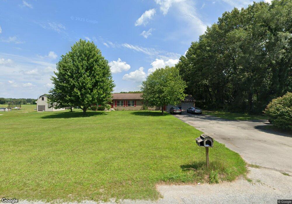
This home is located at 800 S 200 E Unit 408925, Knox, IN 46534 and is currently estimated at $310,389, approximately $86 per square foot. 800 S 200 E Unit 408925 is a home located in Starke County with nearby schools including Knox Community Elementary School, Knox Community Middle School, and Knox Community High School.
Ownership History
Date
Name
Owned For
Owner Type
Purchase Details
Closed on
Aug 30, 2024
Sold by
Phillippe Monica
Bought by
Phillippe Monica and Phillippe Harry
Current Estimated Value
Purchase Details
Closed on
Oct 19, 2018
Sold by
Kuhn John A
Bought by
Perez Jeffrey
Home Financials for this Owner
Home Financials are based on the most recent Mortgage that was taken out on this home.
Original Mortgage
$163,000
Interest Rate
4.5%
Mortgage Type
VA
Purchase Details
Closed on
May 23, 2008
Sold by
Smith Harold L and Petry Christy
Bought by
Kuhn John A
Home Financials for this Owner
Home Financials are based on the most recent Mortgage that was taken out on this home.
Original Mortgage
$136,000
Interest Rate
5.93%
Mortgage Type
New Conventional
Purchase Details
Closed on
Jun 22, 2000
Sold by
Smith Harold L
Bought by
Smith Harold L and Smith Petry Christy
Create a Home Valuation Report for This Property
The Home Valuation Report is an in-depth analysis detailing your home's value as well as a comparison with similar homes in the area
Purchase History
| Date | Buyer | Sale Price | Title Company |
|---|---|---|---|
| Phillippe Monica | $280,000 | First American Title | |
| Phillippe Monica | -- | None Listed On Document | |
| Perez Jeffrey | -- | Liberty Title & Escrow Compa | |
| Gunderson Ray F | -- | Liberty Title & Escrow Compa | |
| Kuhn John A | -- | Meridan Title Corp | |
| Smith Harold L | $18,500 | -- |
Source: Public Records
Mortgage History
| Date | Status | Borrower | Loan Amount |
|---|---|---|---|
| Previous Owner | Perez Jeffrey | $163,000 | |
| Previous Owner | Kuhn John A | $136,000 |
Source: Public Records
Tax History
| Year | Tax Paid | Tax Assessment Tax Assessment Total Assessment is a certain percentage of the fair market value that is determined by local assessors to be the total taxable value of land and additions on the property. | Land | Improvement |
|---|---|---|---|---|
| 2025 | $2,137 | $301,500 | $34,600 | $266,900 |
| 2024 | $2,137 | $294,500 | $33,100 | $261,400 |
| 2023 | $1,692 | $269,200 | $28,600 | $240,600 |
| 2022 | $1,584 | $241,000 | $26,000 | $215,000 |
| 2021 | $1,343 | $204,100 | $24,600 | $179,500 |
| 2020 | $1,236 | $184,100 | $24,500 | $159,600 |
| 2019 | $1,154 | $174,500 | $24,100 | $150,400 |
| 2018 | $1,381 | $189,500 | $31,300 | $158,200 |
| 2017 | $1,321 | $188,700 | $30,900 | $157,800 |
| 2016 | $1,334 | $186,500 | $30,500 | $156,000 |
| 2014 | $1,314 | $194,600 | $30,800 | $163,800 |
| 2013 | $1,253 | $194,000 | $29,300 | $164,700 |
Source: Public Records
Map
Nearby Homes
- 8692 E 200 S
- 8715 E Long Lane Dr
- 8845 E 200 S
- 7240 Indiana 8
- 3455 S 800 E
- 0-Rear Toto Rd
- 6540 E 200 S
- TBD LOT 42 Wild Rose Dr
- 3520 S 750 E
- 6776 Fox Crossing
- - Fox Crossing
- Lot 8 E 125 S
- Lot 16 E 125 S
- Lot 4 E 125 S
- Lot 13 E 125 S
- Lot 5 E 125 S
- Lot 14 E 125 S
- Lot 17 E 125 S
- Lot 12 E 125 S
- Lot 9 E 125 S
- 800 S 200 E
- 8515 E 200 S
- 8185 E 200 S
- 8479 E 200 S
- 8095 E 200 S
- 8615 E 200 S
- 8320 E 150 S
- 0-TBD S 800 E
- TBD S 800 E
- 8449 E Long Lane Dr
- 1901 S 800 E
- 8575 E Long Lane Dr
- 8495 E 150 S
- 8420 E 150 S
- 8100 E Long Lane Dr
- 8591 E Long Lane Dr
- 8560 E Long Lane Dr
- 8520 E 150 S
- 8625 E Long Lane Dr
- 8576 E Long Lane Dr
Your Personal Tour Guide
Ask me questions while you tour the home.