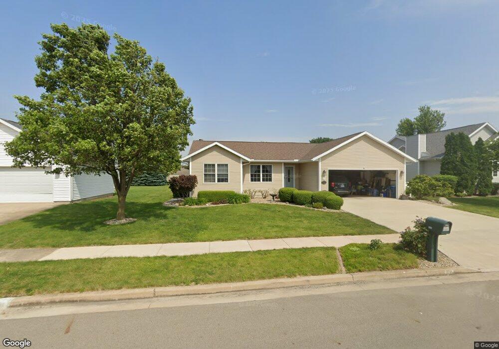
800 S Lawrence Way Pontiac, IL 61764
Estimated Value: $257,000 - $297,304
3
Beds
2
Baths
3,584
Sq Ft
$79/Sq Ft
Est. Value
About This Home
This home is located at 800 S Lawrence Way, Pontiac, IL 61764 and is currently estimated at $282,826, approximately $78 per square foot. 800 S Lawrence Way is a home located in Livingston County with nearby schools including Central Elementary School, Lincoln Elementary School, and Washington Elementary School.
Ownership History
Date
Name
Owned For
Owner Type
Purchase Details
Closed on
Jun 21, 2017
Sold by
Stilwell Rebecca J
Bought by
Stilwell William Scott and Williams Sherry K
Current Estimated Value
Purchase Details
Closed on
Sep 2, 2015
Sold by
Bane Parker J
Bought by
Stilwell Rebecca J and Stilwell William V
Home Financials for this Owner
Home Financials are based on the most recent Mortgage that was taken out on this home.
Original Mortgage
$67,000
Outstanding Balance
$26,794
Interest Rate
3.9%
Mortgage Type
Stand Alone First
Estimated Equity
$256,032
Create a Home Valuation Report for This Property
The Home Valuation Report is an in-depth analysis detailing your home's value as well as a comparison with similar homes in the area
Home Values in the Area
Average Home Value in this Area
Purchase History
| Date | Buyer | Sale Price | Title Company |
|---|---|---|---|
| Stilwell William Scott | -- | -- | |
| Stilwell Rebecca J | $192,500 | None Available |
Source: Public Records
Mortgage History
| Date | Status | Borrower | Loan Amount |
|---|---|---|---|
| Open | Stilwell Rebecca J | $67,000 |
Source: Public Records
Tax History Compared to Growth
Tax History
| Year | Tax Paid | Tax Assessment Tax Assessment Total Assessment is a certain percentage of the fair market value that is determined by local assessors to be the total taxable value of land and additions on the property. | Land | Improvement |
|---|---|---|---|---|
| 2024 | $6,705 | $83,515 | $8,309 | $75,206 |
| 2023 | $6,464 | $78,125 | $7,773 | $70,352 |
| 2022 | $6,065 | $71,306 | $7,773 | $63,533 |
| 2021 | $5,855 | $68,563 | $7,474 | $61,089 |
| 2020 | $5,769 | $66,501 | $7,249 | $59,252 |
| 2019 | $5,588 | $63,589 | $6,932 | $56,657 |
| 2018 | $5,470 | $62,848 | $7,002 | $55,846 |
| 2017 | $5,448 | $62,785 | $6,995 | $55,790 |
| 2016 | $5,486 | $63,548 | $7,080 | $56,468 |
| 2015 | $5,909 | $63,548 | $7,080 | $56,468 |
| 2013 | $3,758 | $68,087 | $7,587 | $60,500 |
Source: Public Records
Map
Nearby Homes
- 1304 W Reynolds St
- 1204 W Reynolds St
- 406 Carol Ct Unit B2
- 105 Carol Ct Unit C-1
- 2 W Edgewood Dr
- 811 W South St
- 1635 Mockingbird Ln
- 721 W South St
- 1620 Meadowlark Dr
- 734 W Henry St
- 1810 Cardinal Ct
- 615 W South St
- 606 N Ladd St
- 319 W Moulton St
- 409 W Water St
- 219 W Bennett St
- 503 W Livingston St
- Lot 3 W Cleary St
- 618 W Sherman Ave
- 119 W Lowell Ave
- 803 S Lawrence Way
- 805 S Lawrence Way
- 806 S Lawrence Way
- 804 S Lawrence Way
- 802 S Lawrence Way
- 705 S Lawrence Way
- 703 S Lawrence Way
- 801 S Lawrence Way
- 702 S Lawrence Way
- 707 S Lawrence Way
- 706 S Lawrence Way
- 704 S Lawrence Way
- 701 S Lawrence Way
- 700 S Lawrence Way
- 702 S Franklin Way
- 700 S Franklin Way
- 605 S Lawrence Way
- 807 S Lawrence Way
- 604 S Franklin Way
- 602 S Lawrence Way