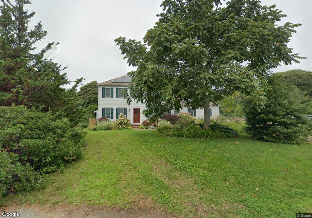
800 Samoset Rd Eastham, MA 02642
Estimated Value: $840,000 - $1,070,000
4
Beds
3
Baths
1,976
Sq Ft
$474/Sq Ft
Est. Value
About This Home
This home is located at 800 Samoset Rd, Eastham, MA 02642 and is currently estimated at $936,230, approximately $473 per square foot. 800 Samoset Rd is a home located in Barnstable County with nearby schools including Eastham Elementary School, Nauset Regional Middle School, and Nauset Regional High School.
Ownership History
Date
Name
Owned For
Owner Type
Purchase Details
Closed on
Nov 23, 2010
Sold by
Harris Judith S
Bought by
Harris Charles D
Current Estimated Value
Home Financials for this Owner
Home Financials are based on the most recent Mortgage that was taken out on this home.
Original Mortgage
$239,300
Outstanding Balance
$158,101
Interest Rate
4.22%
Estimated Equity
$778,129
Purchase Details
Closed on
Jun 10, 2003
Sold by
Grant Kristina M
Bought by
Harris Charles D and Harris Judith S
Home Financials for this Owner
Home Financials are based on the most recent Mortgage that was taken out on this home.
Original Mortgage
$408,090
Interest Rate
5.83%
Mortgage Type
Purchase Money Mortgage
Purchase Details
Closed on
Dec 17, 2002
Sold by
Meservey-Grant Kristina
Bought by
Eastham Town Of
Create a Home Valuation Report for This Property
The Home Valuation Report is an in-depth analysis detailing your home's value as well as a comparison with similar homes in the area
Home Values in the Area
Average Home Value in this Area
Purchase History
| Date | Buyer | Sale Price | Title Company |
|---|---|---|---|
| Harris Charles D | -- | -- | |
| Harris Charles D | $299,900 | -- | |
| Eastham Town Of | $95,000 | -- |
Source: Public Records
Mortgage History
| Date | Status | Borrower | Loan Amount |
|---|---|---|---|
| Open | Eastham Town Of | $239,300 | |
| Previous Owner | Eastham Town Of | $408,090 |
Source: Public Records
Tax History
| Year | Tax Paid | Tax Assessment Tax Assessment Total Assessment is a certain percentage of the fair market value that is determined by local assessors to be the total taxable value of land and additions on the property. | Land | Improvement |
|---|---|---|---|---|
| 2025 | $5,965 | $773,700 | $292,600 | $481,100 |
| 2024 | $5,267 | $751,300 | $284,100 | $467,200 |
| 2023 | $4,695 | $648,500 | $236,700 | $411,800 |
| 2022 | $4,352 | $507,200 | $211,400 | $295,800 |
| 2021 | $4,260 | $464,100 | $192,100 | $272,000 |
| 2020 | $3,929 | $450,600 | $196,100 | $254,500 |
| 2019 | $3,634 | $440,500 | $190,400 | $250,100 |
| 2018 | $3,596 | $430,600 | $184,800 | $245,800 |
| 2017 | $3,335 | $422,200 | $181,200 | $241,000 |
| 2016 | $3,346 | $449,700 | $201,300 | $248,400 |
| 2015 | $3,071 | $432,600 | $197,400 | $235,200 |
Source: Public Records
Map
Nearby Homes
- 20 Billingsgate Ave
- 600 Kingsbury Beach Rd
- 2705 State Hwy
- 2705 State Hwy Unit 1-8
- 55 Grandfathers Way
- 10 Cartway N
- 82 Old Orchard Rd
- 330 Hay Rd
- 300 School House Rd
- 70 Deerfield Ln
- 1061 State Hwy Unit 4
- 1061 State Hwy Unit 1061
- 255 Massasoit Rd
- 25 Forrest Ave
- 315 Candlewood Dr
- 25 Twin Rocks Dr
- 40 Bayview Rd
- 20 Kittiwake Ln
- 85 Huckleberry Ln
- 10 Bradford Ln
- 825 Samoset Rd
- 810 Samoset Rd
- 835 Samoset Rd
- 700 Samoset Rd
- 815 Samoset Rd
- 4 Clarkes Point Rd
- 820 Samoset Rd
- 845 Samoset Rd
- 2 Linwood Trace
- 4 Sues Walk
- 805 Samoset Rd
- 2 Sue's Walk
- 0 Samoset Rd
- 2 Sues Walk
- 6 Clarkes Point Rd
- 680 Samoset Rd
- 0 Clark's Point Rd
- 4 Clark's Point Rd
- 895 Samoset Rd
- 875 Samoset Rd
Your Personal Tour Guide
Ask me questions while you tour the home.