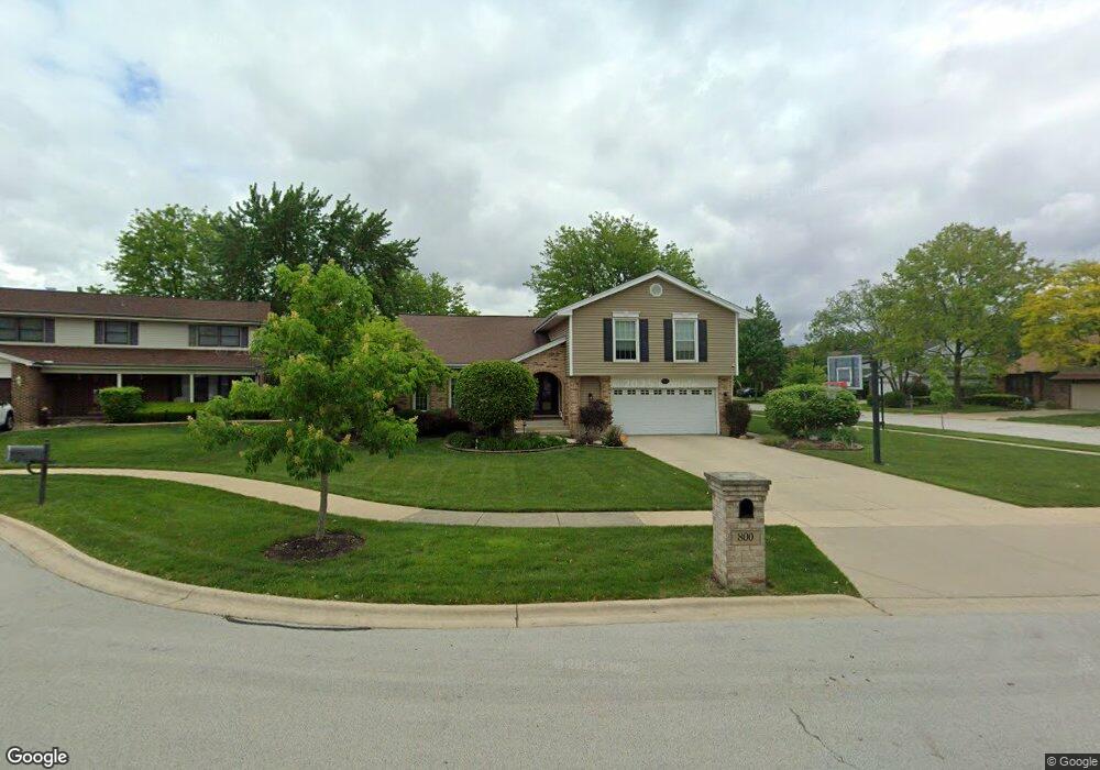
800 Seaside Ct Schaumburg, IL 60193
South Schaumburg NeighborhoodEstimated Value: $625,000 - $684,000
4
Beds
3
Baths
2,717
Sq Ft
$239/Sq Ft
Est. Value
About This Home
This home is located at 800 Seaside Ct, Schaumburg, IL 60193 and is currently estimated at $648,338, approximately $238 per square foot. 800 Seaside Ct is a home located in Cook County with nearby schools including Nathan Hale Elementary School, Robert Frost Junior High School, and Schaumburg High School.
Ownership History
Date
Name
Owned For
Owner Type
Purchase Details
Closed on
Jul 20, 2004
Sold by
Homp Daniel T and Homp Patricia J
Bought by
Hill David H and Hill Paula S
Current Estimated Value
Home Financials for this Owner
Home Financials are based on the most recent Mortgage that was taken out on this home.
Original Mortgage
$333,700
Outstanding Balance
$168,889
Interest Rate
6.42%
Mortgage Type
Unknown
Estimated Equity
$479,449
Create a Home Valuation Report for This Property
The Home Valuation Report is an in-depth analysis detailing your home's value as well as a comparison with similar homes in the area
Home Values in the Area
Average Home Value in this Area
Purchase History
| Date | Buyer | Sale Price | Title Company |
|---|---|---|---|
| Hill David H | $403,000 | Multiple |
Source: Public Records
Mortgage History
| Date | Status | Borrower | Loan Amount |
|---|---|---|---|
| Open | Hill David H | $333,700 |
Source: Public Records
Tax History Compared to Growth
Tax History
| Year | Tax Paid | Tax Assessment Tax Assessment Total Assessment is a certain percentage of the fair market value that is determined by local assessors to be the total taxable value of land and additions on the property. | Land | Improvement |
|---|---|---|---|---|
| 2024 | $11,677 | $45,000 | $9,960 | $35,040 |
| 2023 | $11,295 | $45,000 | $9,960 | $35,040 |
| 2022 | $11,295 | $45,000 | $9,960 | $35,040 |
| 2021 | $10,969 | $39,520 | $7,470 | $32,050 |
| 2020 | $10,848 | $39,520 | $7,470 | $32,050 |
| 2019 | $10,851 | $43,912 | $7,470 | $36,442 |
| 2018 | $11,914 | $43,135 | $6,363 | $36,772 |
| 2017 | $11,744 | $43,135 | $6,363 | $36,772 |
| 2016 | $11,225 | $43,135 | $6,363 | $36,772 |
| 2015 | $11,225 | $40,143 | $5,533 | $34,610 |
| 2014 | $11,118 | $40,143 | $5,533 | $34,610 |
| 2013 | $10,815 | $40,143 | $5,533 | $34,610 |
Source: Public Records
Map
Nearby Homes
- 818 Brentwood Ct
- 1109 Beach Comber Dr
- 988 Chelsea Ln
- 1008 Shannock Ln
- 415 Laconia Ln
- 1027 Duxbury Ln
- 1104 Taunton Ct
- 1150 Attleboro Ct
- 516 W Weathersfield Way
- 712 Dante Ct
- 1126 Tiverton Ct
- 1300 Cranbrook Dr
- 1285 Cranbrook Dr
- 1171 Regency Dr
- 357 Lucille Ln Unit 30
- 412 Redwood Ln
- 1313 Hartmann Dr
- 305 Williams Dr
- 1342 Lunt Ct Unit 56
- 315 Ashwood Dr