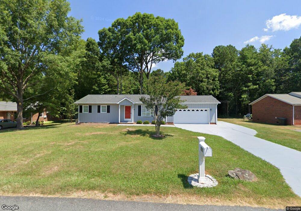
800 Sherwood Rd Asheboro, NC 27205
Estimated Value: $201,267 - $272,000
--
Bed
1
Bath
1,320
Sq Ft
$184/Sq Ft
Est. Value
About This Home
This home is located at 800 Sherwood Rd, Asheboro, NC 27205 and is currently estimated at $242,317, approximately $183 per square foot. 800 Sherwood Rd is a home located in Randolph County with nearby schools including Guy B. Teachey Elementary School, South Asheboro Middle School, and Asheboro High School.
Ownership History
Date
Name
Owned For
Owner Type
Purchase Details
Closed on
Apr 8, 2005
Sold by
Brady Virginia M
Bought by
Allred Sherry Davis
Current Estimated Value
Purchase Details
Closed on
Jan 14, 1992
Bought by
Allred Sherry Annette
Purchase Details
Closed on
Dec 31, 1991
Bought by
Allred Sherry Annette
Purchase Details
Closed on
Mar 7, 1988
Bought by
Allred Sherry Annette
Create a Home Valuation Report for This Property
The Home Valuation Report is an in-depth analysis detailing your home's value as well as a comparison with similar homes in the area
Home Values in the Area
Average Home Value in this Area
Purchase History
| Date | Buyer | Sale Price | Title Company |
|---|---|---|---|
| Allred Sherry Davis | -- | -- | |
| Allred Sherry Annette | -- | -- | |
| Allred Sherry Annette | -- | -- | |
| Allred Sherry Annette | $51,000 | -- |
Source: Public Records
Tax History Compared to Growth
Tax History
| Year | Tax Paid | Tax Assessment Tax Assessment Total Assessment is a certain percentage of the fair market value that is determined by local assessors to be the total taxable value of land and additions on the property. | Land | Improvement |
|---|---|---|---|---|
| 2025 | $2,142 | $161,630 | $40,000 | $121,630 |
| 2024 | $2,142 | $161,630 | $40,000 | $121,630 |
| 2023 | $2,142 | $161,630 | $40,000 | $121,630 |
| 2022 | $1,514 | $105,010 | $17,500 | $87,510 |
| 2021 | $1,514 | $105,010 | $17,500 | $87,510 |
| 2020 | $1,514 | $105,010 | $17,500 | $87,510 |
| 2019 | $153 | $105,010 | $17,500 | $87,510 |
| 2018 | $1,591 | $108,400 | $16,920 | $91,480 |
| 2016 | $1,591 | $108,397 | $16,920 | $91,477 |
| 2015 | $1,593 | $108,397 | $16,920 | $91,477 |
| 2014 | -- | $108,397 | $16,920 | $91,477 |
Source: Public Records
Map
Nearby Homes
- 724 Sherwood Rd
- 1922 Oak Dr
- 811 Sherwood Ave
- 481 McLarkling Ln
- 2006 Lambert Dr
- 406 Ashmont Ct
- 7808 State Highway 49
- 386 Sherwood Oaks Dr
- 1427 S Fayetteville St
- 1037 Robbins St
- 01 Mack Rd
- 960 Lee St
- 737 Britt Ave
- 228 Anchor Dr
- 287 Eldorado Rd
- 841 Hollings Rd
- 261 Charles Ave
- 855 Lee St
- 828 Windermere Ct
- 353 Auman Ave
- 738 Sherwood Rd
- 810 Sherwood Rd
- 801 Sherwood Rd
- 818 Sherwood Rd
- 732 Sherwood Rd
- 735 Sherwood Rd
- 803 Sherwood Rd
- 728 Sherwood Rd
- 729 Sherwood Rd
- 819 Sherwood Rd
- 828 Sherwood Rd
- 1820 Oak Dr
- 1821 Oak Dr
- 1805 Dennis St
- 725 Sherwood Rd
- 720 Sherwood Rd
- 1813 Dennis St
- 834 Sherwood Rd
- 1828 Oak Dr
- 1829 Oak Dr