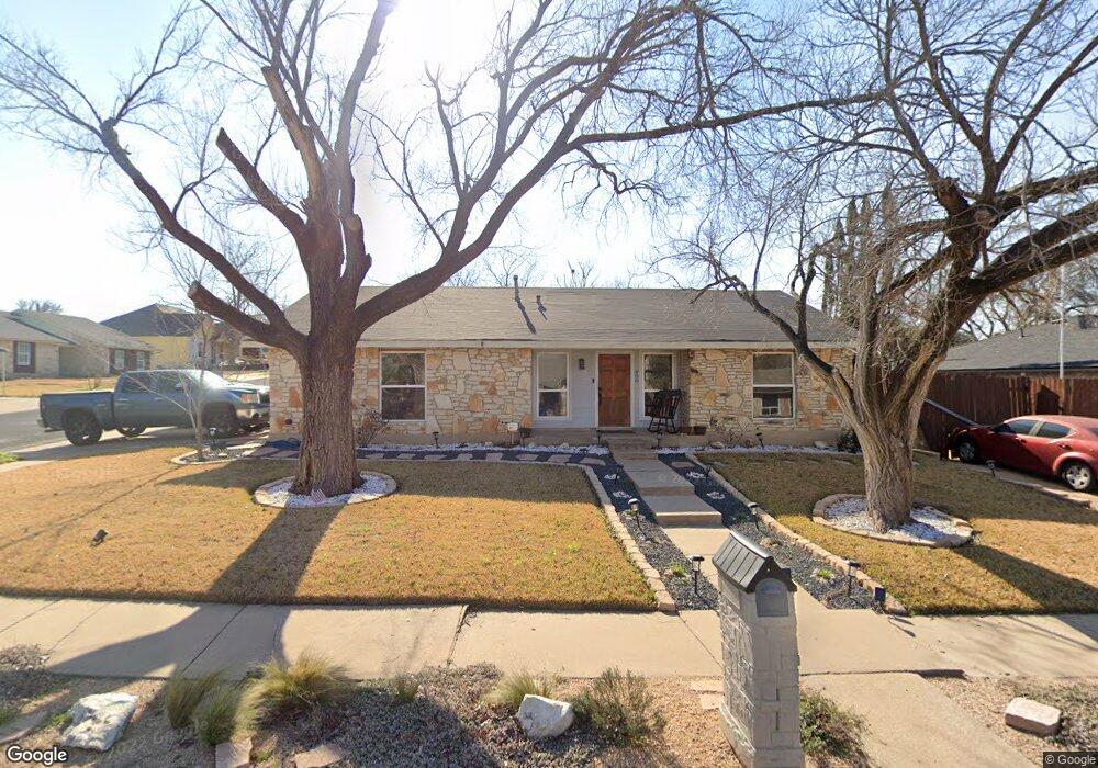
800 Spring Tree St Round Rock, TX 78681
Brushy Creek NeighborhoodEstimated Value: $331,754 - $357,000
3
Beds
2
Baths
1,313
Sq Ft
$263/Sq Ft
Est. Value
About This Home
This home is located at 800 Spring Tree St, Round Rock, TX 78681 and is currently estimated at $344,689, approximately $262 per square foot. 800 Spring Tree St is a home located in Williamson County with nearby schools including Brushy Creek Elementary School, Cedar Valley Middle School, and McNeil High School.
Ownership History
Date
Name
Owned For
Owner Type
Purchase Details
Closed on
Jul 27, 2005
Sold by
Buckler Robert
Bought by
Brown Naomi
Current Estimated Value
Home Financials for this Owner
Home Financials are based on the most recent Mortgage that was taken out on this home.
Original Mortgage
$95,044
Outstanding Balance
$54,606
Interest Rate
7.15%
Mortgage Type
Adjustable Rate Mortgage/ARM
Estimated Equity
$290,083
Create a Home Valuation Report for This Property
The Home Valuation Report is an in-depth analysis detailing your home's value as well as a comparison with similar homes in the area
Home Values in the Area
Average Home Value in this Area
Purchase History
| Date | Buyer | Sale Price | Title Company |
|---|---|---|---|
| Brown Naomi | -- | None Available |
Source: Public Records
Mortgage History
| Date | Status | Borrower | Loan Amount |
|---|---|---|---|
| Open | Brown Naomi | $95,044 |
Source: Public Records
Tax History Compared to Growth
Tax History
| Year | Tax Paid | Tax Assessment Tax Assessment Total Assessment is a certain percentage of the fair market value that is determined by local assessors to be the total taxable value of land and additions on the property. | Land | Improvement |
|---|---|---|---|---|
| 2025 | $5,180 | $356,250 | $79,500 | $276,750 |
| 2024 | $5,180 | $328,067 | $79,500 | $248,567 |
| 2023 | $4,684 | $300,418 | $0 | $0 |
| 2022 | $5,652 | $273,107 | $0 | $0 |
| 2021 | $5,874 | $248,279 | $60,000 | $223,243 |
| 2020 | $5,368 | $225,708 | $55,181 | $170,527 |
| 2019 | $5,202 | $212,458 | $51,500 | $160,958 |
| 2018 | $4,815 | $210,280 | $45,154 | $165,126 |
| 2017 | $4,879 | $195,473 | $42,200 | $155,744 |
| 2016 | $4,435 | $177,703 | $42,200 | $140,823 |
| 2015 | $3,492 | $161,548 | $35,100 | $130,327 |
| 2014 | $3,492 | $146,862 | $0 | $0 |
Source: Public Records
Map
Nearby Homes
- 809 Stillhouse Spring
- 913 Spring Tree St
- 3915 Hillside Dr
- 9011 Wildwater Way
- 8711 Glen Canyon Dr
- 8613 Glen Canyon Dr
- 4011 Hillside Dr
- 1400 Hargis Creek Trail
- 3917 Rolling Hill
- 9024 Wildwater Way
- 407 Hillside Dr
- 7203 Two Jacks Trail
- 9400 Graceland Trail
- 8422 Priest River Dr
- 8602 Bobcat Dr
- 17405 Priest River Cove
- 9108 Cessna Ln
- 16914 Dorman Dr
- 9201 Cessna Ln
- 8305 Hillrock Dr
- 802 Spring Tree St
- 803 Powderhorn Dr
- 805 Powderhorn Dr
- 804 Spring Tree St
- 3713 Spring Branch
- 3801 Spring Branch
- 3711 Spring Branch
- 801 Spring Tree St
- 803 Spring Tree St
- 807 Powderhorn Dr
- 3803 Spring Branch
- 3709 Spring Branch
- 900 Spring Tree St
- 805 Spring Tree St
- 809 Powderhorn Dr
- 3706 Hillside Cove
- 3710 Hillside Dr
- 3707 Spring Branch
- 901 Spring Tree St
- 808 Stillhouse Spring