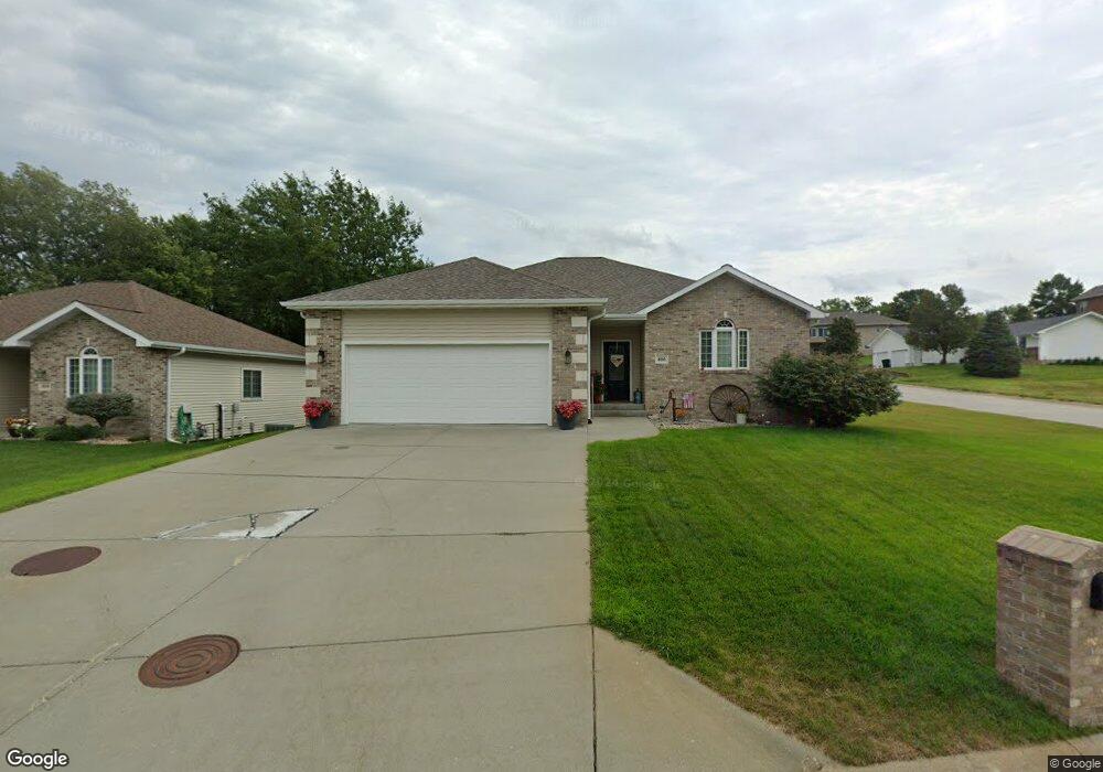
800 Via Linda St West Point, NE 68788
Estimated Value: $346,000 - $429,000
2
Beds
3
Baths
1,518
Sq Ft
$247/Sq Ft
Est. Value
About This Home
This home is located at 800 Via Linda St, West Point, NE 68788 and is currently estimated at $375,448, approximately $247 per square foot. 800 Via Linda St is a home located in Cuming County with nearby schools including West Point-Beemer Junior/Senior High School, Guardian Angels Elementary School, and St. Paul Lutheran School.
Ownership History
Date
Name
Owned For
Owner Type
Purchase Details
Closed on
Jun 19, 2014
Sold by
Knobbe Mark R
Bought by
Wegner Doak L and Wegner Petty L
Current Estimated Value
Home Financials for this Owner
Home Financials are based on the most recent Mortgage that was taken out on this home.
Original Mortgage
$200,000
Outstanding Balance
$152,524
Interest Rate
4.27%
Mortgage Type
Future Advance Clause Open End Mortgage
Estimated Equity
$222,924
Create a Home Valuation Report for This Property
The Home Valuation Report is an in-depth analysis detailing your home's value as well as a comparison with similar homes in the area
Home Values in the Area
Average Home Value in this Area
Purchase History
| Date | Buyer | Sale Price | Title Company |
|---|---|---|---|
| Wegner Doak L | $230,000 | None Available |
Source: Public Records
Mortgage History
| Date | Status | Borrower | Loan Amount |
|---|---|---|---|
| Open | Wegner Doak L | $200,000 |
Source: Public Records
Tax History Compared to Growth
Tax History
| Year | Tax Paid | Tax Assessment Tax Assessment Total Assessment is a certain percentage of the fair market value that is determined by local assessors to be the total taxable value of land and additions on the property. | Land | Improvement |
|---|---|---|---|---|
| 2024 | $2,991 | $353,225 | $16,685 | $336,540 |
| 2023 | $3,920 | $339,690 | $14,745 | $324,945 |
| 2022 | $3,872 | $306,060 | $14,745 | $291,315 |
| 2021 | $3,596 | $269,920 | $13,580 | $256,340 |
| 2020 | $3,404 | $254,840 | $13,580 | $241,260 |
| 2019 | $3,312 | $242,375 | $13,580 | $228,795 |
| 2018 | $3,093 | $225,345 | $13,580 | $211,765 |
| 2017 | $3,162 | $225,445 | $13,580 | $211,865 |
| 2016 | $3,112 | $215,420 | $12,030 | $203,390 |
| 2015 | $3,311 | $215,420 | $12,030 | $203,390 |
| 2014 | $3,491 | $197,820 | $12,030 | $185,790 |
| 2013 | $3,491 | $197,820 | $12,030 | $185,790 |
Source: Public Records
Map
Nearby Homes
- 819 Cornhusker Dr
- 1207 N Main St
- 1402 E Bridge St
- 208 N Lincoln St
- 219 S Monitor St
- 749 E Grove St
- 1045 E Grove St
- 420 S Farragut St
- 205 E Sheridan St
- 626 S Monitor St
- 771 E Willow St
- 808 18th Rd
- 741 S Niphon St
- 301 W Pine St
- 402 W Pine St
- 1493 U S 275
- 2235 K Rd
- 1043 23rd Rd
- 112 Par Acres Dr Unit 4
- 2416 F Rd
- 804 Via Linda St
- 400 E Neligh St
- 806 Via Linda St
- 406 E Neligh St
- 801 Via Linda St
- 803 Via Linda St
- 805 Via Linda St
- 807 Via Linda St
- 410 E Neligh St
- 415 E Neligh St
- 421 E Neligh St
- 811 Via Linda St
- 810 Via Linda St
- 414 E Neligh St
- 425 E Neligh St
- 416 E Neligh St
- 420 E Neligh St
- 424 E Neligh St
- 313 E Weiler St
- 430 E Neligh St