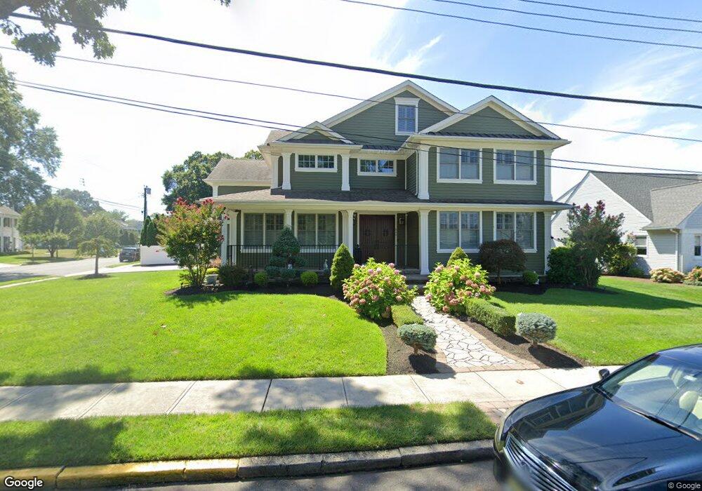
800 Walnut Ave Point Pleasant Beach, NJ 08742
Point Pleasant Beach NeighborhoodEstimated Value: $2,287,000 - $2,828,822
3
Beds
5
Baths
7,849
Sq Ft
$317/Sq Ft
Est. Value
About This Home
This home is located at 800 Walnut Ave, Point Pleasant Beach, NJ 08742 and is currently estimated at $2,491,206, approximately $317 per square foot. 800 Walnut Ave is a home located in Ocean County with nearby schools including G Harold Antrim Elementary School, Point Pleasant Beach High School, and St. Peter School.
Ownership History
Date
Name
Owned For
Owner Type
Purchase Details
Closed on
Jun 6, 2012
Sold by
Griggs Barbara J
Bought by
Carannate Giuseppe and Carannante Antonella
Current Estimated Value
Home Financials for this Owner
Home Financials are based on the most recent Mortgage that was taken out on this home.
Original Mortgage
$296,000
Outstanding Balance
$205,331
Interest Rate
3.85%
Mortgage Type
New Conventional
Estimated Equity
$2,285,875
Purchase Details
Closed on
Oct 17, 2001
Sold by
Griggs Edward
Bought by
Lammers William
Create a Home Valuation Report for This Property
The Home Valuation Report is an in-depth analysis detailing your home's value as well as a comparison with similar homes in the area
Home Values in the Area
Average Home Value in this Area
Purchase History
| Date | Buyer | Sale Price | Title Company |
|---|---|---|---|
| Carannate Giuseppe | $370,000 | None Available | |
| Lammers William | $306,000 | -- |
Source: Public Records
Mortgage History
| Date | Status | Borrower | Loan Amount |
|---|---|---|---|
| Open | Carannate Giuseppe | $296,000 |
Source: Public Records
Tax History Compared to Growth
Tax History
| Year | Tax Paid | Tax Assessment Tax Assessment Total Assessment is a certain percentage of the fair market value that is determined by local assessors to be the total taxable value of land and additions on the property. | Land | Improvement |
|---|---|---|---|---|
| 2025 | $16,458 | $958,000 | $369,100 | $588,900 |
| 2024 | $15,960 | $958,000 | $369,100 | $588,900 |
| 2023 | $15,510 | $958,000 | $369,100 | $588,900 |
| 2022 | $15,510 | $958,000 | $369,100 | $588,900 |
| 2021 | $15,165 | $958,000 | $369,100 | $588,900 |
| 2020 | $15,146 | $958,000 | $369,100 | $588,900 |
| 2019 | $14,935 | $958,000 | $369,100 | $588,900 |
| 2018 | $14,705 | $958,000 | $369,100 | $588,900 |
| 2017 | $14,475 | $958,000 | $369,100 | $588,900 |
| 2016 | $14,542 | $958,000 | $369,100 | $588,900 |
| 2015 | $14,427 | $958,000 | $369,100 | $588,900 |
| 2014 | $14,360 | $958,000 | $369,100 | $588,900 |
Source: Public Records
Map
Nearby Homes
- 326 Curtis Ave Unit Lot 27
- 328 Curtis Ave Unit Lot 28
- 845 Arnold Ave Unit 3
- 728 Arnold Ave
- 331 Hawthorne Ave
- 325 Hawthorne Ave Unit 327
- 842 Arnold Ave Unit 2
- 842 Arnold Ave Unit 3
- 606 Bay Ave Unit 2
- 807 Trenton Ave
- 204 Curtis Ave
- 303 Cooks Ln
- 607 Richmond Ave Unit 4
- 37 Arnold Ave
- 704 Forman Ave
- 921 Arnold Ave
- 109 Griffiths Ave
- 615 Atlantic Ave
- 305 Chicago Ave
- 818 Sinclair Rd
- 804 Walnut Ave Unit 806
- 801 Orchard Ave
- 805 Orchard Ave
- 312 Woodland Rd
- 314 Woodland Rd
- 310 Woodland Rd
- 316 Woodland Rd
- 807 Orchard Ave
- 803 Walnut Ave
- 308 Woodland Rd
- 808 Walnut Ave
- 723 Mclean Ave
- 811 Orchard Ave
- 807 Walnut Ave
- 306 Woodland Rd
- 726 Mclean Ave
- 343 Curtis Ave
- 812 Walnut Ave
- 341 Curtis Ave
- 339 Curtis Ave