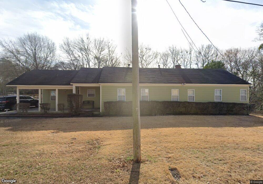
800 West Cir SW Conyers, GA 30012
Estimated Value: $206,680
--
Bed
--
Bath
2,529
Sq Ft
$82/Sq Ft
Est. Value
About This Home
This home is located at 800 West Cir SW, Conyers, GA 30012 and is currently estimated at $206,680, approximately $81 per square foot. 800 West Cir SW is a home located in Rockdale County with nearby schools including Shoal Creek Elementary School, Edwards Middle School, and Rockdale County High School.
Ownership History
Date
Name
Owned For
Owner Type
Purchase Details
Closed on
Nov 19, 2010
Sold by
Ib Property Holdings Llc
Bought by
Ricks Jennifer D
Current Estimated Value
Home Financials for this Owner
Home Financials are based on the most recent Mortgage that was taken out on this home.
Original Mortgage
$52,000
Outstanding Balance
$781
Interest Rate
4.31%
Mortgage Type
Commercial
Estimated Equity
$205,899
Purchase Details
Closed on
Apr 1, 2008
Sold by
Randolph Melvin D
Bought by
Ib Property Holdings Llc
Purchase Details
Closed on
Feb 21, 2005
Sold by
Holdorf Benjamin G
Bought by
Randolph Melvin D
Home Financials for this Owner
Home Financials are based on the most recent Mortgage that was taken out on this home.
Original Mortgage
$133,000
Interest Rate
7.8%
Mortgage Type
Commercial
Create a Home Valuation Report for This Property
The Home Valuation Report is an in-depth analysis detailing your home's value as well as a comparison with similar homes in the area
Home Values in the Area
Average Home Value in this Area
Purchase History
| Date | Buyer | Sale Price | Title Company |
|---|---|---|---|
| Ricks Jennifer D | $65,000 | -- | |
| Ib Property Holdings Llc | $163,000 | -- | |
| Randolph Melvin D | $140,000 | -- |
Source: Public Records
Mortgage History
| Date | Status | Borrower | Loan Amount |
|---|---|---|---|
| Open | Ricks Jennifer D | $52,000 | |
| Previous Owner | Randolph Melvin D | $133,000 |
Source: Public Records
Tax History Compared to Growth
Tax History
| Year | Tax Paid | Tax Assessment Tax Assessment Total Assessment is a certain percentage of the fair market value that is determined by local assessors to be the total taxable value of land and additions on the property. | Land | Improvement |
|---|---|---|---|---|
| 2024 | $2,188 | $39,080 | $16,000 | $23,080 |
| 2023 | $1,772 | $30,280 | $11,200 | $19,080 |
| 2022 | $1,771 | $29,600 | $11,200 | $18,400 |
| 2021 | $1,692 | $27,920 | $11,200 | $16,720 |
| 2020 | $1,801 | $27,920 | $11,200 | $16,720 |
| 2019 | $1,870 | $27,920 | $11,200 | $16,720 |
| 2018 | $1,259 | $27,920 | $11,200 | $16,720 |
| 2017 | $1,778 | $27,360 | $11,200 | $16,160 |
| 2016 | $1,789 | $27,360 | $11,200 | $16,160 |
| 2015 | $1,247 | $27,360 | $11,200 | $16,160 |
| 2014 | $1,260 | $27,360 | $11,200 | $16,160 |
| 2013 | -- | $36,320 | $14,000 | $22,320 |
Source: Public Records
Map
Nearby Homes
- 2022 Appaloosa Way
- 2048 Appaloosa Way
- 1070 Barton St NW
- 1068 N Main St NW
- 1087 N Main St NW
- 948 Peek St NW
- 1150 Tinsley Dr NW
- 954 Bryant St SW
- 680 2nd Ave SW
- 902 Andrews Dr NW
- 1204 Lakeview Dr NW
- 893 Andrews Dr NW
- 214 Seward St Unit 94
- 1200 Wilson Ct NW
- 1065 Milstead Ave NE
- 990 Oakland Ave SE
- 1272 Lakeview Dr NW
- W Southwest Cir
- 830 West Cir SW
- 794 West Cir SW
- 2136 Appaloosa Way
- 2134 Appaloosa Way
- 2000 Appaloosa Way
- 795 West Cir SW
- 2132 Appaloosa Way
- 2002 Appaloosa Way
- 2133 Appaloosa Way
- 2130 Appaloosa Way
- 0 West Cir Unit SW 7321745
- 0 West Cir Unit 7416585
- 0 West Cir Unit 8345336
- 2004 Appaloosa Way Unit 2004
- 2004 Appaloosa Way
- 2128 Appaloosa Way
- 0 West Cir SW Unit 7416585
- 0 West Cir SW
- 2129 Appaloosa Way