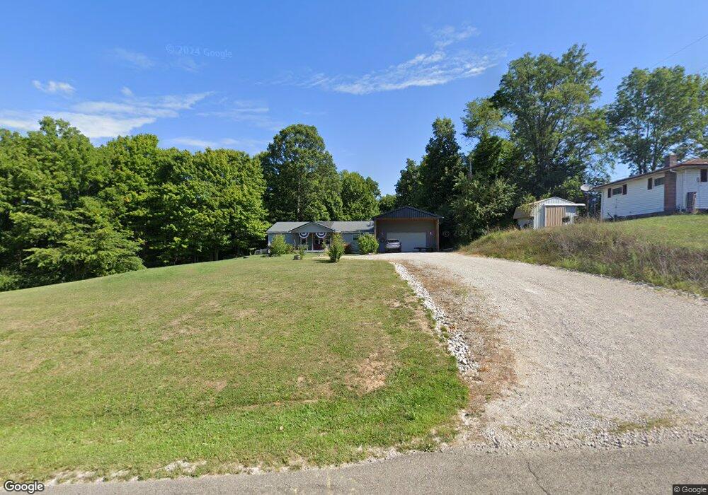
8000 Tarlton Rd SW Amanda, OH 43102
Estimated Value: $186,002 - $288,000
3
Beds
2
Baths
1,404
Sq Ft
$162/Sq Ft
Est. Value
About This Home
This home is located at 8000 Tarlton Rd SW, Amanda, OH 43102 and is currently estimated at $226,751, approximately $161 per square foot. 8000 Tarlton Rd SW is a home located in Fairfield County with nearby schools including Amanda-Clearcreek Elementary School, Amanda-Clearcreek Primary School, and Amanda-Clearcreek Middle School.
Ownership History
Date
Name
Owned For
Owner Type
Purchase Details
Closed on
Jun 4, 2021
Sold by
Grubb Bonnie Sue and Grubb Rhonda Gayle
Bought by
Shariten Rentals Llc
Current Estimated Value
Purchase Details
Closed on
Jun 30, 2015
Sold by
Walker Steven R and Walker Sandra K
Bought by
Grubb Bonnie Sue and Grubb Rhonda Gayle
Home Financials for this Owner
Home Financials are based on the most recent Mortgage that was taken out on this home.
Original Mortgage
$75,000
Interest Rate
3.82%
Mortgage Type
New Conventional
Purchase Details
Closed on
Oct 24, 2000
Sold by
Est Thomas W Karshner
Bought by
Walker Steven R
Create a Home Valuation Report for This Property
The Home Valuation Report is an in-depth analysis detailing your home's value as well as a comparison with similar homes in the area
Home Values in the Area
Average Home Value in this Area
Purchase History
| Date | Buyer | Sale Price | Title Company |
|---|---|---|---|
| Shariten Rentals Llc | $140,000 | Valmer Land Title Agency Box | |
| Grubb Bonnie Sue | $115,000 | Transcounty Title Agency | |
| Walker Steven R | $29,000 | -- |
Source: Public Records
Mortgage History
| Date | Status | Borrower | Loan Amount |
|---|---|---|---|
| Previous Owner | Grubb Bonnie Sue | $75,000 |
Source: Public Records
Tax History Compared to Growth
Tax History
| Year | Tax Paid | Tax Assessment Tax Assessment Total Assessment is a certain percentage of the fair market value that is determined by local assessors to be the total taxable value of land and additions on the property. | Land | Improvement |
|---|---|---|---|---|
| 2024 | $2,859 | $49,000 | $19,440 | $29,560 |
| 2023 | $1,580 | $49,000 | $19,440 | $29,560 |
| 2022 | $1,579 | $49,000 | $19,440 | $29,560 |
| 2021 | $1,429 | $49,950 | $16,190 | $33,760 |
| 2020 | $431 | $49,000 | $16,190 | $32,810 |
| 2019 | $1,455 | $49,000 | $16,190 | $32,810 |
| 2018 | $329 | $38,820 | $13,660 | $25,160 |
| 2017 | $1,100 | $38,410 | $13,660 | $24,750 |
| 2016 | $1,074 | $38,410 | $13,660 | $24,750 |
| 2015 | $1,406 | $37,300 | $13,660 | $23,640 |
| 2014 | $1,318 | $36,810 | $13,660 | $23,150 |
| 2013 | $1,318 | $36,810 | $13,660 | $23,150 |
Source: Public Records
Map
Nearby Homes
- 11875 Chillicothe Lancaster Rd SW
- 260 Harrison St
- 12999 Tarlton Rd
- 11144 16th Rd SW
- 10527 Garrett Rd SW
- 26377 Tarlton Adelphi Rd
- 12499 Tarlton Rd
- 10539 Garrett Rd SW
- 26563 Tarlton Adelphi Rd
- 9680 Tarlton Rd SW
- 6164 Heigle Rd SW
- 15828 Hedges Rd
- 6895 Heigle Rd SW
- 26199 Jackson Rd
- 0 Heigle Rd SW Unit 225034864
- 26295 Jackson Rd
- 16740 Ellis Rd
- 26265 Shoemaker Rd
- 28088 Kime-Holderman Rd
- 28129 Kime Holderman Rd
- 7990 Tarlton Rd SW
- 13903 Tarlton Rd SW
- 13943 Tarlton Rd SW
- 7950 Tarlton Rd SW
- 7950 Tarlton Road S W
- 13977 Tarlton Rd SW
- 13903 Tarlton Rd
- 7920 Tarlton Rd SW
- 8120 Tarlton Rd SW
- 14001 Tarlton Rd SW
- 215 E Main St
- 7858 Tarlton Rd SW
- 7818 Tarlton Rd SW
- 8260 Clay St
- 7862 Tarlton Rd SW
- 14109 Tarlton Rd
- 14109 Tarlton Rd SW
- 8240 Clay St
- 10 N Clay St
- 11920 Chilli Lanc Rd