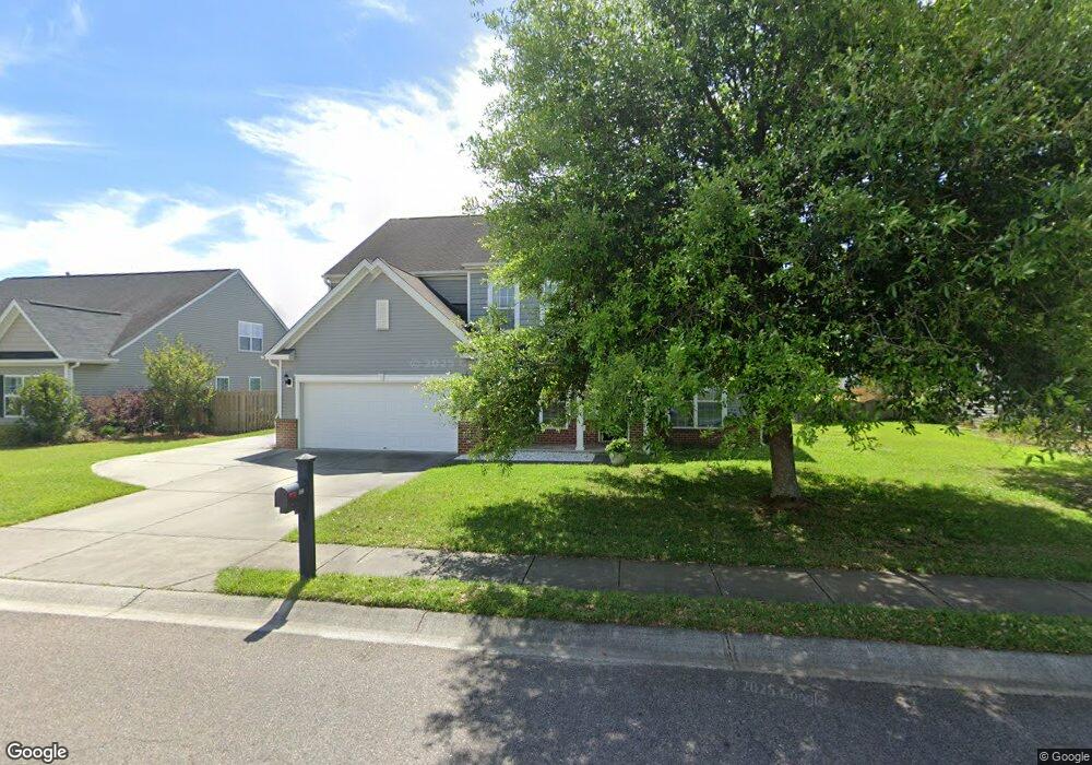
8002 McKayla Rd Summerville, SC 29483
Estimated Value: $417,207 - $500,000
4
Beds
3
Baths
2,843
Sq Ft
$160/Sq Ft
Est. Value
About This Home
This home is located at 8002 McKayla Rd, Summerville, SC 29483 and is currently estimated at $455,802, approximately $160 per square foot. 8002 McKayla Rd is a home located in Dorchester County with nearby schools including Knightsville Elementary School, Charles B. DuBose Middle School, and Summerville High School.
Ownership History
Date
Name
Owned For
Owner Type
Purchase Details
Closed on
Aug 6, 2010
Sold by
The Ryland Group Inc
Bought by
Burgess Nathan P and Burgess Luciene L
Current Estimated Value
Home Financials for this Owner
Home Financials are based on the most recent Mortgage that was taken out on this home.
Original Mortgage
$191,000
Outstanding Balance
$64,634
Interest Rate
4.7%
Mortgage Type
New Conventional
Estimated Equity
$391,168
Purchase Details
Closed on
Apr 22, 2010
Sold by
Myers Mill Llc
Bought by
The Ryland Group Inc
Create a Home Valuation Report for This Property
The Home Valuation Report is an in-depth analysis detailing your home's value as well as a comparison with similar homes in the area
Home Values in the Area
Average Home Value in this Area
Purchase History
| Date | Buyer | Sale Price | Title Company |
|---|---|---|---|
| Burgess Nathan P | $244,416 | -- | |
| The Ryland Group Inc | $144,840 | -- |
Source: Public Records
Mortgage History
| Date | Status | Borrower | Loan Amount |
|---|---|---|---|
| Open | Burgess Nathan P | $191,000 |
Source: Public Records
Tax History Compared to Growth
Tax History
| Year | Tax Paid | Tax Assessment Tax Assessment Total Assessment is a certain percentage of the fair market value that is determined by local assessors to be the total taxable value of land and additions on the property. | Land | Improvement |
|---|---|---|---|---|
| 2024 | $2,071 | $15,668 | $4,560 | $11,108 |
| 2023 | $2,071 | $10,109 | $1,800 | $8,309 |
| 2022 | $1,844 | $10,110 | $1,800 | $8,310 |
| 2021 | $1,844 | $10,110 | $1,800 | $8,310 |
| 2020 | $1,727 | $8,920 | $1,600 | $7,320 |
| 2019 | $1,672 | $8,920 | $1,600 | $7,320 |
| 2018 | $1,489 | $8,920 | $1,600 | $7,320 |
| 2017 | $1,479 | $8,920 | $1,600 | $7,320 |
| 2016 | $1,466 | $8,920 | $1,600 | $7,320 |
| 2015 | $1,460 | $8,920 | $1,600 | $7,320 |
| 2014 | $1,543 | $243,700 | $0 | $0 |
| 2013 | -- | $9,750 | $0 | $0 |
Source: Public Records
Map
Nearby Homes
- 10001 Begovich Ct
- 4021 Sanderson Ln
- 990 Augustine Ct
- 5021 Blair Rd
- 1036 Whitlow Blvd
- 2005 Isabela Ct
- 110 Barton Ln
- 120 Greenhill Pastures
- 1956 Central Ave
- 1960 Central Ave
- 1964 Central Ave
- Sumter Plan at Central Estates
- Ludington Plan at Central Estates
- Morgan Plan at Central Estates
- Brewster Plan at Central Estates
- Putnam Plan at Central Estates
- Mercer Plan at Central Estates
- Adams Plan at Central Estates
- 1968 Central Ave
- 000 Central Ave
- 8004 McKayla Rd
- 8000 McKayla Rd
- 8006 McKayla Rd
- 9008 Chato Ct
- 4001 Sanderson Ln
- 4003 Sanderson Ln
- 8005 McKayla Rd
- 4005 Sanderson Ln
- 9006 Chato Ct
- 8008 McKayla Rd
- 10003 Begovich Ct
- 4007 Sanderson Ln
- 8007 McKayla Rd
- 10002 Begovich Ct
- 9010 Chato Ct
- 4009 Sanderson Ln
- 9004 Chato Ct
- 4000 Blair Rd
- 2182 Blair Rd
- 5000 Blair Rd