Estimated Value: $466,000 - $490,000
4
Beds
3
Baths
2,738
Sq Ft
$175/Sq Ft
Est. Value
About This Home
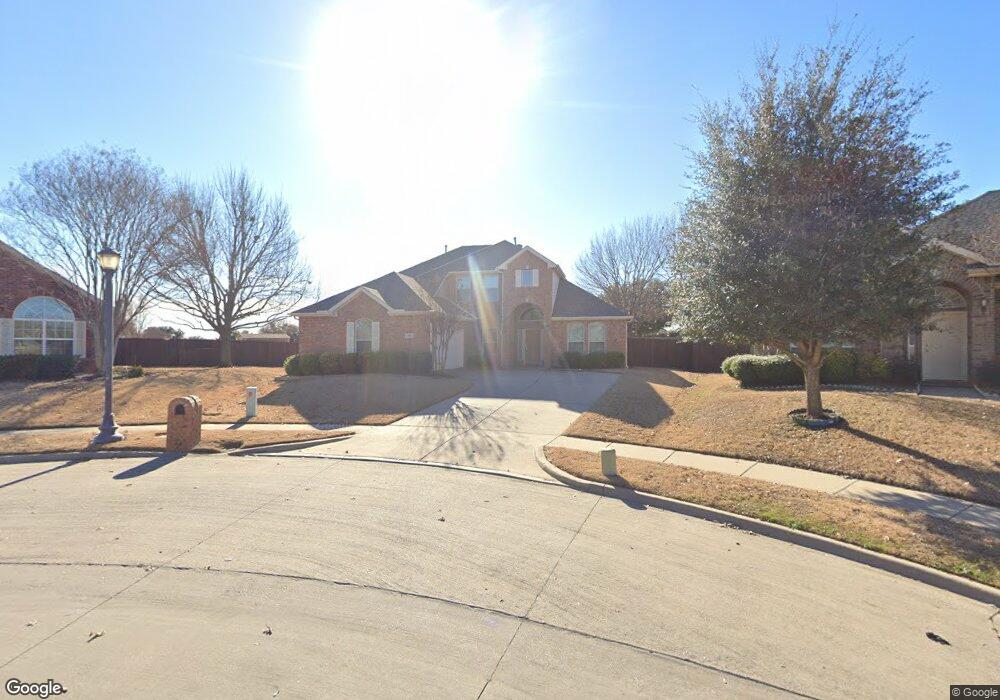
This home is located at 801 Appalachian Dr, Wylie, TX 75098 and is currently estimated at $478,914, approximately $174 per square foot. 801 Appalachian Dr is a home located in Collin County with nearby schools including R V Groves Elementary School, Dr. Al Draper Intermediate Middle School, and Raymond B Cooper J High School.
Ownership History
Date
Name
Owned For
Owner Type
Purchase Details
Closed on
Feb 14, 2002
Sold by
Ashton Dallas Residential Llc
Bought by
Shinn Stanley W and Shinn Janine R
Current Estimated Value
Home Financials for this Owner
Home Financials are based on the most recent Mortgage that was taken out on this home.
Original Mortgage
$167,900
Outstanding Balance
$69,376
Interest Rate
7.05%
Estimated Equity
$409,538
Create a Home Valuation Report for This Property
The Home Valuation Report is an in-depth analysis detailing your home's value as well as a comparison with similar homes in the area
Home Values in the Area
Average Home Value in this Area
Purchase History
| Date | Buyer | Sale Price | Title Company |
|---|---|---|---|
| Shinn Stanley W | -- | -- |
Source: Public Records
Mortgage History
| Date | Status | Borrower | Loan Amount |
|---|---|---|---|
| Open | Shinn Stanley W | $167,900 |
Source: Public Records
Tax History Compared to Growth
Tax History
| Year | Tax Paid | Tax Assessment Tax Assessment Total Assessment is a certain percentage of the fair market value that is determined by local assessors to be the total taxable value of land and additions on the property. | Land | Improvement |
|---|---|---|---|---|
| 2025 | $7,224 | $475,659 | $130,625 | $360,255 |
| 2024 | $7,224 | $432,417 | $130,625 | $318,623 |
| 2023 | $7,224 | $393,106 | $114,950 | $349,643 |
| 2022 | $7,840 | $357,369 | $94,050 | $303,064 |
| 2021 | $7,644 | $325,822 | $73,150 | $252,672 |
| 2020 | $7,334 | $295,346 | $67,925 | $227,421 |
| 2019 | $7,788 | $296,345 | $67,925 | $228,420 |
| 2018 | $7,731 | $287,077 | $67,925 | $219,152 |
| 2017 | $7,388 | $281,158 | $62,700 | $218,458 |
| 2016 | $6,929 | $253,066 | $52,250 | $200,816 |
| 2015 | $5,575 | $228,705 | $47,025 | $181,680 |
Source: Public Records
Map
Nearby Homes
- 802 Appalachian Dr
- 517 Royal Oak Dr
- 620 Fall Wheat Dr
- 3119 Connor Ln
- 728 Morningside Trail
- 413 Royal Oak Dr
- 801 Hunters Glen
- 563 John Ross Rd
- 3014 Eastwood Dr
- 607 Hilltop Dr
- 404 Crepe Myrtle Ln
- 3105 Admiral Dr
- 1205 Periwinkle Dr
- 3111 Candlebrook Dr
- 310 Admiral Dr
- 502 Leeward Dr
- 307 Wooded Creek Ave
- 2912 Katie Cir
- 3600 Nandina Dr
- 2907 Abby Ln
- 3608 Brookside Dr
- 803 Appalachian Dr
- 805 Appalachian Dr
- 3606 Brookside Dr
- 3606 Abelia Dr
- 3604 Abelia Dr
- 603 Paint Creek Ct
- 807 Appalachian Dr
- 3604 Brookside Dr
- 603 Paint Creek Ct
- 804 Appalachian Dr
- 537 Cave River Dr
- 605 Honey Suckle Dr
- 607 Paint Creek Ct
- 809 Appalachian Dr
- 3602 Brookside Dr
- 713 Sundown Way
- 3602 Abelia Dr
- 806 Appalachian Dr
- 600 Greystone Ct