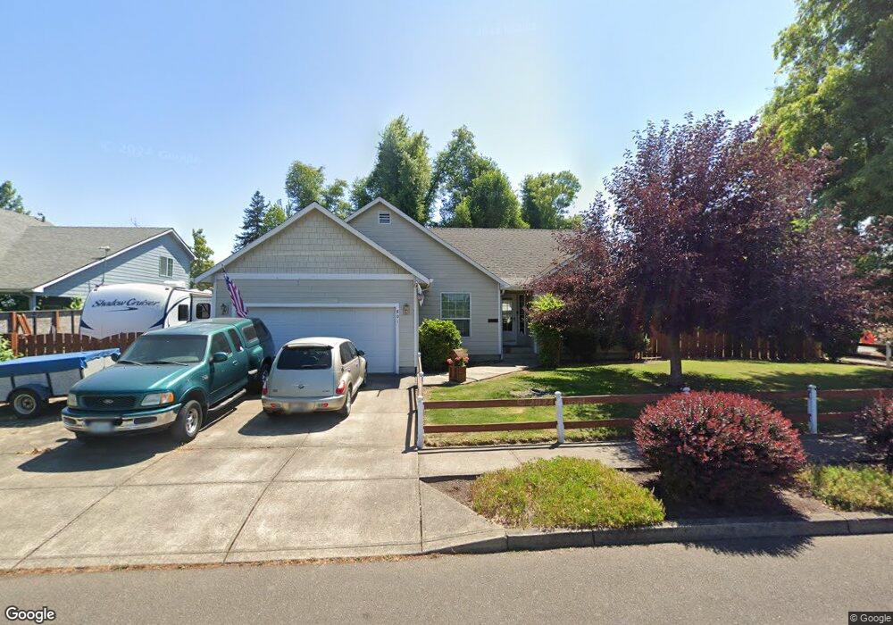
801 April Ln Silverton, OR 97381
Estimated Value: $464,000 - $554,000
3
Beds
2
Baths
1,550
Sq Ft
$323/Sq Ft
Est. Value
About This Home
This home is located at 801 April Ln, Silverton, OR 97381 and is currently estimated at $500,802, approximately $323 per square foot. 801 April Ln is a home located in Marion County with nearby schools including Robert Frost Elementary School, Silverton Middle School, and Silverton High School.
Ownership History
Date
Name
Owned For
Owner Type
Purchase Details
Closed on
Oct 26, 2023
Sold by
Perdue Troy W and Perdue Peggy A
Bought by
Troy W And Peggy A Perdue Trust and Perdue
Current Estimated Value
Purchase Details
Closed on
Apr 16, 2004
Sold by
David Donald A and David Doris T
Bought by
Perdue Troy W and Perdue Peggy A
Purchase Details
Closed on
Jan 13, 2004
Sold by
Tangerine Development Llc
Bought by
David Donald A and David Doris T
Purchase Details
Closed on
Jan 7, 2004
Sold by
Tangerine Development Llc
Bought by
Tangerine Development Llc
Create a Home Valuation Report for This Property
The Home Valuation Report is an in-depth analysis detailing your home's value as well as a comparison with similar homes in the area
Home Values in the Area
Average Home Value in this Area
Purchase History
| Date | Buyer | Sale Price | Title Company |
|---|---|---|---|
| Troy W And Peggy A Perdue Trust | -- | None Listed On Document | |
| Perdue Troy W | $185,000 | Ticor Title | |
| David Donald A | $175,500 | Ticor Title | |
| Tangerine Development Llc | -- | Ticor Title |
Source: Public Records
Tax History
| Year | Tax Paid | Tax Assessment Tax Assessment Total Assessment is a certain percentage of the fair market value that is determined by local assessors to be the total taxable value of land and additions on the property. | Land | Improvement |
|---|---|---|---|---|
| 2025 | $4,002 | $248,740 | -- | -- |
| 2024 | $4,002 | $241,500 | -- | -- |
| 2023 | $3,899 | $234,470 | $0 | $0 |
| 2022 | $3,692 | $227,650 | $0 | $0 |
| 2021 | $3,592 | $221,020 | $0 | $0 |
| 2020 | $3,503 | $214,590 | $0 | $0 |
| 2019 | $3,401 | $208,340 | $0 | $0 |
| 2018 | $3,414 | $0 | $0 | $0 |
| 2017 | $3,337 | $0 | $0 | $0 |
| 2016 | $3,276 | $0 | $0 | $0 |
| 2015 | $3,245 | $0 | $0 | $0 |
| 2014 | $3,146 | $0 | $0 | $0 |
Source: Public Records
Map
Nearby Homes
- 655 Schemmel Ln
- 1010 Well St
- 820 Pine St
- 818 Pine St
- 816 Pine St
- 216 S James St
- 623 McClaine St
- 847 Chestnut Way
- 872 Laurel Place
- 665 Parker Loop
- 251 Fairview St
- 673 Parker Loop
- 677 Parker Loop
- 871 Oakleaf Way
- 845 Oakleaf Way
- 714 Tigerlily St
- 706 Tigerlily St
- 718 Tigerlily St
- 702 Tigerlily St
- 308 A St
Your Personal Tour Guide
Ask me questions while you tour the home.