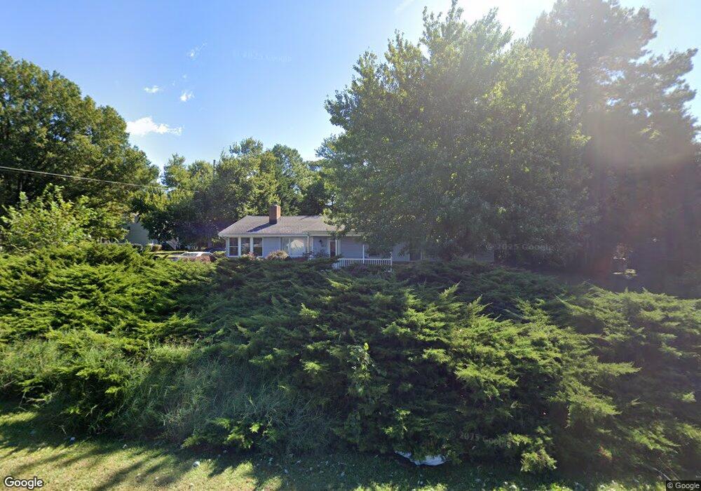
801 Bayside Dr Stevensville, MD 21666
Estimated Value: $548,000 - $656,000
--
Bed
1
Bath
2,817
Sq Ft
$213/Sq Ft
Est. Value
About This Home
This home is located at 801 Bayside Dr, Stevensville, MD 21666 and is currently estimated at $600,603, approximately $213 per square foot. 801 Bayside Dr is a home located in Queen Anne's County with nearby schools including Matapeake Elementary School, Matapeake Middle School, and Kent Island High School.
Ownership History
Date
Name
Owned For
Owner Type
Purchase Details
Closed on
Aug 12, 2003
Sold by
Northam Gerald S
Bought by
Oxenham David P and Krafte Jill H
Current Estimated Value
Purchase Details
Closed on
May 15, 1981
Sold by
Mcphaul Jim A and Mcphaul Margaret L
Bought by
Northan Gerald S and Northan Mary
Home Financials for this Owner
Home Financials are based on the most recent Mortgage that was taken out on this home.
Original Mortgage
$66,000
Interest Rate
16.64%
Create a Home Valuation Report for This Property
The Home Valuation Report is an in-depth analysis detailing your home's value as well as a comparison with similar homes in the area
Home Values in the Area
Average Home Value in this Area
Purchase History
| Date | Buyer | Sale Price | Title Company |
|---|---|---|---|
| Oxenham David P | $292,900 | -- | |
| Northan Gerald S | $69,500 | -- |
Source: Public Records
Mortgage History
| Date | Status | Borrower | Loan Amount |
|---|---|---|---|
| Previous Owner | Northan Gerald S | $66,000 | |
| Closed | Oxenham David P | -- |
Source: Public Records
Tax History Compared to Growth
Tax History
| Year | Tax Paid | Tax Assessment Tax Assessment Total Assessment is a certain percentage of the fair market value that is determined by local assessors to be the total taxable value of land and additions on the property. | Land | Improvement |
|---|---|---|---|---|
| 2025 | $4,008 | $425,433 | $0 | $0 |
| 2024 | $3,674 | $390,067 | $0 | $0 |
| 2023 | $3,341 | $354,700 | $162,100 | $192,600 |
| 2022 | $3,341 | $354,700 | $162,100 | $192,600 |
| 2021 | $3,402 | $354,700 | $162,100 | $192,600 |
| 2020 | $3,673 | $383,000 | $162,100 | $220,900 |
| 2019 | $3,501 | $365,067 | $0 | $0 |
| 2018 | $3,329 | $347,133 | $0 | $0 |
| 2017 | $3,157 | $329,200 | $0 | $0 |
| 2016 | -- | $294,833 | $0 | $0 |
| 2015 | $2,749 | $260,467 | $0 | $0 |
| 2014 | $2,749 | $226,100 | $0 | $0 |
Source: Public Records
Map
Nearby Homes
- 410 Stafford Rd
- 418 Bay City Rd
- 412 Bay City Rd
- 914 Chesapeake Dr
- 1000 Chesapeake Dr
- 312 William Way
- 802 Broadcreek Dr
- 526 Victoria Dr
- 306 Irene Way
- 103 Irene Way
- 440 Moorings Cir Unit 85
- 109 Woodmoor Rd
- 96 Annapolis View Rd
- 298 Moorings Cir
- 312 Topside Dr Unit 223
- 349 Topside Dr
- 0 Sunset Wharf Lot D-3 Unit MDQA2010280
- 736 Moorings Cir Unit 35
- 0 Sunset Wharf Lot D-1 Unit MDQA2010276
- 858 Moorings Cir Unit 11
- 803 Bayside Dr
- 805 Bayside Dr
- 501 Stafford Rd
- 802 Worcester Dr
- 802 Bayside Dr
- 416 Stafford Rd
- 807 Bayside Dr
- 804 Bayside Dr
- 804 Worcester Dr
- 705 Bayside Dr
- 710 Bayside Dr
- 800 Bayside Dr
- 414 Stafford Rd
- 806 Bayside Dr
- 708 Bayside Dr
- 809 Bayside Dr
- 806 Worcester Dr
- 808 Bayside Dr
- 412 Stafford Rd
- 703 Bayside Dr